Historic churches · South East England
Borough of Swale
Swale is a local government district with borough status in Kent, England. The council is based in Sittingbourne, the borough's largest town. The borough also contains the towns of Faversham, Queenbor

John Salmon — CC BY-SA 2.0 via Wikimedia Commons licence
Plan your visit
- Typical visit
- 30 min–1 h
- Free entry
About
Swale is a local government district with borough status in Kent, England. The council is based in Sittingbourne, the borough's largest town. The borough also contains the towns of Faversham, Queenborough and Sheerness, along with numerous villages and surrounding rural areas. It includes the Isle of Sheppey and is named after The Swale, the narrow channel which separates Sheppey from the mainland part of the borough. Some southern parts of the borough lie within the Kent Downs, a designated Area of Outstanding Natural Beauty. The borough borders the Medway unitary authority area to the west, the Borough of Maidstone to the south-west, the Borough of Ashford to the south-east, and the City of Canterbury to the east. Under proposed reorganisation in either April 2027 or 2028 the borough will face abolition and will join with one or more adjoining councils to form a new Unitary Authority. Details of such proposals are expected in Autumn 2025.
Photo gallery
From the Wikipedia article
Swale is a local government district with borough status in Kent, England. The council is based in Sittingbourne, the borough's largest town. The borough also contains the towns of Faversham, Queenborough and Sheerness, along with numerous villages and surrounding rural areas. It includes the Isle of Sheppey and is named after The Swale, the narrow channel which separates Sheppey from the mainland part of the borough. Some southern parts of the borough lie within the Kent Downs, a designated Area of Outstanding Natural Beauty. The borough borders the Medway unitary authority area to the west, the Borough of Maidstone to the south-west, the Borough of Ashford to the south-east, and the City of Canterbury to the east. Under proposed reorganisation in either April 2027 or 2028 the borough will face abolition and will join with one or more adjoining councils to form a new Unitary Authority. Details of such proposals are expected in Autumn 2025.
Excerpt from Wikipedia under CC BY-SA 4.0. See the source article linked in Sources below.
Background
History
The district was created on 1 April 1974 under the Local Government Act 1972 covering the area of four former districts, which were all abolished at the same time: The new district was named Swale, after the waterway which divides the mainland part of the district from the Isle of Sheppey. The district was awarded borough status on 20 January 1978, allowing the chair of the council to take the title of mayor.
Sourced from Wikipedia under CC BY-SA 4.0.
- Coordinates
- 51.3402, 0.7309
- County
- Kent
- District
- Swale
- Parish
- Swale, unparished area
- Postcode
- ME10 1HR
- Parliamentary constituency
- Sittingbourne and Sheppey
- Official site
- sittingbourne.thelight.co.uk
Sources
- wikipedia: Borough of Swale (CC BY-SA 4.0)
Other places nearby
Loading nearby places…
Nearby
Hotels · South East England
The Golden Hope
The Golden Hope — a hotel in england south east.
 📷 5
📷 5Historic churches · South East England
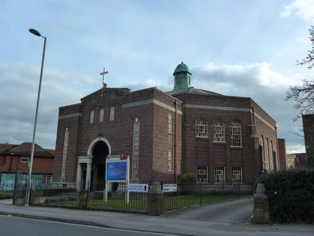
Sittingbourne Islamic Cultural Centre
Sittingbourne Islamic Cultural Centre — a church in england-south-east, United Kingdom.
 📷 5
📷 5Bowling alleys · South East England
The Light Bowling Alley Sittingbourne
The Light Bowling Alley Sittingbourne — a bowling in england-south-east, United Kingdom.
Cinemas · South East England
Light Cinema Sittingbourne
Light Cinema Sittingbourne — a cinema in england south east.
Cinemas · South East England
The Light Cinema Sittingbourne
The Light Cinema Sittingbourne — a cinema in england south east. Brand: The Light.
 📷 5
📷 5Cemeteries · South East England
Sittingbourne Cemetery
Sittingbourne Cemetery is a cemetery in the United Kingdom.
More places in this region
 Flagship📷 10
Historic churches · South East England
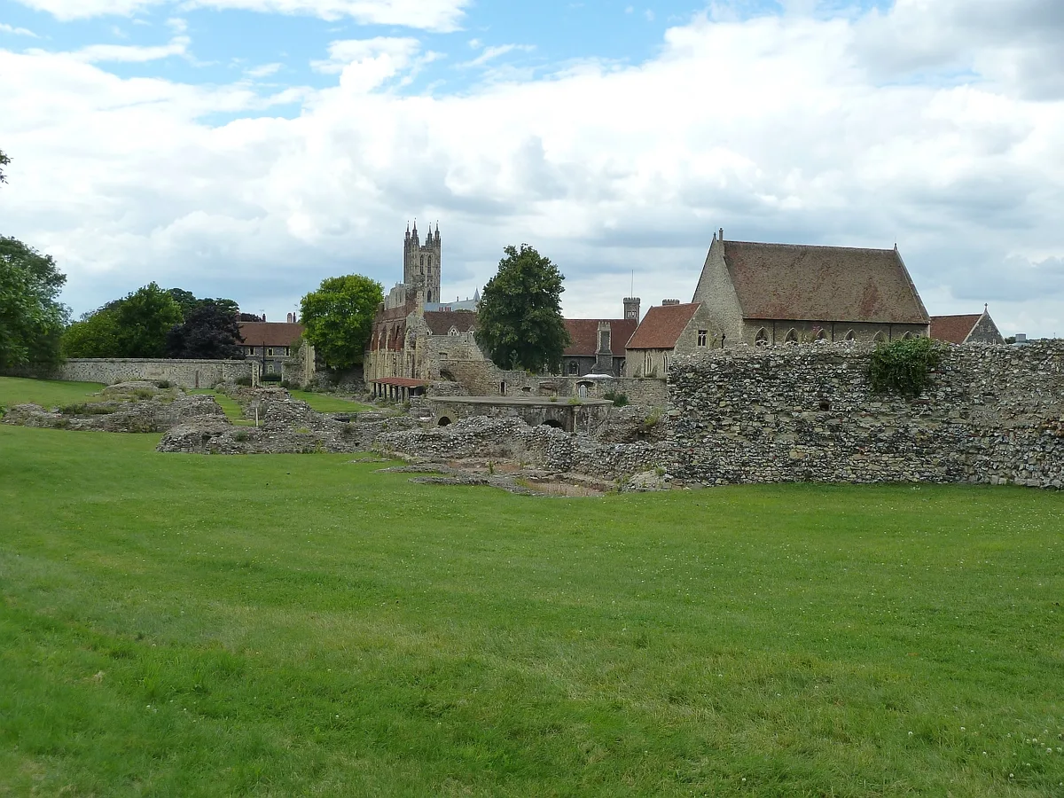
St Augustine's Abbey
St Augustine's Abbey — monastery in Canterbury, Kent, England, UK.
 📷 5
📷 5Historic churches · South East England
286
286 — church building in Swaythling, Southampton, England.
 📷 5
📷 5Historic churches · South East England
Abbey Church of St Gregory the Great, Downside Abbey
Abbey Church of St Gregory the Great, Downside Abbey — church in Stratton-on-the-Fosse, Somerset, England, UK.
 📷 5
📷 5Historic churches · South East England
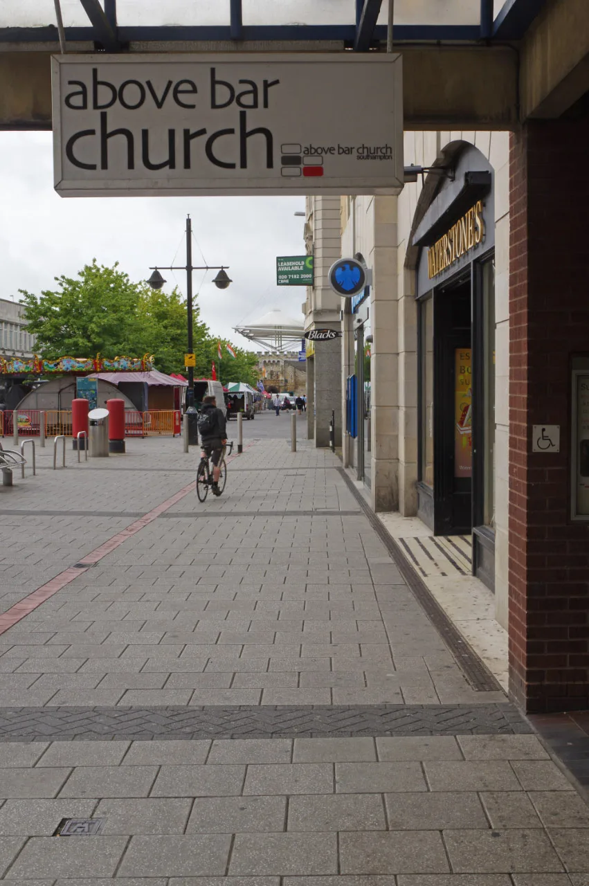
Above Bar Church, Southampton
Above Bar Church, Southampton — church in Southampton, UK.
Frequently asked questions
- Where is Borough of Swale?
- Borough of Swale is in Kent, South-East England, United Kingdom (postcode ME10 1HR), in the parish of Swale, unparished area.
- Who owns Borough of Swale?
- Borough of Swale is owned by Swale Borough Council.
- Is Borough of Swale free to visit?
- Yes, Borough of Swale is free to enter.
- How do I get to Borough of Swale?
- Drivers can navigate to postcode ME10 1HR. It sits within the Sittingbourne and Sheppey parliamentary constituency.