Museums · London
Borough of Brentwood
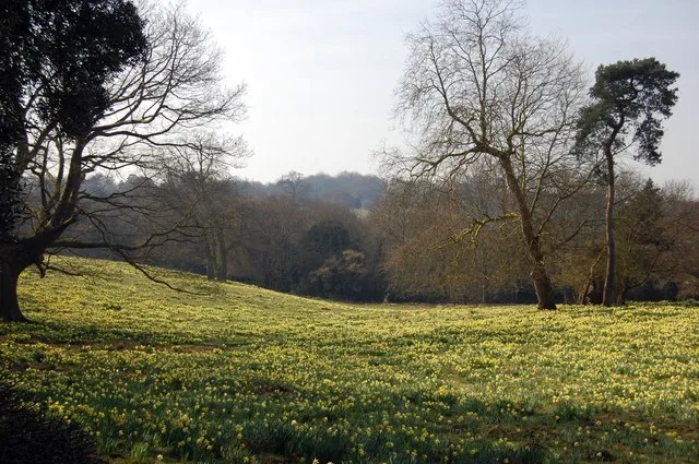
The Borough of Brentwood is a local government district with borough status in Essex, England. The borough is named after its main town of Brentwood, where the council is based; it includes several vi

Earth Science and Remote Sensing Unit, Lyndon B. Johnson Space Center — Public domain via Wikimedia Commons licence
Plan your visit
- Typical visit
- 1.5 h–3 h
- Best time of year
- Year-round
- Family-friendly
- Limited wheelchair access
About
The Borough of Brentwood is a local government district with borough status in Essex, England. The borough is named after its main town of Brentwood, where the council is based; it includes several villages and the surrounding rural area. The neighbouring districts are Epping Forest, Chelmsford, Basildon, Thurrock and the London Borough of Havering.
Photo gallery
From the Wikipedia article
The Borough of Brentwood is a local government district with borough status in Essex, England. The borough is named after its main town of Brentwood, where the council is based; it includes several villages and the surrounding rural area. The neighbouring districts are Epping Forest, Chelmsford, Basildon, Thurrock and the London Borough of Havering.
Excerpt from Wikipedia under CC BY-SA 4.0. See the source article linked in Sources below.
Background
History
The former Brentwood Urban District had been created in 1899. Urban districts were abolished in 1974 under the Local Government Act 1972. A new non-metropolitan district was created on 1 April 1974 covering the whole of the former Brentwood Urban District plus parts of another two districts, which were all abolished at the same time: The new district was named Brentwood after its main town. The district was awarded borough status on 10 March 1993, allowing the chair of the council to take the title of mayor. Under upcoming local government reform plans the area of the district will be combined with the Chelmsford and Maldon districts to form the new Mid Essex unitary authority from 2028.
Sourced from Wikipedia under CC BY-SA 4.0.
- Coordinates
- 51.6000, 0.3000
- County
- Essex
- District
- Brentwood
- Parish
- Brentwood, unparished area
- Postcode
- CM13 3GW
- Parliamentary constituency
- Brentwood and Ongar
Sources
- wikipedia: Borough of Brentwood (CC BY-SA 4.0)
Other places nearby
Loading nearby places…
Nearby
 📷 5
📷 5Cemeteries · London
Woodman Road Cemetery
Woodman Road Cemetery is a cemetery in the United Kingdom.
 📷 5
📷 5Museums · London
Brentwood Museum
Brentwood Museum — a museum in england-london, United Kingdom.
 Flagship📷 10
Wildlife reserves · London
Warley Place
Warley Place — Essex Wildlife Trust Nature reserve.
 Flagship📷 6
Wildlife reserves · London
Thorndon Park
Thorndon Park — Site of Special Scientific Interest in England.
 📷 5
📷 5Historic churches · London
Brentwood Mosque
Brentwood Mosque — a church in england-london, United Kingdom.
 📷 5
📷 5Public art & sculpture · London
Gruffalo's Child
Gruffalo's Child — a public art in england-london, United Kingdom.
More museums in this region
 Flagship📷 10
Museums · London
Kenwood House
Kenwood House — art museum and historic house in Hampstead, London.
 📷 5
📷 5Museums · London
American Air Museum
American Air Museum — museum at Imperial War Museum Duxford, Cambridgeshire, England, UK.
 📷 5
📷 5Museums · London
Amora London
Amora London — European touring exhibition dedicated to love, relationships and sexual wellbeing.
 📷 5
📷 5Museums · London
Antique Breadboard Museum
Antique Breadboard Museum — small museum in Putney, London, England, UK.
Frequently asked questions
- Where is Borough of Brentwood?
- Borough of Brentwood is in Essex, London, United Kingdom (postcode CM13 3GW), in the parish of Brentwood, unparished area.
- Who owns Borough of Brentwood?
- Borough of Brentwood is owned by Brentwood Borough Council.
- How do I get to Borough of Brentwood?
- Drivers can navigate to postcode CM13 3GW. It sits within the Brentwood and Ongar parliamentary constituency.