Wildlife reserves · West Midlands
Blow's Down
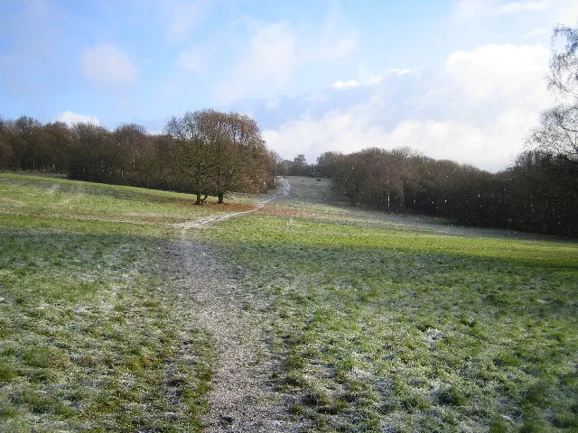
Blow's Down — nature reserve in the United Kingdom.

Wikimedia Commons contributors — see linked file page for photographer and licence licence
Plan your visit
- Typical visit
- 2 h–4 h
- Best time of year
- Autumn & winter (migration & wildfowl)
- Nearest railway station
- Leagrave · 3.9 km
- Free entry
- Family-friendly
- Dog-friendly
- Limited wheelchair access
About
Blow's Down is a wildlife reserve in the United Kingdom. Heritage designation: Site of Special Scientific Interest. Managed by Wildlife Trust for Bedfordshire, Cambridgeshire and Northamptonshire. Wikidata describes it as: "nature reserve in the United Kingdom". Coordinates: 51.8830°, -0.5020°.
Photo gallery
Protected designations
- Site of Special Scientific Interest: Blow's Down SSSI
- Area of Outstanding Natural Beauty: Chilterns
Designations sourced from Natural England open data under OGL v3.
From the Wikipedia article
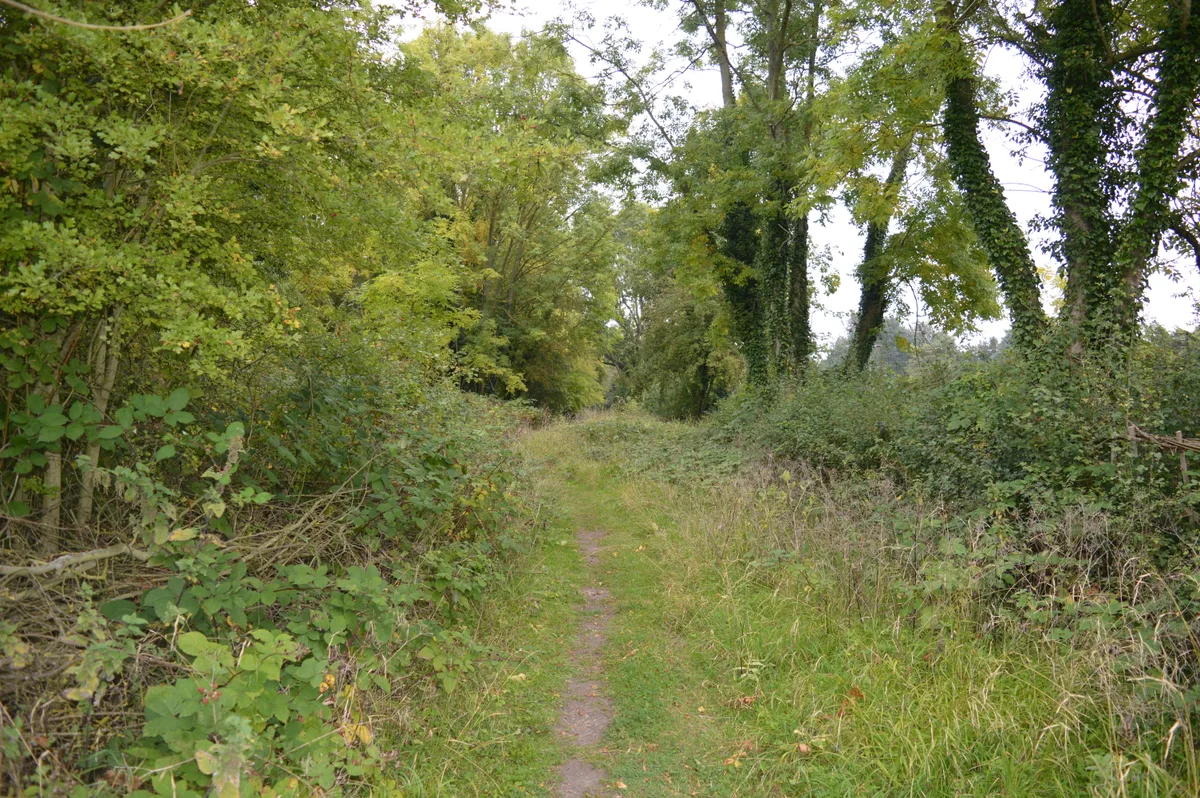
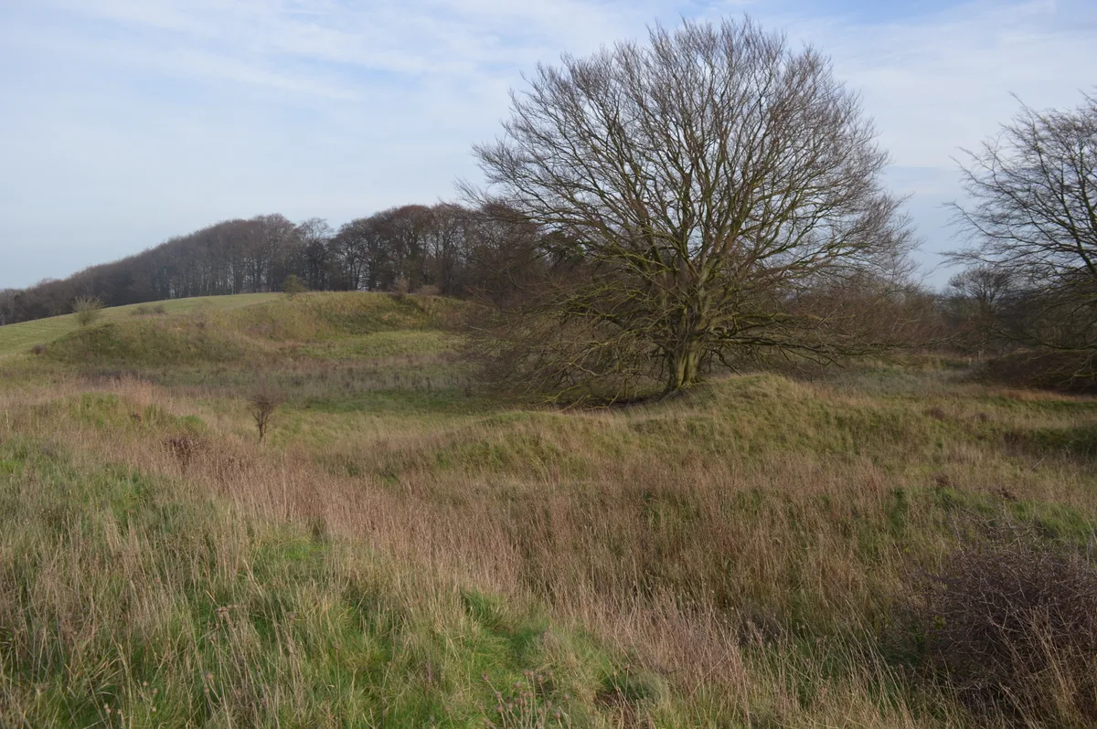
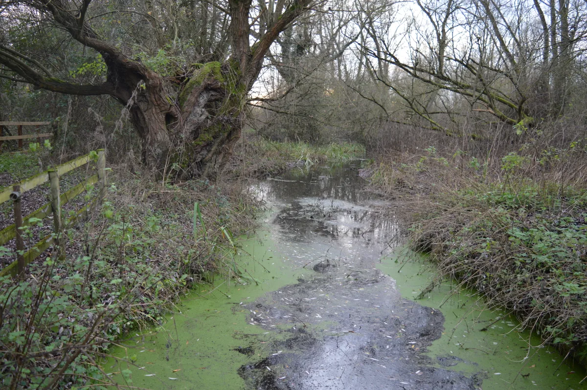
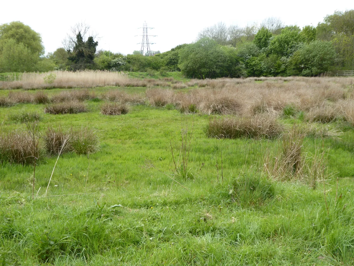
Blow's Down (or Blow's Downs) is a 33.1-hectare (82-acre) biological Site of Special Scientific Interest in Dunstable in Bedfordshire. It was notified in 1989 under Section 28 of the Wildlife and Countryside Act 1981, and the local planning authority is Central Bedfordshire Council. The site forms around half of the 62.3-hectare (154-acre) Blow's Downs nature reserve, which is managed by the Wildlife Trust for Bedfordshire, Cambridgeshire and Northamptonshire. It has a maximum elevation of 212 m. The site has varied habitats with a large area of unimproved grassland, a scarce survival of this important habitat. Cattle help to maintain the pasture. Features include a disused quarry and medieval cultivation terraces. A rare plant, Bunium bulbocastanum, and beetle Odontaeus armiger can be found at the site. Dunstable is built around Blow's Down, from the south around clockwise to the east. The A5 road follows a valley between the Blow's Down and the neighbouring Dunstable Downs, which together make up part of the Chiltern Hills range. There is access from Jeans Way in the north, from Jardine Way and Half Moon Lane in the west, and from Skimpot Road in the east.
Excerpt from Wikipedia under CC BY-SA 4.0. See the source article linked in Sources below.
- Coordinates
- 51.8830, -0.5020
- District
- Central Bedfordshire
- Parish
- Dunstable
- Postcode
- LU5 4AG
- Parliamentary constituency
- Dunstable and Leighton Buzzard
- Nearest railway station
- Leagrave — 3.9 km
Sources
- wikidata: Q20878081 (CC0)
- wikipedia: Blow's Down (CC BY-SA 4.0)
- commons: Dunstable, Blow's Down or Downs - geograph.org.uk - 145589.jpg (CC BY-SA 4.0)
Other places nearby
Loading nearby places…
Nearby
Vineyards · London
Medieval village 100m west of Zouches Farm
Medieval village 100m west of Zouches Farm — a UK vineyard in england london, producing English or Welsh wine from cool-climate grape varieties.
 📷 3
📷 3Theatres · West Midlands
Little Theatre
Little Theatre is a theatre in the United Kingdom.
 📷 3
📷 3Hill forts · West Midlands
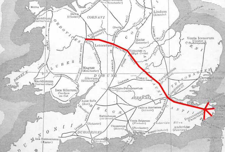
Durocobrivis
Durocobrivis — archaeological site in Dunstable, Central Bedfordshire, England, UK.
 📷 3
📷 3Theatres · West Midlands
Dunstable Conference Centre
Dunstable Conference Centre is a theatre in the United Kingdom.
📷 5Theatres · West Midlands
Union Cinema
Union Cinema — a cinema heritage in england-west-midlands, United Kingdom.
 📷 3
📷 3Theatres · West Midlands
Grove Theatre
Grove Theatre is a theatre in the United Kingdom.
More places run by Wildlife Trust for Bedfordshire, Cambridgeshire and Northamptonshire
 📷 5
📷 5Wildlife reserves · London
Arlesey Old Moat and Glebe Meadows
Arlesey Old Moat and Glebe Meadows — nature reserve in the United Kingdom.
 📷 5
📷 5Wildlife reserves · London
Barton Gravel Pit
Barton Gravel Pit — nature reserve in the United Kingdom.
 📷 5
📷 5Wildlife reserves · London
Beechwoods nature reserve
Beechwoods nature reserve is a wildlife reserve in the United Kingdom.
 📷 5
📷 5Wildlife reserves · London
Begwary Brook
Begwary Brook — nature reserve in the United Kingdom.
More places in this region
 Flagship📷 3
Wildlife reserves · West Midlands
Abington Meadows
Abington Meadows — nature reserve in the United Kingdom.
 📷 5
📷 5Wildlife reserves · West Midlands
Brandon Marsh
Brandon Marsh — nature reserve in the United Kingdom.
 📷 5
📷 5Wildlife reserves · West Midlands
Bugbrooke Meadows
Bugbrooke Meadows — nature reserve in the United Kingdom.
 📷 5
📷 5Wildlife reserves · West Midlands
Chorleywood Common
Chorleywood Common — nature reserve in Hertfordshire, England.
Frequently asked questions
- Where is Blow's Down?
- Blow's Down is in the West Midlands, United Kingdom (postcode LU5 4AG), in the parish of Dunstable.
- Who runs Blow's Down?
- Blow's Down is operated by Wildlife Trust for Bedfordshire, Cambridgeshire and Northamptonshire.
- Is Blow's Down a listed building?
- Blow's Down is officially recognised as Site of Special Scientific Interest listed.
- Is Blow's Down a protected site?
- Yes — Blow's Down is part of the Blow's Down SSSI Site of Special Scientific Interest and the Chilterns National Landscape (AONB).
- Is Blow's Down free to visit?
- Yes, Blow's Down is free to enter.
- How do I get to Blow's Down?
- The nearest railway station is Leagrave, about 3.9 km away. Drivers can navigate to postcode LU5 4AG.