Reservoirs & lochs · Yorkshire & the Humber
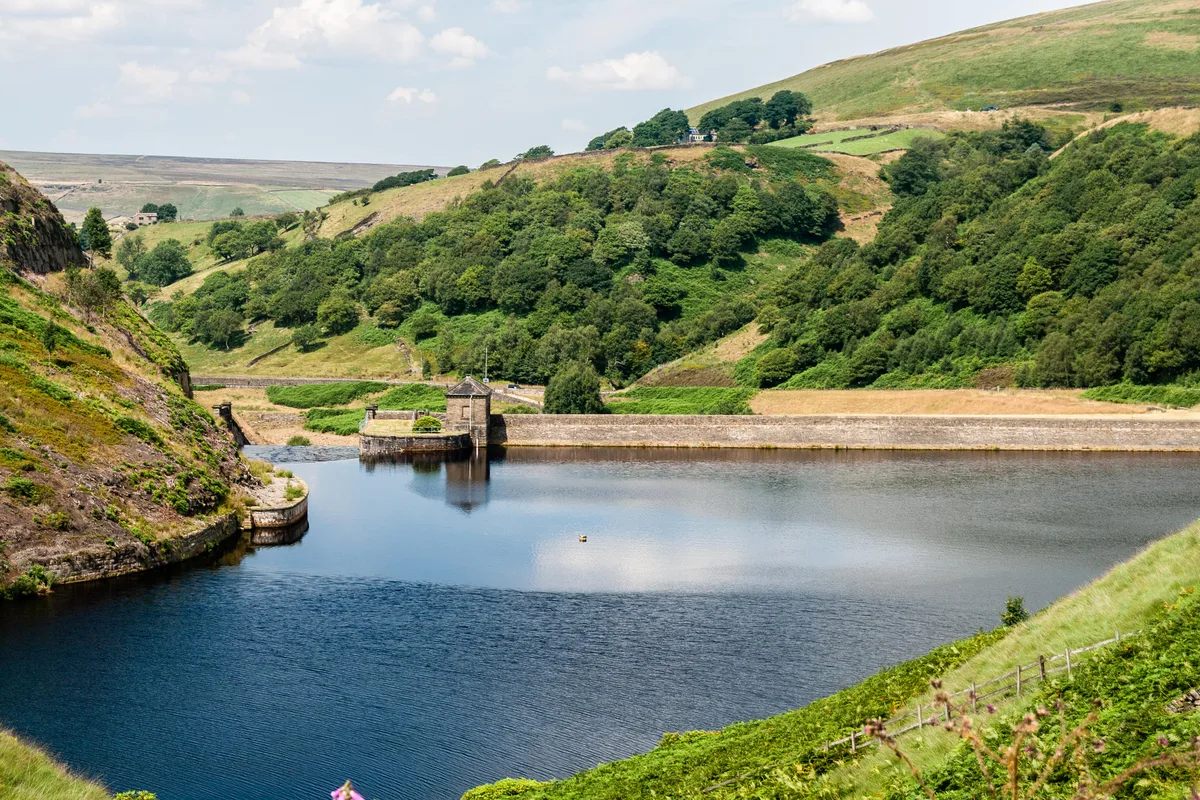
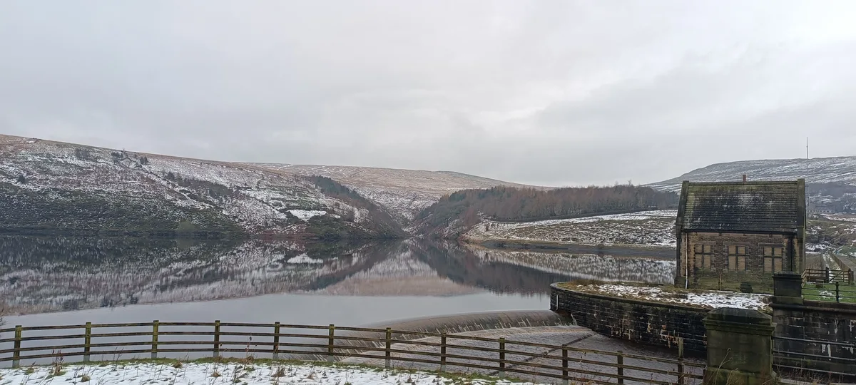
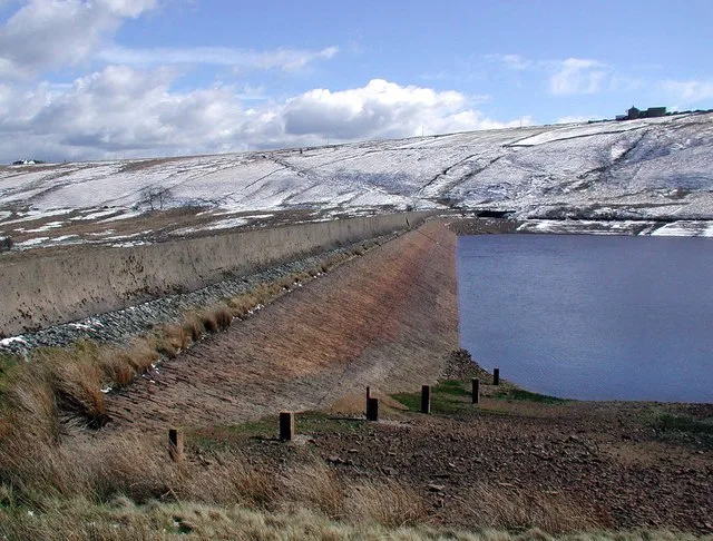
Blackmoorfoot Reservoir
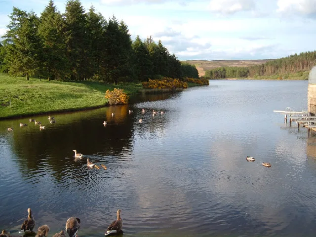
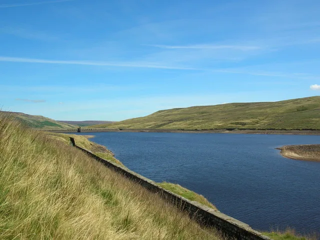
Blackmoorfoot Reservoir — reservoir in West Yorkshire, England, UK.

Wikimedia Commons licence
Plan your visit
- Typical visit
- 1 h–2.5 h
- Nearest railway station
- Slaithwaite · 2.3 km
- Free entry
- Dog-friendly
About
Blackmoorfoot Reservoir is a reservoir in the United Kingdom. Managed by Huddersfield Corporation Water Works. Wikidata describes it as: "reservoir in West Yorkshire, England, UK". Coordinates: 53.6110°, -1.8530°.
Photo gallery
Protected designations
- Site of Special Scientific Interest: South Pennine Moors SSSI
Designations sourced from Natural England open data under OGL v3.
From the Wikipedia article
Blackmoorfoot Reservoir is a freshwater supply reservoir located on moorland 4 miles (6.4 km) south of Huddersfield in West Yorkshire, England. The reservoir lies at an altitude of 253 metres (830 ft) above sea level, and is fed by catchwaters dug into the moorland to the south-west of the reservoir. It was built in the 1870s, and is now owned by Yorkshire Water.
Excerpt from Wikipedia under CC BY-SA 4.0. See the source article linked in Sources below.
Background
History
The reservoir is 4 mi south-west of Huddersfield, and lies at an altitude of 253 m, draining an area of 130 ha, with water being fed into the reservoir by catchwaters cut into the moorland. The reservoir contains 2,962,139 m3 of water, covers an area of 38 ha, and has an average depth of 7.8 m. The name is first recorded on Ordnance Survey maps in the early 19th century, deriving from Old Norse blæc mōr fōt. The reservoir was approved under the Huddersfield Water Act 1869 (32 & 33 Vict. c. cx) although it lists the reservoir as Black Moor Foot. As built, the reservoir infrastructure also included 5.5 mi of conduits (catchwaters) across the moorland carrying water into the reservoir. This…
Sourced from Wikipedia under CC BY-SA 4.0.
- Coordinates
- 53.6110, -1.8530
- District
- Kirklees
- Parish
- Kirklees, unparished area
- Postcode
- HD7 5PZ
- Parliamentary constituency
- Colne Valley
- Nearest railway station
- Slaithwaite — 2.3 km
- Official site
- www.yorkshirewater.com
Sources
- wikidata: Q24661244 (CC0)
- wikipedia: Blackmoorfoot Reservoir (CC BY-SA 4.0)
Other places nearby
Loading nearby places…
Nearby
 📷 3
📷 3Viewpoints · Yorkshire & the Humber
Huddersfield Observatory
Huddersfield Observatory is a viewpoint in the United Kingdom.
 📷 3
📷 3Natural landmarks · Yorkshire & the Humber
Tractor Turning Circle
Tractor Turning Circle — a natural landmark in england-yorkshire, United Kingdom.
 📷 3
📷 3Historic bridges · Yorkshire & the Humber
Road Bridge Over Brindley Brook
Road Bridge Over Brindley Brook — Grade II listed building-listed bridge in england-yorkshire, United Kingdom.
 📷 3
📷 3Historic houses · Yorkshire & the Humber
Crosland Hall
Crosland Hall — house in Kirklees, West Yorkshire, England, UK.
 📷 3
📷 3Historic bridges · Yorkshire & the Humber
Bridge Over Hall Dike
Bridge Over Hall Dike — Grade II listed building-listed bridge in england-yorkshire, United Kingdom.
 📷 5
📷 5Museums · Yorkshire & the Humber
Meltham
Meltham is a town and civil parish within the Metropolitan Borough of Kirklees, in West Yorkshire, England. It lies in the Holme Valley, below Wessenden Moor, 5 miles (8 kilometres) south-west of Hudd
More places run by Huddersfield Corporation Water Works
 📷 3
📷 3Reservoirs & lochs · Yorkshire & the Humber
Blakeley Reservoir
Blakeley Reservoir — reservoir in West Yorkshire, England, UK.
 📷 3
📷 3Reservoirs & lochs · Yorkshire & the Humber
Butterley Reservoir
Butterley Reservoir — reservoir in West Yorkshire, England, UK.
 📷 3
📷 3Reservoirs & lochs · Yorkshire & the Humber
Deanhead Reservoir
Deanhead Reservoir — reservoir in West Yorkshire, England, UK.
 📷 3
📷 3Reservoirs & lochs · Yorkshire & the Humber
Digley Reservoir
Digley Reservoir — reservoir in West Yorkshire, England, UK.
More places in this region
 Flagship📷 3
Reservoirs & lochs · Yorkshire & the Humber
Chelker Reservoir
Chelker Reservoir — reservoir in North Yorkshire, England, UK.
 Flagship📷 5
Reservoirs & lochs · Yorkshire & the Humber
Cod Beck Reservoir
Cod Beck Reservoir — reservoir in North Yorkshire, England, UK.
 📷 5
📷 5Reservoirs & lochs · Yorkshire & the Humber
Angram Reservoir
Angram Reservoir — reservoir in North Yorkshire, England, UK.
 📷 5
📷 5Reservoirs & lochs · Yorkshire & the Humber
Baitings Reservoir
Baitings Reservoir — reservoir in West Yorkshire, England, UK.
Frequently asked questions
- Where is Blackmoorfoot Reservoir?
- Blackmoorfoot Reservoir is in Yorkshire, United Kingdom (postcode HD7 5PZ), in the parish of Kirklees, unparished area.
- Who runs Blackmoorfoot Reservoir?
- Blackmoorfoot Reservoir is operated by Huddersfield Corporation Water Works.
- Is Blackmoorfoot Reservoir a protected site?
- Yes — Blackmoorfoot Reservoir is part of the South Pennine Moors SSSI Site of Special Scientific Interest.
- How do I get to Blackmoorfoot Reservoir?
- The nearest railway station is Slaithwaite, about 2.3 km away. Drivers can navigate to postcode HD7 5PZ.