Natural landmarks · Scottish Highlands
Blà Bheinn
Blà Bheinn — 929m high mountain on the Isle of Skye, in Highland, Scotland, UK.

Wikimedia Commons contributors — see linked file page for photographer and licence licence
Plan your visit
- Typical visit
- 1 h–2 h
- Free entry
- Dog-friendly
About
Blà Bheinn is a named natural landmark in the United Kingdom. Wikidata describes it as: "929m high mountain on the Isle of Skye, in Highland, Scotland, UK". Coordinates: 57.2196°, -6.0932°.
Photo gallery
From the Wikipedia article
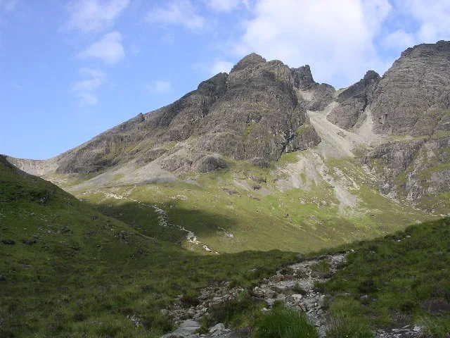
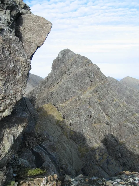
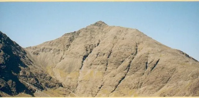
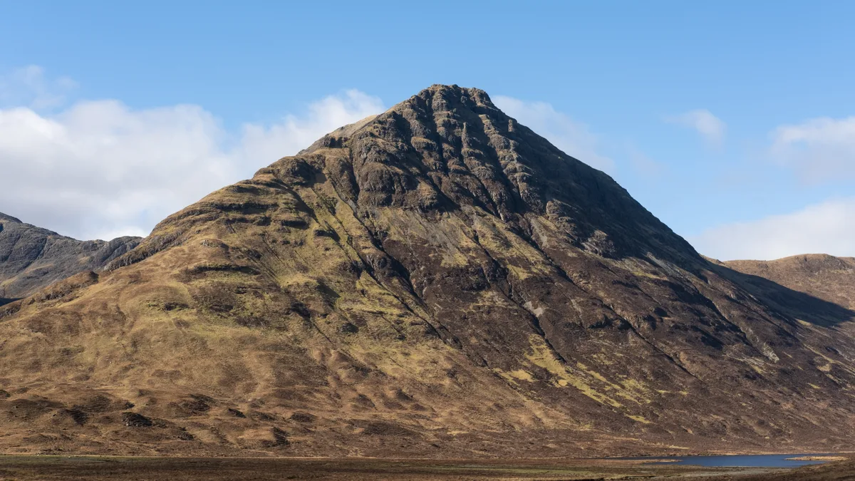
Blà Bheinn or Blàbheinn, also known as Blaven, is a mountain on the Isle of Skye in Scotland. It is usually regarded as an outlier of the Black Cuillin range. It is a Munro with a height of 929 metres (3,048 ft). North of the summit is the ridge of Clach Glas, which leads to the peaks of Garbh-bheinn (808 m) and Sgùrr nan Each (720 m). It is mainly composed of gabbro, a rock with excellent grip for mountaineers and scramblers. The name Blà Bheinn is thought to mean "blue mountain", from a combination of Norse and Gaelic. Whereas blå in Modern Norwegian means "blue", the Old Norse word blá could, however, also refer to the colours blue-black and black. The normal route of ascent for walkers is from the east. A path leaves the B8083 on the shores of Loch Slapin about 4 km after the village of Torrin. The path follows a burn, the Allt na Dunachie, into the corrie of Coire Uaigneich. From here a short steep route along the ridge leads to the summit. A small amount of scrambling is needed to reach the true top of the mountain. Alternative routes follow the south ridge, or come from the north having traversed the Clach Glas ridge which links to the Red Cuillin peaks. Blaven stands in the Strathaird Estate, owned and managed since 1994 by the John Muir Trust.
Excerpt from Wikipedia under CC BY-SA 4.0. See the source article linked in Sources below.
- Coordinates
- 57.2196, -6.0932
- Address
- Skye, Scotland
- Official site
- www.hill-bagging.co.uk
Sources
- wikidata: Q3775703 (CC0)
- wikipedia: Blà Bheinn (CC BY-SA 4.0)
- commons: Blaven geograph.jpg (CC BY-SA 4.0)
Other places nearby
Loading nearby places…
Nearby
 📷 4
📷 4Mountains & hills · Scottish Highlands
Blà Bheinn
Blà Bheinn — Named summit at 928 m.
 📷 3
📷 3Natural landmarks · Scottish Highlands
Clach Glas
Clach Glas — mountain on the Isle of Skye, in Highland, Scotland, UK.
 📷 3
📷 3Mountains & hills · Scottish Highlands
Garbh-bheinn
Garbh-bheinn — Named summit at 808 m.
 📷 4
📷 4Other places · Scottish Islands
Kilmaluag Formation
Kilmaluag Formation in Scotland Islands, United Kingdom.
 📷 3
📷 3Mountains & hills · Scottish Highlands
Belig
Belig — Named summit at 702 m.
 📷 5
📷 5Islands · Scottish Islands
Camasunary
Camasunary in Scotland Islands, United Kingdom.
More natural landmarks in this region
 Flagship📷 3
Natural landmarks · Scottish Highlands
Dunalastair Water
Dunalastair Water — lake in Perth and Kinross, Scotland, UK, on the River Tummel.
 Flagship📷 3
Natural landmarks · Scottish Highlands
Loch Arkaig
Loch Arkaig — lake in Highland, Scotland, UK, outflows east to River Arkaig.
 Flagship📷 3
Natural landmarks · Scottish Highlands
Loch Assynt
Loch Assynt — lake in Highland, Scotland, UK, outflows to the River Inver and Loch na Garbh Uidhe.
 Flagship📷 3
Natural landmarks · Scottish Highlands
Loch Awe
Loch Awe — lake in Argyll and Bute, Scotland, UK, outflows to the River Awe.
Frequently asked questions
- Where is Blà Bheinn?
- Blà Bheinn is in Scottish Highlands, in the United Kingdom — coordinates 57.2196°, -6.0932°.
- Is Blà Bheinn free to visit?
- Yes — admission to Blà Bheinn is free.