Mountains & hills · North East England
Bessyboot
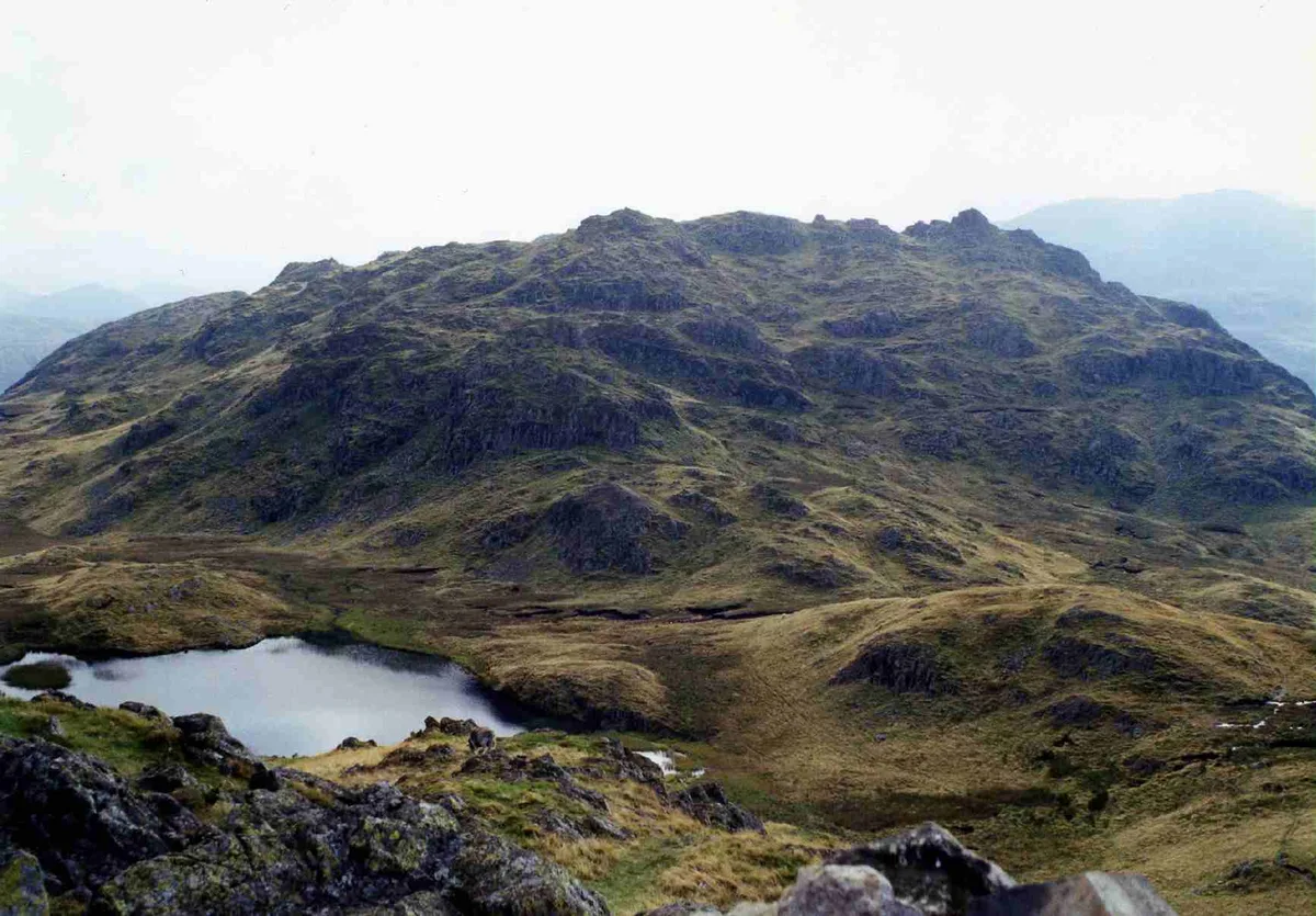
Bessyboot — Named summit at 551 m.

Wikimedia Commons contributors — see linked file page for photographer and licence licence
Plan your visit
- Typical visit
- 3 h–8 h
- Best time of year
- Late spring – early autumn (May–Oct)
- Free entry
- Dog-friendly
About
Bessyboot is a named summit in the United Kingdom. Wikidata describes it as: "Named summit at 551 m.". Coordinates: 54.5022°, -3.1468°.
Photo gallery
Protected designations
- Site of Special Scientific Interest: River Derwent and Tributaries SSSI
- Site of Special Scientific Interest: Rosthwaite Fell SSSI
- National Nature Reserve: BORROWDALE RAINFOREST
Designations sourced from Natural England open data under OGL v3.
From the Wikipedia article
Rosthwaite Fell is a fell in the English Lake District. It is situated some 12 kilometres (7+1⁄2 miles) due south of Keswick and 2 kilometres (1+1⁄4 miles) south of the village of Rosthwaite in Borrowdale. Rosthwaite Fell also has loose connections to the Scafell group of fells. The fells name derives from the Old Norse language and means “The peak above the clearing with a heap of stones” with “hreysi” meaning a heap of stones and “thveit” meaning a clearing.
Excerpt from Wikipedia under CC BY-SA 4.0. See the source article linked in Sources below.
- Coordinates
- 54.5022, -3.1468
- District
- Cumberland
- Parish
- Borrowdale
- Postcode
- CA12 5XH
- Parliamentary constituency
- Penrith and Solway
Sources
- osm: n5688151448 (ODbL)
- wikipedia: Rosthwaite Fell (CC BY-SA 4.0)
- commons: Rosthwaite Cam from Bessyboot.jpg (CC BY-SA 4.0)
Other places nearby
Loading nearby places…
Nearby
 📷 3
📷 3Natural landmarks · North West England
Rosthwaite Fell
Rosthwaite Fell — mountain in United Kingdom.
Campsites · North East England
National Trust Campsite
National Trust Campsite — a campsite in england north east.
 Flagship📷 5
National parks · North East England
Lake District
Lake District is a Mountainous region and national park in North West England.
Climbing & bouldering crags · North West England
Raven Crag
Raven Crag — a climbing crag in england north west.
Campsites · North East England
Chapel House Farm Campsite
Chapel House Farm Campsite — a campsite in england north east.
Campsites · North East England
Seatoller Farm
Seatoller Farm — a campsite in england north east.
More mountains in this region
 📷 3
📷 3Mountains & hills · North East England
Angletarn Pikes
Angletarn Pikes — Named summit at 566 m.
 📷 3
📷 3Mountains & hills · North East England
Angletarn Pikes South Top
Angletarn Pikes South Top — Named summit at 563.6 m.
 📷 3
📷 3Mountains & hills · North East England
Ard Crags
Ard Crags — Named summit at 581 m.
 📷 3
📷 3Mountains & hills · North East England
Arnison Crag
Arnison Crag — Named summit at 433 m.
Frequently asked questions
- Where is Bessyboot?
- Bessyboot is in North-East England, United Kingdom (postcode CA12 5XH), in the parish of Borrowdale.
- Is Bessyboot a protected site?
- Yes — Bessyboot is part of the River Derwent and Tributaries SSSI Site of Special Scientific Interest and the Rosthwaite Fell SSSI Site of Special Scientific Interest.
- Is Bessyboot free to visit?
- Yes, Bessyboot is free to enter.
- How do I get to Bessyboot?
- Drivers can navigate to postcode CA12 5XH. It sits within the Penrith and Solway parliamentary constituency.