Mountains & hills · Scottish Highlands
Ben Rinnes
Also known as: Beinn Ruaidhneis
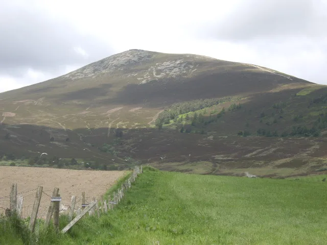
Ben Rinnes — Named summit at 840 m.

Wikimedia Commons contributors — see linked file page for photographer and licence licence
Plan your visit
- Typical visit
- 3 h–8 h
- Best time of year
- Late spring – early autumn (May–Oct)
- Nearest railway station
- Dufftown · 9.0 km
- Free entry
- Dog-friendly
About
Ben Rinnes is a named summit in the United Kingdom. Also known as: Beinn Ruaidhneis. Wikidata describes it as: "Named summit at 840 m.". Coordinates: 57.4033°, -3.2413°.
Photo gallery
From the Wikipedia article
Ben Rinnes (Scottish Gaelic: Beinn Ruaidhneis) is a mountain in Moray, in northern Scotland. The mountain is popular with hikers. The mountain is 20 km2 in total and is located 8 km southwest of Dufftown. The mountain has one main path and can be easily accessed from the nearby car park. The Friends of Ben Rinnes program has been working on the paths to make it more accessible to the public and to prevent further erosion of the fragile ecosystem on the steep slopes and has been rather successful.
Excerpt from Wikipedia under CC BY-SA 4.0. See the source article linked in Sources below.
- Coordinates
- 57.4033, -3.2413
- Address
- Moray, Scotland
- Nearest railway station
- Dufftown — 9 km
Sources
- osm: n863758721 (ODbL)
- wikipedia: Ben Rinnes (CC BY-SA 4.0)
- commons: View to Ben Rinnes - geograph.org.uk - 1339405.jpg (CC BY-SA 4.0)
Other places nearby
Loading nearby places…
Nearby
 📷 5
📷 5Natural landmarks · Scottish Highlands
Ben Rinnes
Ben Rinnes — mountain in Moray, Scotland, UK.
 📷 5
📷 5Castles · Scottish Highlands
Moray
Moray — a castle in scotland-highlands, United Kingdom.
 📷 3
📷 3Distilleries · Scottish Highlands
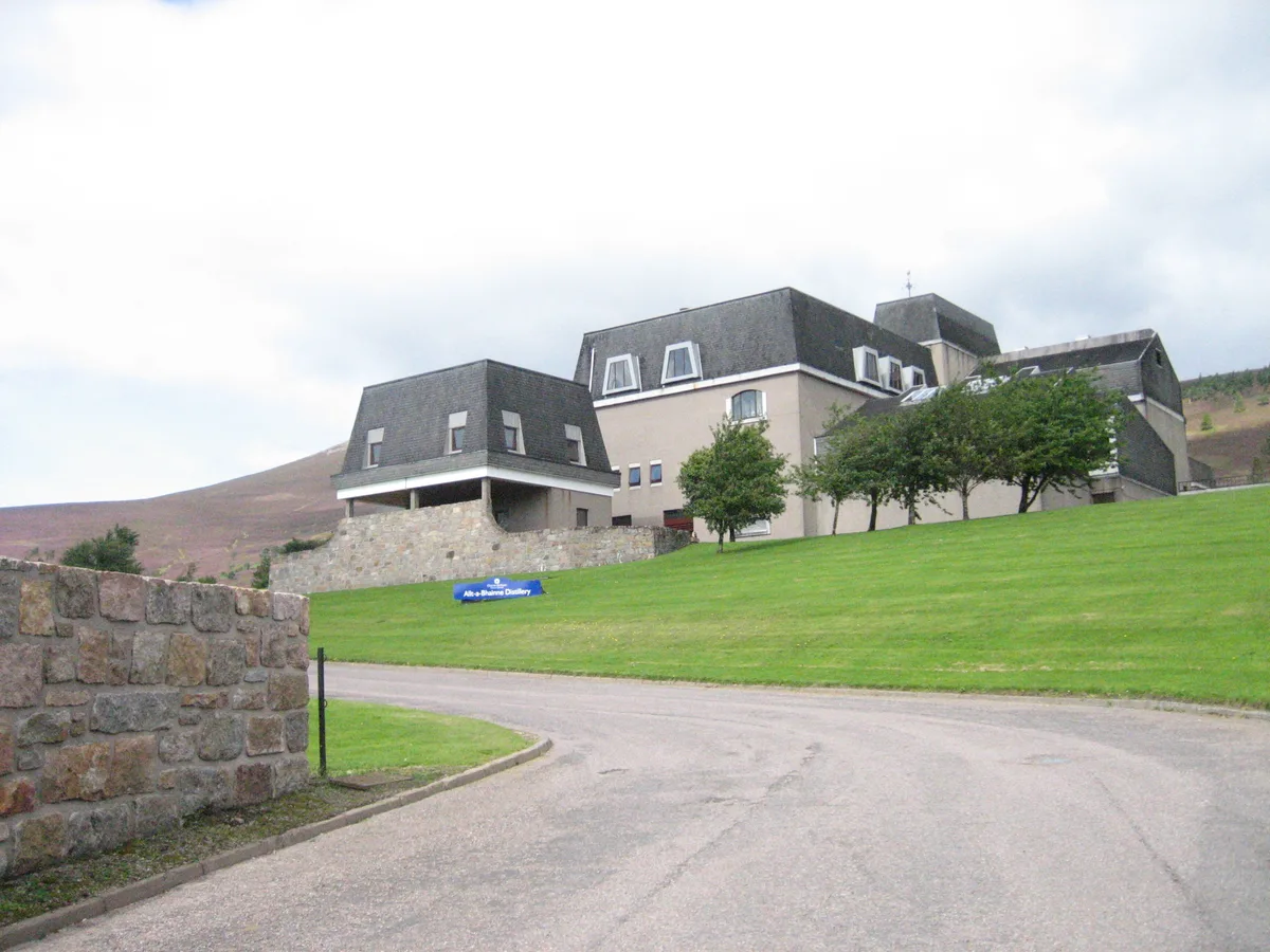
Allt-A-Bhainne distillery
Allt-A-Bhainne distillery — Whisky/spirit distillery.
 📷 3
📷 3Distilleries · Scottish Highlands
Glenrinnes Distillery
Glenrinnes Distillery — Whisky/spirit distillery.
 📷 3
📷 3Memorials & monuments · Scottish Highlands
Glenrinnes War Memorial
Glenrinnes War Memorial — a memorial in scotland-highlands, United Kingdom.
📷 5Historic churches · Scottish Highlands
Glen Rinnes Church Of Scotland
Glen Rinnes Church Of Scotland — category B listed building-listed church in scotland-highlands, United Kingdom.
More mountains in this region
 📷 3
📷 3Mountains & hills · Scottish Highlands
A' Bhuidheanach Bheag
A' Bhuidheanach Bheag — Named summit at 936 m.
 📷 3
📷 3Mountains & hills · Scottish Highlands
A' Chailleach
A' Chailleach — Named summit at 997 m.
 📷 3
📷 3Mountains & hills · Scottish Highlands
A' Chailleach
A' Chailleach — Named summit at 930 m.
 📷 3
📷 3Mountains & hills · Scottish Highlands
A' Chaoirnich
A' Chaoirnich — Named summit at 875 m.
Frequently asked questions
- Where is Ben Rinnes?
- Ben Rinnes is in Scottish Highlands, in the United Kingdom — coordinates 57.4033°, -3.2413°. The nearest railway station is Dufftown, around 9 km away.
- Is Ben Rinnes free to visit?
- Yes — admission to Ben Rinnes is free.