Natural landmarks · Scottish Highlands
Ben Macdui
Also known as: Ben Macdhui, Beinn Mac Duibh
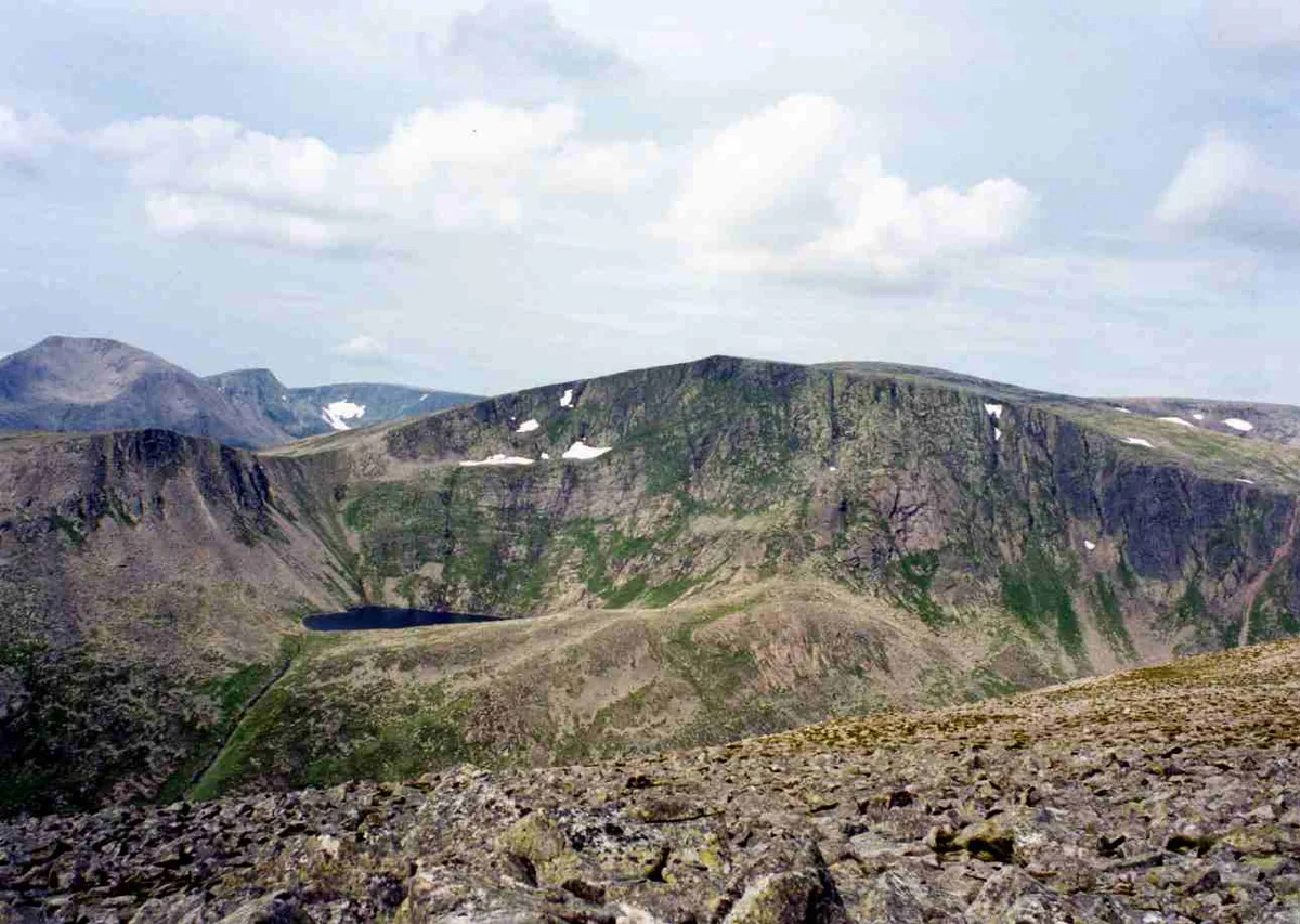
Ben Macdui — mountain on the Aberseendshire and Moray border, Scotland; second highest mountain in the UK.

Wikimedia Commons contributors — see linked file page for photographer and licence licence
Plan your visit
- Typical visit
- 1 h–2 h
- Nearest railway station
- Ptarmigan Station · 6.1 km
- Free entry
- Dog-friendly
About
Ben Macdui is a named natural landmark in the United Kingdom. Wikidata describes it as: "mountain on the Aberseendshire and Moray border, Scotland; second highest mountain in the UK". Coordinates: 57.0704°, -3.6691°.
Photo gallery
From the Wikipedia article
Ben Macdui (Scottish Gaelic: Beinn MacDuibh, meaning "MacDuff's mountain") is the second-highest mountain in Scotland and all of the British Isles, after Ben Nevis, and the highest of the Cairngorm Mountains. The summit is 1,309 metres (4,295 ft) above sea level and it is classed as a Munro. Ben Macdui is situated on the southwestern edge of the Cairngorm plateau, overlooking the Lairig Ghru pass to the west, and Loch Etchachan to the east. It lies on the boundary between the historic counties of Aberdeenshire and Banffshire. Before the production of accurate maps of Scotland in the 19th century, it was not known for certain that Ben Nevis was the highest point in Britain, and it was often thought that Ben Macdui might be higher. Following surveys of both peaks in 1846–47, Ben Nevis was confirmed as the higher. The summit of the mountain has a direction indicator erected in 1925 by the Cairngorm Club of Aberdeen in memory of former president Alexander Copland. The indicator shows the directions of the most noteworthy mountains that can be seen from the summit in clear weather. Snow patches have been known to persist at various locations on Ben Macdui, most notably Garbh Uisge Beag. The mountain is said to be haunted by the legendary Am Fear Liath Mòr (Big Grey Man).
Excerpt from Wikipedia under CC BY-SA 4.0. See the source article linked in Sources below.
Background
History
to the west]] After the defeat of Domnall mac Uilliam in 1187, Donnchad II, Earl of Fife, acquired Stratha'an, a territory stretching from Ballindalloch to Ben Macdui. Because the mountain marked the western boundary of Donnchad's territory, Gaelic scholar historian F.C. Diack and place-name scholar Professor G.W.S. Barrow have suggested that the mountain took its name from Donnchad's family, the Mac Duibh. Another suggestion is that the name comes from the Gaelic for "black pig", , referring to its shape. A 19th-Century Ordnance Survey name book suggests the name signifies "The Black Son mountain". In 1810 a Rev Dr Keith surveyed the heights of several Cairngorm summits using a barometer,…
Sourced from Wikipedia under CC BY-SA 4.0.
- Coordinates
- 57.0704, -3.6691
- Address
- Moray / Aberdeenshire, Scotland
- Nearest railway station
- Ptarmigan Station — 6.1 km
- Official site
- www.hill-bagging.co.uk
Sources
- wikidata: Q816560 (CC0)
- wikipedia: Ben Macdui (CC BY-SA 4.0)
- commons: Ben Macdui from Derry Cairngorm.jpg (CC BY-SA 4.0)
Other places nearby
Loading nearby places…
Nearby
 📷 5
📷 5Mountains & hills · Scottish Highlands
Ben Macdui
Ben Macdui — Named summit at 1309 m.
 📷 3
📷 3Memorials & monuments · Scottish Highlands
Anson DJ106 Air Crash Site Memorial
Anson DJ106 Air Crash Site Memorial — a memorial in scotland-highlands, United Kingdom.
 📷 3
📷 3Mountains & hills · Scottish Highlands
Ben Macdui North Top
Ben Macdui North Top — a mountain in scotland-highlands, United Kingdom.
 📷 3
📷 3Mountains & hills · Scottish Highlands
Ben Macdui - Stob Coire Sputan Dearg
Ben Macdui - Stob Coire Sputan Dearg — a mountain in scotland-highlands, United Kingdom.
 Flagship📷 5
National parks · Scottish Highlands
Cairngorms National Park
Cairngorms National Park is a National park in Scotland.
 📷 3
📷 3Mountains & hills · Scottish Highlands
Sron Riach
Sron Riach — a mountain in scotland-highlands, United Kingdom.
More natural landmarks in this region
 Flagship📷 3
Natural landmarks · Scottish Highlands
Dunalastair Water
Dunalastair Water — lake in Perth and Kinross, Scotland, UK, on the River Tummel.
 Flagship📷 3
Natural landmarks · Scottish Highlands
Loch Arkaig
Loch Arkaig — lake in Highland, Scotland, UK, outflows east to River Arkaig.
 Flagship📷 3
Natural landmarks · Scottish Highlands
Loch Assynt
Loch Assynt — lake in Highland, Scotland, UK, outflows to the River Inver and Loch na Garbh Uidhe.
 Flagship📷 3
Natural landmarks · Scottish Highlands
Loch Awe
Loch Awe — lake in Argyll and Bute, Scotland, UK, outflows to the River Awe.
Frequently asked questions
- Where is Ben Macdui?
- Ben Macdui is in the Scottish Highlands, United Kingdom.
- Is Ben Macdui free to visit?
- Yes, Ben Macdui is free to enter.
- How do I get to Ben Macdui?
- The nearest railway station is Ptarmigan Station, about 6.1 km away.