Natural landmarks · Scottish Highlands
Beinn Sgulaird
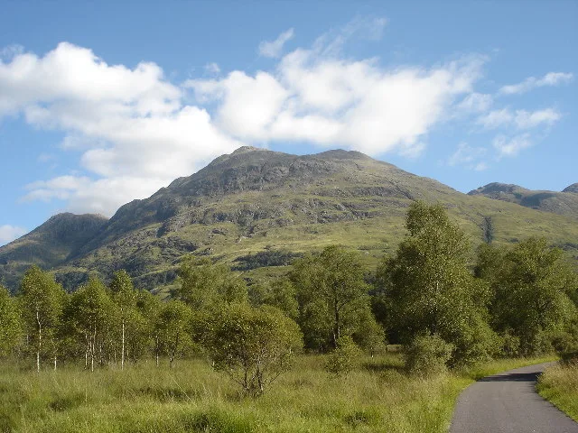
Beinn Sgulaird — 937m high mountain in Argyll and Bute, Scotland, UK.

Wikimedia Commons contributors — see linked file page for photographer and licence licence
Plan your visit
- Typical visit
- 1 h–2 h
- Free entry
- Dog-friendly
About
Beinn Sgulaird is a named natural landmark in the United Kingdom. Wikidata describes it as: "937m high mountain in Argyll and Bute, Scotland, UK". Coordinates: 56.5662°, -5.1704°.
Photo gallery
From the Wikipedia article
Beinn Sgulaird or Beinn Sguiliaird is a mountain in the Lorn region of the Scottish Highlands, between Glen Creran and Glen Etive. It has a height of 937 m (3074 ft) and is classed as a Munro. The mountain takes the form of a long ridge which runs from southwest to northeast, three kilometres of which lie above 800 m. Hillwalkers commonly traverse the ridge from north to south, as this gives the best views of the Hebrides to the west, in particular the Isle of Mull. While most walkers start from Glen Creran to the west, an ascent from Glen Etive is also possible.
Excerpt from Wikipedia under CC BY-SA 4.0. See the source article linked in Sources below.
- Coordinates
- 56.5662, -5.1704
- Address
- Argyll and Bute, Scotland
- Official site
- www.walkhighlands.co.uk
Sources
- wikidata: Q3397054 (CC0)
- wikipedia: Beinn Sgulaird (CC BY-SA 4.0)
- commons: Beinn Sgulaird.jpg (CC BY-SA 4.0)
Other places nearby
Loading nearby places…
Nearby
 📷 3
📷 3Mountains & hills · Scottish Highlands
Beinn Sgulaird
Beinn Sgulaird — Named summit at 937 m.
 📷 3
📷 3Mountains & hills · Scottish Highlands
Beinn Sgulaird North Top
Beinn Sgulaird North Top — a mountain in scotland-highlands, United Kingdom.

Mountains & hills · Scottish Highlands
Stob Gaibhre
Stob Gaibhre — a mountain in scotland-highlands, United Kingdom.
 📷 3
📷 3Mountains & hills · Scottish Highlands
Beinn Sgulaird South Top
Beinn Sgulaird South Top — a mountain in scotland-highlands, United Kingdom.
 📷 3
📷 3Mountains & hills · Scottish Highlands
Creag na Cathaig
Creag na Cathaig — a mountain in scotland-highlands, United Kingdom.
 📷 3
📷 3Caves · Scottish Highlands
Tight'un
Tight'un is a cave in the United Kingdom.
More natural landmarks in this region
 Flagship📷 3
Natural landmarks · Scottish Highlands
Dunalastair Water
Dunalastair Water — lake in Perth and Kinross, Scotland, UK, on the River Tummel.
 Flagship📷 3
Natural landmarks · Scottish Highlands
Loch Arkaig
Loch Arkaig — lake in Highland, Scotland, UK, outflows east to River Arkaig.
 Flagship📷 3
Natural landmarks · Scottish Highlands
Loch Assynt
Loch Assynt — lake in Highland, Scotland, UK, outflows to the River Inver and Loch na Garbh Uidhe.
 Flagship📷 3
Natural landmarks · Scottish Highlands
Loch Awe
Loch Awe — lake in Argyll and Bute, Scotland, UK, outflows to the River Awe.
Frequently asked questions
- Where is Beinn Sgulaird?
- Beinn Sgulaird is in Scottish Highlands, in the United Kingdom — coordinates 56.5662°, -5.1704°.
- Is Beinn Sgulaird free to visit?
- Yes — admission to Beinn Sgulaird is free.