Mountains & hills · Scottish Highlands
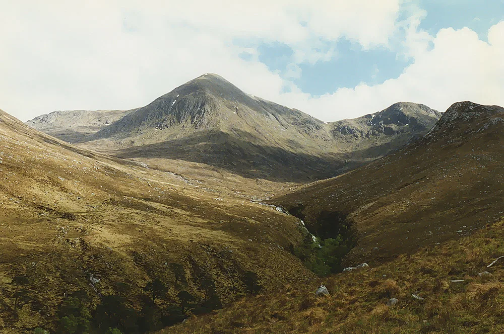
Beinn nan Aighenan
Beinn nan Aighenan — Named summit at 960 m.

Wikimedia Commons contributors — see linked file page for photographer and licence licence
Plan your visit
- Typical visit
- 3 h–8 h
- Best time of year
- Late spring – early autumn (May–Oct)
- Free entry
- Dog-friendly
About
Beinn nan Aighenan is a named summit in the United Kingdom. Wikidata describes it as: "Named summit at 960 m.". Coordinates: 56.5202°, -5.0111°.
Photo gallery
From the Wikipedia article
Beinn nan Aighenan is a 960-metre-high (3,150 ft) mountain in the Grampian Mountains of Scotland. It lies in Argyll and Bute, north of the village of Taynuilt. An isolated mountain, the most popular routes to its summit are from either Glen Kinglass or a climb above the ridge from Glen Etive.
Excerpt from Wikipedia under CC BY-SA 4.0. See the source article linked in Sources below.
- Coordinates
- 56.5202, -5.0111
- Address
- Argyll and Bute, Scotland
- Official site
- www.hill-bagging.co.uk
Sources
- osm: n259452109 (ODbL)
- wikipedia: Beinn nan Aighenan (CC BY-SA 4.0)
- commons: East ridge of Beinn nan Aighenan - geograph.org.uk - 204070.jpg (CC BY-SA 4.0)
Other places nearby
Loading nearby places…
Nearby
 📷 4
📷 4Mountains & hills · Scottish Highlands
Beinn nan Aighenan East Top
Beinn nan Aighenan East Top — a mountain in scotland-highlands, United Kingdom.
 📷 2
📷 2Mountains & hills · Scottish Highlands
Glas Bheinn Mhor - Meall nan Tri Tighearnan
Glas Bheinn Mhor - Meall nan Tri Tighearnan — a mountain in scotland-highlands, United Kingdom.
 📷 3
📷 3Mountains & hills · Scottish Highlands
Meall Cruidh
Meall Cruidh — a mountain in scotland-highlands, United Kingdom.
📷 3Mountains & hills · Scottish Highlands
Stob an Duine Ruaidh
Stob an Duine Ruaidh — a mountain in scotland-highlands, United Kingdom.
 📷 3
📷 3Mountains & hills · Scottish Highlands
Glas Bheinn Mhòr
Glas Bheinn Mhòr — Named summit at 997 m.
 📷 3
📷 3Mountains & hills · Scottish Highlands
Stob Coire Dheirg (1984-1990 position)
Stob Coire Dheirg (1984-1990 position) — a mountain in scotland-highlands, United Kingdom.
More mountains in this region
 📷 3
📷 3Mountains & hills · Scottish Highlands
A' Bhuidheanach Bheag
A' Bhuidheanach Bheag — Named summit at 936 m.
 📷 3
📷 3Mountains & hills · Scottish Highlands
A' Chailleach
A' Chailleach — Named summit at 997 m.
 📷 3
📷 3Mountains & hills · Scottish Highlands
A' Chailleach
A' Chailleach — Named summit at 930 m.
 📷 3
📷 3Mountains & hills · Scottish Highlands
A' Chaoirnich
A' Chaoirnich — Named summit at 875 m.
Frequently asked questions
- Where is Beinn nan Aighenan?
- Beinn nan Aighenan is in Scottish Highlands, in the United Kingdom — coordinates 56.5202°, -5.0111°.
- Is Beinn nan Aighenan free to visit?
- Yes — admission to Beinn nan Aighenan is free.