Natural landmarks · Scottish Highlands
Beinn Damh
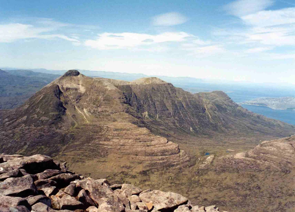
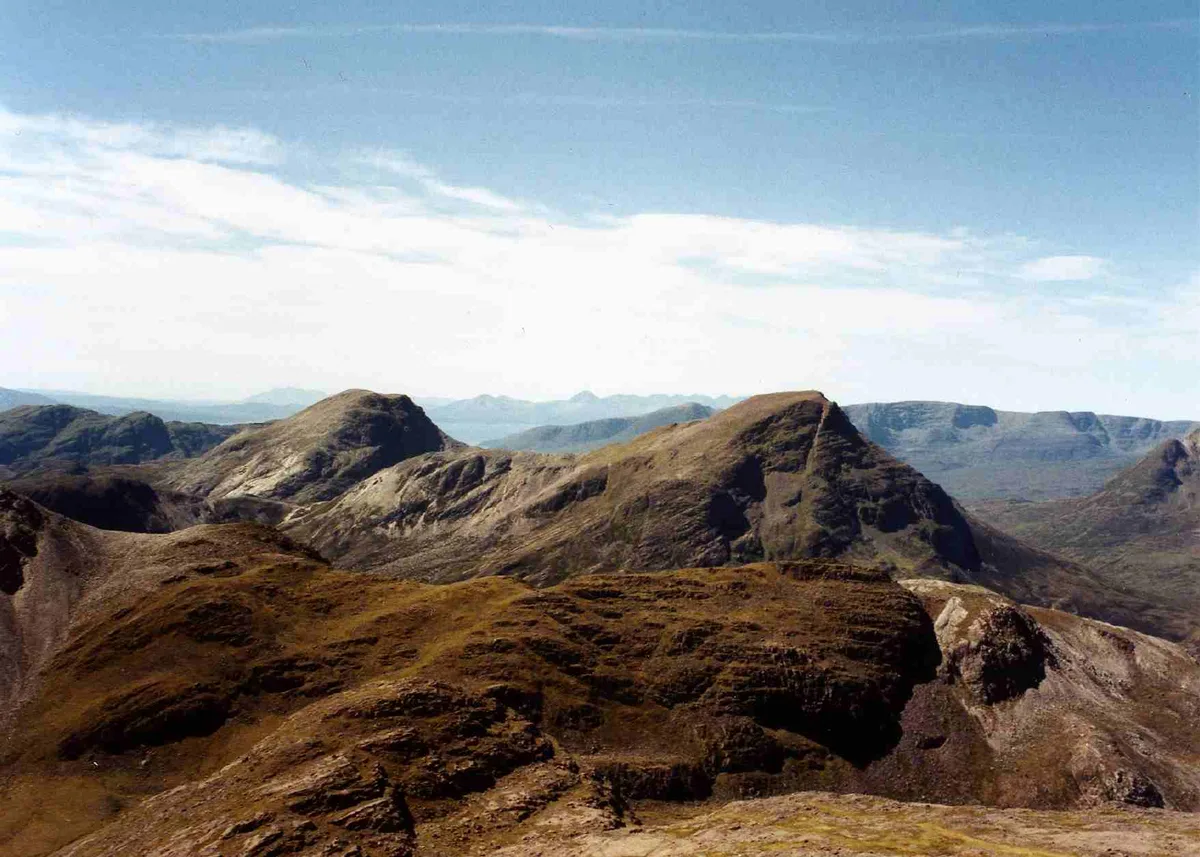
Beinn Damh — mountain in Highland, Scotland, UK.

Wikimedia Commons contributors — see linked file page for photographer and licence licence
Plan your visit
- Typical visit
- 1 h–2 h
- Nearest railway station
- Strathcarron · 9.5 km
- Free entry
- Dog-friendly
About
Beinn Damh is a named natural landmark in the United Kingdom. Part of Northwest Highlands. Wikidata describes it as: "mountain in Highland, Scotland, UK". Coordinates: 57.4933°, -5.5167°.
Photo gallery
From the Wikipedia article
Beinn Damh (or Ben Damph) is a Scottish mountain situated in the wild mountainous area between Upper Loch Torridon and Glen Carron, 25 kilometres north northeast of Kyle of Lochalsh. Beinn Damh is classed as a Corbett reaching a height of 903 metres (2,962 feet) failing to qualify as a Munro by eleven metres, despite this it is a fine mountain with a four-kilometre-long undulating summit ridge with three tops, it has steep slopes and crags with its eastern face being especially dramatic with huge buttresses and cliffs. The mountain has the conspicuous “Stirrup Mark” just to the south west of the summit, this is a semi circular area of white quartzite surrounded by grey rock which stands out when the mountain is viewed from the south west. The mountain's translated name of “Hill of the Stag” is apt because it stands in the middle of the Ben Damh deer estate.
Excerpt from Wikipedia under CC BY-SA 4.0. See the source article linked in Sources below.
- Coordinates
- 57.4933, -5.5167
- Address
- Torridon Hills, Scotland
- Nearest railway station
- Strathcarron — 9.5 km
Sources
- wikidata: Q3398082 (CC0)
- wikipedia: Beinn Damh (CC BY-SA 4.0)
- commons: Beinn Damh from Maol Chean-dearg.jpg (CC BY-SA 4.0)
Other places nearby
Loading nearby places…
Nearby
 📷 3
📷 3Mountains & hills · Scottish Highlands
Beinn Damh
Beinn Damh — Named summit at 903 m.
 📷 3
📷 3Mountains & hills · Scottish Highlands
Creagan Dubh Toll nam Biast
Creagan Dubh Toll nam Biast — a mountain in scotland-highlands, United Kingdom.
 📷 4
📷 4Mountains & hills · Scottish Highlands
Beinn na h-Eaglaise
Beinn na h-Eaglaise in Scotland Islands, United Kingdom.
 📷 3
📷 3Natural landmarks · Scottish Highlands
Maol Chean-dearg
Maol Chean-dearg — 933m high mountain in Highland, Scotland, UK.
 📷 3
📷 3Mountains & hills · Scottish Highlands
Maol Chean-dearg
Maol Chean-dearg — Named summit at 933 m.
 📷 3
📷 3Mountains & hills · Scottish Highlands
Sgùrr na Bana Mhoraire
Sgùrr na Bana Mhoraire — a mountain in scotland-highlands, United Kingdom.
More natural landmarks in this region
 Flagship📷 3
Natural landmarks · Scottish Highlands
Dunalastair Water
Dunalastair Water — lake in Perth and Kinross, Scotland, UK, on the River Tummel.
 Flagship📷 3
Natural landmarks · Scottish Highlands
Loch Arkaig
Loch Arkaig — lake in Highland, Scotland, UK, outflows east to River Arkaig.
 Flagship📷 3
Natural landmarks · Scottish Highlands
Loch Assynt
Loch Assynt — lake in Highland, Scotland, UK, outflows to the River Inver and Loch na Garbh Uidhe.
 Flagship📷 3
Natural landmarks · Scottish Highlands
Loch Awe
Loch Awe — lake in Argyll and Bute, Scotland, UK, outflows to the River Awe.
Frequently asked questions
- Where is Beinn Damh?
- Beinn Damh is in Scottish Highlands, in the United Kingdom — coordinates 57.4933°, -5.5167°. The nearest railway station is Strathcarron, around 9.5 km away.
- Is Beinn Damh free to visit?
- Yes — admission to Beinn Damh is free.