Natural landmarks · Scottish Highlands
Beinn Chuirn
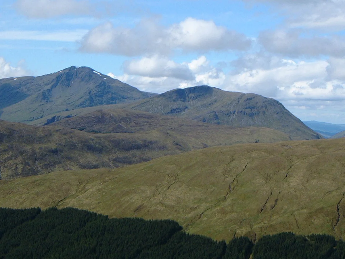
Beinn Chuirn — 880m high mountain in Scotland.

Wikimedia Commons contributors — see linked file page for photographer and licence licence
Plan your visit
- Typical visit
- 1 h–2 h
- Nearest railway station
- Tyndrum Lower · 4.7 km
- Free entry
- Dog-friendly
About
Beinn Chuirn is a named natural landmark in the United Kingdom. Wikidata describes it as: "880m high mountain in Scotland". Coordinates: 56.4236°, -4.7883°.
Photo gallery
From the Wikipedia article
Beinn Chùirn is a hill five kilometres (three miles) west-southwest of Tyndrum, Scotland, standing on the border of Stirlingshire and Perthshire at the northern extremity of the Loch Lomond and The Trossachs National Park.
Excerpt from Wikipedia under CC BY-SA 4.0. See the source article linked in Sources below.
Background
Description
Beinn Chùirn reaches a height of 880 m and qualifies as a Corbett and a Marilyn. It stands in the Cononish valley in the company of three other mountains (Ben Lui, Ben Oss and Beinn Dubhchraig which are all Munros and tend to overshadow the smaller hill. When seen from the east, Beinn Chùirn looks like a smaller version of the neighbouring Ben Lui, both having impressive east-facing corries; it is sometimes mistaken for Ben Lui by motorists on the A82 road in Strath Fillan. The hill's name translates from the Gaelic language as "cairn hill", This is thought to have originated because the hill was an important point on the ancient boundary between the kingdoms of the Picts and Dál Riata. In…
Sourced from Wikipedia under CC BY-SA 4.0.
- Coordinates
- 56.4236, -4.7883
- Address
- Stirlingshire, Scotland
- Nearest railway station
- Tyndrum Lower — 4.7 km
Sources
- wikidata: Q3405785 (CC0)
- wikipedia: Beinn Chùirn (CC BY-SA 4.0)
- commons: Beinn Chuirn and Ben Lui 1.jpg (CC BY-SA 4.0)
Other places nearby
Loading nearby places…
Nearby
 📷 3
📷 3Mountains & hills · Scottish Highlands
Beinn Chuirn
Beinn Chuirn — Named summit at 880 m.
 📷 3
📷 3Mountains & hills · Scottish Highlands
Beinn Chuirn South Top
Beinn Chuirn South Top — a mountain in scotland-highlands, United Kingdom.
 📷 3
📷 3Mountains & hills · Scottish Highlands
Meall Odhar
Meall Odhar — Named summit at 656 m.
 📷 3
📷 3Natural landmarks · Scottish Highlands
Meall Odhar
Meall Odhar — 656 metre high mountain in Stirling, Scotland, UK.
 📷 3
📷 3Mountains & hills · Scottish Highlands
Ben Lui NW Top
Ben Lui NW Top — a mountain in scotland-highlands, United Kingdom.
 📷 3
📷 3Natural landmarks · Scottish Highlands
Ben Lui
Ben Lui — 1130m high mountain in Stirling, Scotland, UK.
More natural landmarks in this region
 Flagship📷 3
Natural landmarks · Scottish Highlands
Dunalastair Water
Dunalastair Water — lake in Perth and Kinross, Scotland, UK, on the River Tummel.
 Flagship📷 3
Natural landmarks · Scottish Highlands
Loch Arkaig
Loch Arkaig — lake in Highland, Scotland, UK, outflows east to River Arkaig.
 Flagship📷 3
Natural landmarks · Scottish Highlands
Loch Assynt
Loch Assynt — lake in Highland, Scotland, UK, outflows to the River Inver and Loch na Garbh Uidhe.
 Flagship📷 3
Natural landmarks · Scottish Highlands
Loch Awe
Loch Awe — lake in Argyll and Bute, Scotland, UK, outflows to the River Awe.
Frequently asked questions
- Where is Beinn Chuirn?
- Beinn Chuirn is in the Scottish Highlands, United Kingdom.
- Is Beinn Chuirn free to visit?
- Yes, Beinn Chuirn is free to enter.
- How do I get to Beinn Chuirn?
- The nearest railway station is Tyndrum Lower, about 4.7 km away.