Mountains & hills · Scottish Highlands
Beinn Bheula
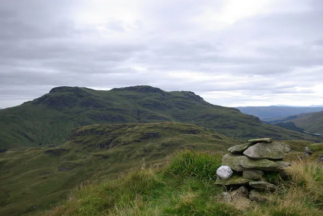
Beinn Bheula — Named summit at 779 m.

Wikimedia Commons contributors — see linked file page for photographer and licence licence
Plan your visit
- Typical visit
- 3 h–8 h
- Best time of year
- Late spring – early autumn (May–Oct)
- Free entry
- Dog-friendly
About
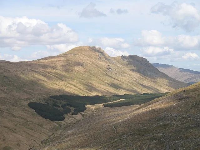
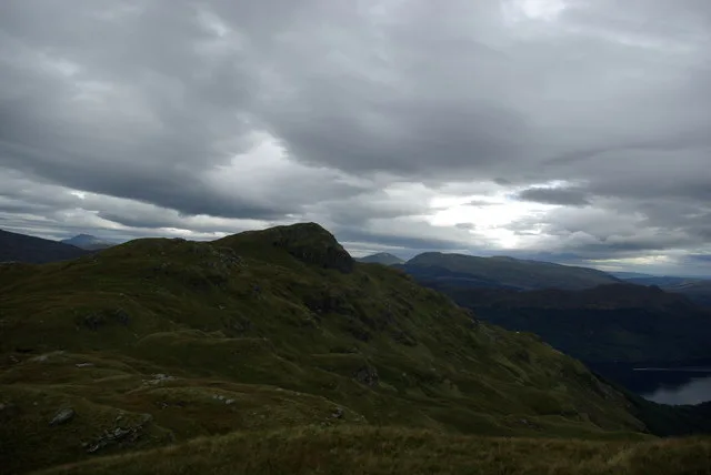
Beinn Bheula is a named summit in the United Kingdom. Wikidata describes it as: "Named summit at 779 m.". Coordinates: 56.1418°, -4.9721°.
Photo gallery
From the Wikipedia article
Beinn Bheula is a mountain located between Loch Goil and Loch Eck. It is part of the Arrochar Alps range. Beinn Bheula appears rugged from Lochgoilhead, with several summits, the highest of which is Caisteal Dubh (Gaelic for black castle). It is commonly climbed from Loch Goil
Excerpt from Wikipedia under CC BY-SA 4.0. See the source article linked in Sources below.
- Coordinates
- 56.1418, -4.9721
- Address
- Argyll and Bute, Scotland
- Official site
- www.hill-bagging.co.uk
Sources
- osm: n1132317421 (ODbL)
- wikipedia: Beinn Bheula (CC BY-SA 4.0)
- commons: Summit cairn on Cruach nam Miseag with view to Beinn Bheula - geograph.org.uk - 958044.jpg (CC BY-SA 4.0)
Other places nearby
Loading nearby places…
Nearby
 📷 3
📷 3Natural landmarks · Scottish Highlands
Beinn Bheula
Beinn Bheula — mountain in Argyll and Bute, Scotland, UK.
 📷 3
📷 3Natural landmarks · Scottish Highlands
Beinn Lochain
Beinn Lochain — 702m high mountain in Argyll and Bute, Scotland, UK.
 📷 3
📷 3Mountains & hills · Scottish Highlands
Beinn Lochain
Beinn Lochain — Named summit at 703 m.
 📷 3
📷 3Mountains & hills · Scottish Highlands
Cruach nam Miseag
Cruach nam Miseag — Named summit at 606 m.
 📷 3
📷 3Natural landmarks · Scottish Highlands
Cruach nam Miseag
Cruach nam Miseag — mountain in Argyll and Bute, Scotland, UK.
 📷 3
📷 3Memorials & monuments · Scottish Highlands
Lauder Memorial
Lauder Memorial — a memorial in scotland-highlands, United Kingdom.
More mountains in this region
 📷 3
📷 3Mountains & hills · Scottish Highlands
A' Bhuidheanach Bheag
A' Bhuidheanach Bheag — Named summit at 936 m.
 📷 3
📷 3Mountains & hills · Scottish Highlands
A' Chailleach
A' Chailleach — Named summit at 997 m.
 📷 3
📷 3Mountains & hills · Scottish Highlands
A' Chailleach
A' Chailleach — Named summit at 930 m.
 📷 3
📷 3Mountains & hills · Scottish Highlands
A' Chaoirnich
A' Chaoirnich — Named summit at 875 m.
Frequently asked questions
- Where is Beinn Bheula?
- Beinn Bheula is in Scottish Highlands, in the United Kingdom — coordinates 56.1418°, -4.9721°.
- Is Beinn Bheula free to visit?
- Yes — admission to Beinn Bheula is free.