Natural landmarks · Scottish Highlands
Beinn Achaladair
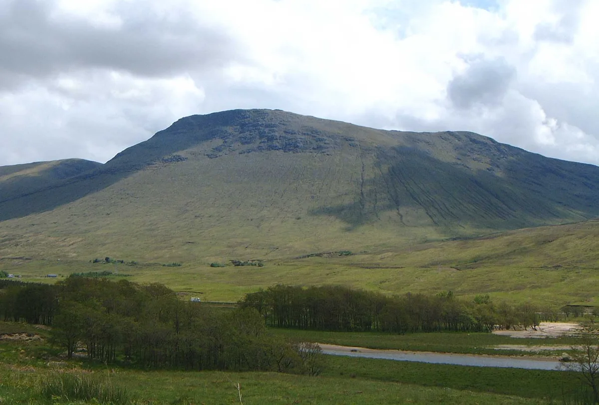
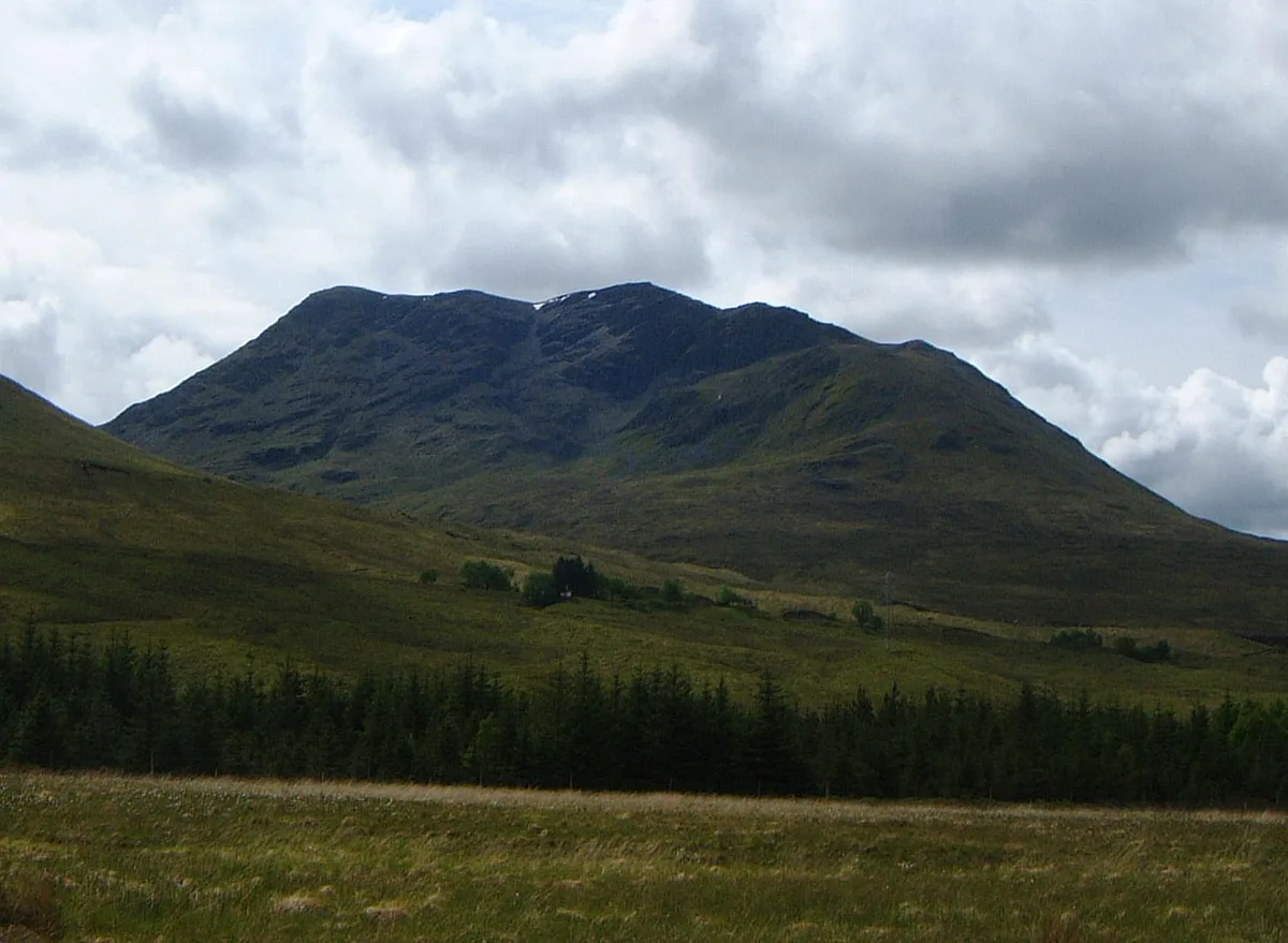
Beinn Achaladair — 1038m high mountain in Scotland.

Wikimedia Commons contributors — see linked file page for photographer and licence licence
Plan your visit
- Typical visit
- 1 h–2 h
- Nearest railway station
- Bridge of Orchy · 5.8 km
- Free entry
- Dog-friendly
About
Beinn Achaladair is a named natural landmark in the United Kingdom. Part of Bridge of Orchy. Wikidata describes it as: "1038m high mountain in Scotland". Coordinates: 56.5519°, -4.6945°.
Photo gallery
From the Wikipedia article
Beinn Achaladair is a Scottish mountain situated six kilometres north east of the hamlet of Bridge of Orchy. The mountain stands on the border of the Perth and Kinross and Argyll and Bute council areas.
Excerpt from Wikipedia under CC BY-SA 4.0. See the source article linked in Sources below.
Background
Description
Beinn Achaladair is a distinct landmark for both road and rail travellers with both the A82 road and the West Highland Line passing close to the foot of the mountain with the railway actually traversing the lower northern slopes before crossing Rannoch Moor on its way to Fort William. The mountain looks impressive from the north west throwing down steep wall like slopes and along with the three adjoining Munros of Beinn Dorain, Beinn an Dothaidh, and Beinn a' Chreachain it forms the historical Great Wall of Rannoch, which was the boundary between the old Pictish Kingdom to the east and the Dál Riata kingdom of the Scots in the west. Beinn Achaladair reaches a height of 1038 m and is classed…
Sourced from Wikipedia under CC BY-SA 4.0.
- Coordinates
- 56.5519, -4.6945
- Address
- Argyll & Perthshire, Scotland
- Nearest railway station
- Bridge of Orchy — 5.8 km
- Official site
- www.walkhighlands.co.uk
Sources
- wikidata: Q3397457 (CC0)
- wikipedia: Beinn Achaladair (CC BY-SA 4.0)
- commons: Beinn Achaladair.jpg (CC BY-SA 4.0)
Other places nearby
Loading nearby places…
Nearby
 📷 3
📷 3Mountains & hills · Scottish Highlands
Beinn Achaladair
Beinn Achaladair — Named summit at 1038 m.
 📷 3
📷 3Mountains & hills · Scottish Highlands
Beinn Achaladair South Top
Beinn Achaladair South Top — a mountain in scotland-highlands, United Kingdom.
 📷 3
📷 3Mountains & hills · Scottish Highlands
Meall Buidhe
Meall Buidhe — Named summit at 981 m.
 📷 3
📷 3Castles · Scottish Highlands
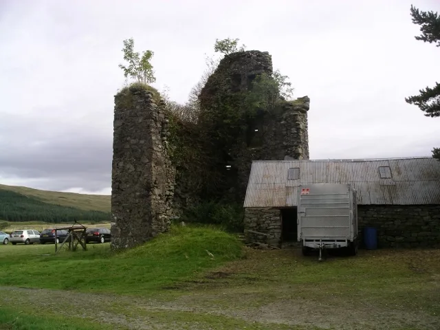
Achallader Castle
Achallader Castle — castle in Argyll and Bute, Scotland, UK.
 📷 3
📷 3Castles · Scottish Highlands
Achallader Castle (ruins)
Achallader Castle (ruins) — a castle in scotland-highlands, United Kingdom.
 📷 3
📷 3Mountains & hills · Scottish Highlands
Beinn an Dothaidh
Beinn an Dothaidh — Named summit at 1004 m.
More natural landmarks in this region
 Flagship📷 3
Natural landmarks · Scottish Highlands
Dunalastair Water
Dunalastair Water — lake in Perth and Kinross, Scotland, UK, on the River Tummel.
 Flagship📷 3
Natural landmarks · Scottish Highlands
Loch Arkaig
Loch Arkaig — lake in Highland, Scotland, UK, outflows east to River Arkaig.
 Flagship📷 3
Natural landmarks · Scottish Highlands
Loch Assynt
Loch Assynt — lake in Highland, Scotland, UK, outflows to the River Inver and Loch na Garbh Uidhe.
 Flagship📷 3
Natural landmarks · Scottish Highlands
Loch Awe
Loch Awe — lake in Argyll and Bute, Scotland, UK, outflows to the River Awe.
Frequently asked questions
- Where is Beinn Achaladair?
- Beinn Achaladair is in the Scottish Highlands, United Kingdom.
- Is Beinn Achaladair free to visit?
- Yes, Beinn Achaladair is free to enter.
- How do I get to Beinn Achaladair?
- The nearest railway station is Bridge of Orchy, about 5.8 km away.