Mountains & hills · Scottish Highlands
Beinn a' Chuallaich
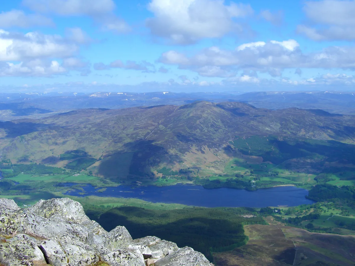
Beinn a' Chuallaich — Named summit at 891 m.

Wikimedia Commons contributors — see linked file page for photographer and licence licence
Plan your visit
- Typical visit
- 3 h–8 h
- Best time of year
- Late spring – early autumn (May–Oct)
- Free entry
- Dog-friendly
About
Beinn a' Chuallaich is a named summit in the United Kingdom. Wikidata describes it as: "Named summit at 891 m.". Coordinates: 56.7291°, -4.1515°.
Photo gallery
From the Wikipedia article
Beinn a' Chuallaich is a Scottish hill, four kilometres northeast of the village of Kinloch Rannoch in the Perth and Kinross council area. It is part of the high ground between Strath Tummel and Glen Errochty.
Excerpt from Wikipedia under CC BY-SA 4.0. See the source article linked in Sources below.
Background
Description
Beinn a’ Chuallaich is a sizeable and extensive hill which can seem quite inconspicuous when viewed from certain places, especially from the south. This is mainly because of the close proximity of the more eye catching and higher Schiehallion which lies seven km to the SE across Dunalastair Water and dominates Strath Tummel. However Beinn a' Chuallaich is well seen from the head of Glen Errochty where it shows its long NE ridge and its craggy eastern corrie. The hill reaches a height of 892 metres (2926 feet) and qualifies as a Corbett and a Marilyn.
Sourced from Wikipedia under CC BY-SA 4.0.
- Coordinates
- 56.7291, -4.1515
- Address
- Perth and Kinross, Scotland
Sources
- osm: n609894779 (ODbL)
- wikipedia: Beinn a' Chuallaich (CC BY-SA 4.0)
- commons: Beinn a Chuallaich from Schiehallion 8.jpg (CC BY-SA 4.0)
Other places nearby
Loading nearby places…
Nearby
 📷 3
📷 3Natural landmarks · Scottish Highlands
Beinn a' Chuallaich
Beinn a' Chuallaich — 892m high mountain in Perth and Kinross, Scotland, UK.
 📷 3
📷 3Mountains & hills · Scottish Highlands
Meall na Moine
Meall na Moine — a mountain in scotland-highlands, United Kingdom.
 📷 3
📷 3Mountains & hills · Scottish Highlands
Carn Fiaclach
Carn Fiaclach — a mountain in scotland-highlands, United Kingdom.
 📷 3
📷 3Archaeological sites · Scottish Highlands
Mullinavadie
Mullinavadie — a archaeological in scotland-highlands, United Kingdom.
 📷 4
📷 4Viewpoints · Scottish Highlands
Craig Varr
Craig Varr is a viewpoint in the United Kingdom.
 📷 3
📷 3Reservoirs & lochs · Scottish Highlands
Loch Errochty
Loch Errochty — 1957 reservoir in Perth and Kinross, Scotland, UK, outflows east to Errochty Water.
More mountains in this region
 📷 3
📷 3Mountains & hills · Scottish Highlands
A' Bhuidheanach Bheag
A' Bhuidheanach Bheag — Named summit at 936 m.
 📷 3
📷 3Mountains & hills · Scottish Highlands
A' Chailleach
A' Chailleach — Named summit at 997 m.
 📷 3
📷 3Mountains & hills · Scottish Highlands
A' Chailleach
A' Chailleach — Named summit at 930 m.
 📷 3
📷 3Mountains & hills · Scottish Highlands
A' Chaoirnich
A' Chaoirnich — Named summit at 875 m.
Frequently asked questions
- Where is Beinn a' Chuallaich?
- Beinn a' Chuallaich is in Scottish Highlands, in the United Kingdom — coordinates 56.7291°, -4.1515°.
- Is Beinn a' Chuallaich free to visit?
- Yes — admission to Beinn a' Chuallaich is free.