Mountains & hills · Scottish Highlands
Beinn a' Bhàthaich Àrd
Also known as: Beinn a' Bha'ach Ard
Beinn a' Bhàthaich Àrd — Named summit at 862 m.

Wikimedia Commons contributors — see linked file page for photographer and licence licence
Plan your visit
- Typical visit
- 3 h–8 h
- Best time of year
- Late spring – early autumn (May–Oct)
- Free entry
- Dog-friendly
About
Beinn a' Bhàthaich Àrd is a named summit in the United Kingdom. Also known as: Beinn a' Bha'ach Ard. Wikidata describes it as: "Named summit at 862 m.". Coordinates: 57.4520°, -4.7339°.
Photo gallery
From the Wikipedia article
Beinn a' Bhathaich Àrd is mountain on the northern side of Glen Strathfarrar, in the Highlands of Scotland. It is situated at the eastern end of the glen, 5 km north-west of the village of Struy, and 16 km west of Beauly. Though not the highest hill in Strathfarrar, its position at the end of the glen makes it visible for some distance around. It is a prominent landmark from much of The Aird, Inverness and the Kessock Bridge. Beinn a' Bhathaich Àrd is usually climbed from the hamlet of Inchmore, at the foot of Strathfarrar.
Excerpt from Wikipedia under CC BY-SA 4.0. See the source article linked in Sources below.
- Coordinates
- 57.4520, -4.7339
- Address
- Highland, Scotland
Sources
- osm: n1972712482 (ODbL)
- wikipedia: Beinn a' Bhathaich Àrd (CC BY-SA 4.0)
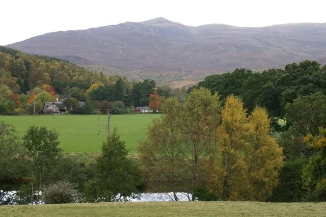
- commons: View across Strathglass at Struy - geograph.org.uk - 1007016.jpg (CC BY-SA 4.0)
Other places nearby
Loading nearby places…
Nearby
 📷 5
📷 5Natural landmarks · Scottish Highlands
Beinn a' Bhathaich Àrd
Beinn a' Bhathaich Àrd — 862m mountain in Highland, Scotland, UK.
 📷 3
📷 3Mountains & hills · Scottish Highlands
Sgùrr a' Phollain
Sgùrr a' Phollain — a mountain in scotland-highlands, United Kingdom.

Mountains & hills · Scottish Highlands
Carn a' Ghorm-locha
Carn a' Ghorm-locha — a mountain in scotland-highlands, United Kingdom.

Mountains & hills · Scottish Highlands
Sgùrr a' Ghlaisein
Sgùrr a' Ghlaisein — a mountain in scotland-highlands, United Kingdom.
 📷 3
📷 3Natural landmarks · Scottish Highlands
Culligran Falls
Culligran Falls in Scotland Islands, United Kingdom.
 📷 3
📷 3Natural landmarks · Scottish Highlands
Inchmore
Inchmore in Scotland Islands, United Kingdom.
More mountains in this region
 📷 3
📷 3Mountains & hills · Scottish Highlands
A' Bhuidheanach Bheag
A' Bhuidheanach Bheag — Named summit at 936 m.
 📷 3
📷 3Mountains & hills · Scottish Highlands
A' Chailleach
A' Chailleach — Named summit at 997 m.
 📷 3
📷 3Mountains & hills · Scottish Highlands
A' Chailleach
A' Chailleach — Named summit at 930 m.
 📷 3
📷 3Mountains & hills · Scottish Highlands
A' Chaoirnich
A' Chaoirnich — Named summit at 875 m.
Frequently asked questions
- Where is Beinn a' Bhàthaich Àrd?
- Beinn a' Bhàthaich Àrd is in Scottish Highlands, in the United Kingdom — coordinates 57.4520°, -4.7339°.
- Is Beinn a' Bhàthaich Àrd free to visit?
- Yes — admission to Beinn a' Bhàthaich Àrd is free.