Mountains & hills · North East England
Beda Fell
Also known as: Beda Head
Beda Fell — Named summit at 509 m.

Wikimedia Commons contributors — see linked file page for photographer and licence licence
Plan your visit
- Typical visit
- 3 h–8 h
- Best time of year
- Late spring – early autumn (May–Oct)
- Free entry
- Dog-friendly
About
Beda Fell is a named summit in the United Kingdom. Also known as: Beda Head. Wikidata describes it as: "Named summit at 509 m.". Coordinates: 54.5465°, -2.8844°.
Photo gallery
Protected designations
- Site of Special Scientific Interest: River Eden and Tributaries SSSI
Designations sourced from Natural England open data under OGL v3.
From the Wikipedia article
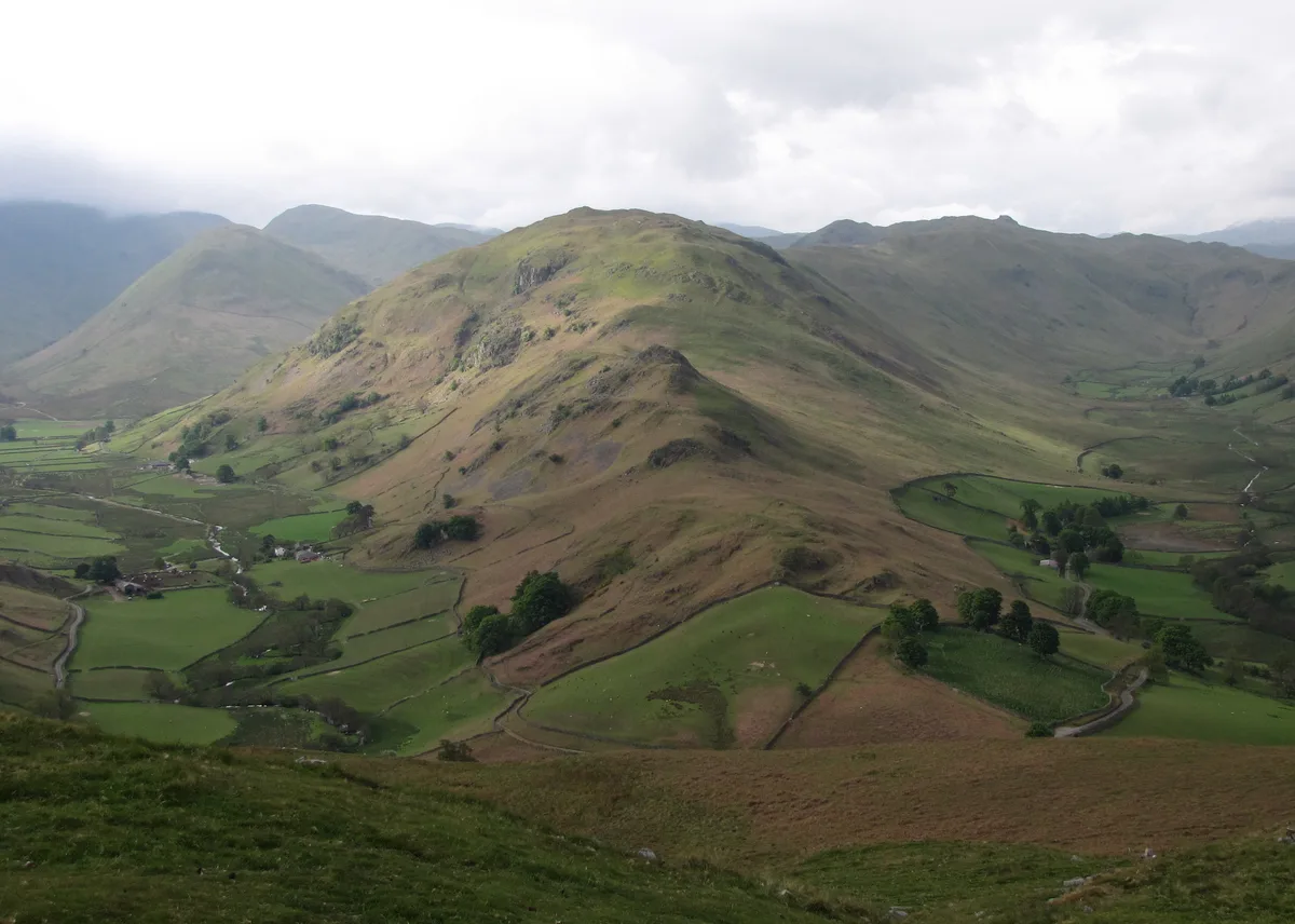
Beda Fell is a fell in the English Lake District, situated to the south of Ullswater. It divides the valleys of Boredale and Bannerdale within the Martindale system.
Excerpt from Wikipedia under CC BY-SA 4.0. See the source article linked in Sources below.
- Coordinates
- 54.5465, -2.8844
- District
- Westmorland and Furness
- Parish
- Martindale
- Postcode
- CA10 2NF
- Parliamentary constituency
- Westmorland and Lonsdale
Sources
- osm: n560045777 (ODbL)
- wikipedia: Beda Fell (CC BY-SA 4.0)
- commons: Beda Fell from Hallin Fell.jpg (CC BY-SA 4.0)
Other places nearby
Loading nearby places…
Nearby
 📷 3
📷 3Natural landmarks · North East England
Beda Fell
Beda Fell — mountain in United Kingdom.
 📷 3
📷 3Historic bridges · North East England
Christy Bridge
Christy Bridge — Grade II listed building-listed bridge in england-north-east, United Kingdom.
 📷 3
📷 3Historic churches · North East England
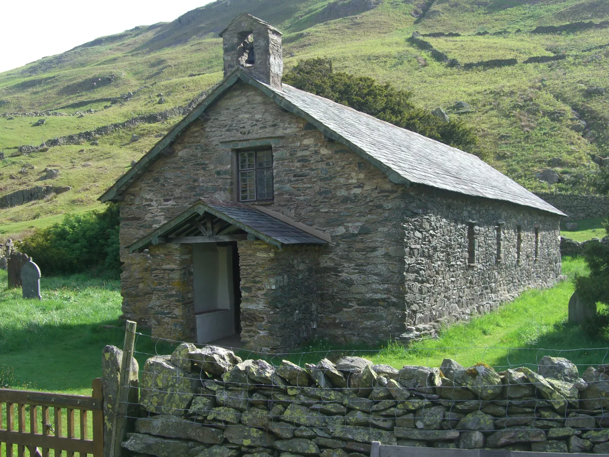
St Martin's Church, Martindale
St Martin's Church, Martindale is a historic church in the United Kingdom.
 📷 4
📷 4Memorials & monuments · North East England
Birkett Tomb
Birkett Tomb — a memorial in england-north-east, United Kingdom.
 📷 3
📷 3Natural landmarks · North East England
Steel Knotts
Steel Knotts — mountain in United Kingdom.
 📷 3
📷 3Mountains & hills · North East England
Steel Knotts
Steel Knotts — Named summit at 432 m.
More mountains in this region
 📷 3
📷 3Mountains & hills · North East England
Angletarn Pikes
Angletarn Pikes — Named summit at 566 m.
 📷 3
📷 3Mountains & hills · North East England
Angletarn Pikes South Top
Angletarn Pikes South Top — Named summit at 563.6 m.
 📷 3
📷 3Mountains & hills · North East England
Ard Crags
Ard Crags — Named summit at 581 m.
 📷 3
📷 3Mountains & hills · North East England
Arnison Crag
Arnison Crag — Named summit at 433 m.
Frequently asked questions
- Where is Beda Fell?
- Beda Fell is in North-East England, United Kingdom (postcode CA10 2NF), in the parish of Martindale.
- Is Beda Fell a protected site?
- Yes — Beda Fell is part of the River Eden and Tributaries SSSI Site of Special Scientific Interest.
- Is Beda Fell free to visit?
- Yes, Beda Fell is free to enter.
- How do I get to Beda Fell?
- Drivers can navigate to postcode CA10 2NF. It sits within the Westmorland and Lonsdale parliamentary constituency.