Towns & cities · London
Barton-le-Clay
Barton-le-Clay — village in and civil parish in Central Bedfordshire, Bedfordshire, United Kingdom.

Wikimedia Commons contributors — see linked file page for photographer and licence licence
Plan your visit
- Typical visit
- 3 h–6 h
- Nearest railway station
- Harlington · 4.9 km
- Free entry
- Family-friendly
- Dog-friendly
About
Barton-le-Clay is a town, city, village or settlement in the United Kingdom. Recent population estimates put it at around 4,793 people. Address: MK45. Wikidata describes it as: "village in and civil parish in Central Bedfordshire, Bedfordshire, United Kingdom". Coordinates: 51.9669°, -0.4241°.
Photo gallery
Protected designations
- Area of Outstanding Natural Beauty: Chilterns
Designations sourced from Natural England open data under OGL v3.
From the Wikipedia article
Barton-le-Clay is a large village and a civil parish in the Central Bedfordshire district of Bedfordshire, England, bordering Hertfordshire. In 2021 the parish had a population of 4,937. The village has existed since at least 1066 and is mentioned in the Domesday Book.
Excerpt from Wikipedia under CC BY-SA 4.0. See the source article linked in Sources below.
Background
Description
Barton-Le-Clay Domesday Book entry, taken from 210d 2. <blockquote> In FLITT Hundred M. The Abbot also holds Barton (in-the-clay). It answers for 11 hides. Land for 12 ploughs. In lordship 3 hides; 2 ploughs there; a third possible. 20 villagers have 9 ploughs. 7 smallholders and 6 slaves. 1 mill, 2s, meadow for 6 ploughs; woodland, 200 pigs. In total, value £10; the same when acquired; before 1066 £12. This manor always lay in (the lands of) St Benedict's Church. With this manor the Abbot claims against Nigel of Aubigny and Walter the Fleming 12 acre of meadow which lay there before 1066, but John of Les Roches dispossessed him wrongfully, and this the Hundred testifies. </blockquote>
Sourced from Wikipedia under CC BY-SA 4.0.
- Coordinates
- 51.9669, -0.4241
- District
- Central Bedfordshire
- Parish
- Barton-le-Clay
- Postcode
- MK45
- Parliamentary constituency
- Mid Bedfordshire
- Population
- 4,793
- Nearest railway station
- Harlington — 4.9 km
- Official site
- www.bartonleclay.co.uk
Sources
- wikidata: Q790951 (CC0)
- wikipedia: Barton-le-Clay (CC BY-SA 4.0)
- commons: Waggon and Horses, Barton-le-Clay, Beds - geograph.org.uk - 194173.jpg (CC BY-SA 4.0)
Other places nearby
Loading nearby places…
Nearby
Hotels · London
The Bull Hotel
The Bull Hotel — a hotel in england london.
 📷 5
📷 5Historic churches · London
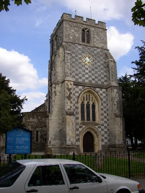
Church of St Nicholas, Barton le Clay
Church of St Nicholas, Barton le Clay — church in Barton-le-Clay, Bedfordshire, England, UK.
 📷 5
📷 5Watermills · London
Barton Mill
Barton Mill — Grade II listed building-listed watermill in england-london, United Kingdom.
📷 5Towns & cities · London
Barton-Le-Clay Airfield
Barton-Le-Clay Airfield — village in Bedfordshire, England, UK.
 📷 5
📷 5Manor houses · London
Westhey Manor
Westhey Manor — Grade II listed building-listed manor in england-london, United Kingdom.
 📷 5
📷 5Wildlife reserves · London
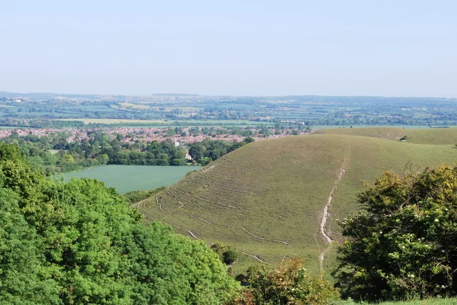
Barton Hills, Bedfordshire
Barton Hills, Bedfordshire — nature reserve and Site of Special Scientific Interest near Barton-le-Clay, Bedfordshire.
More towns in this region
 Flagship📷 10
Towns & cities · London
Aldenham
Aldenham — village and civil parish in Hertfordshire, England.
 Flagship📷 10
Towns & cities · London
Ashdon
Ashdon — village and civil parish in Essex, UK.
 Flagship📷 10
Towns & cities · London
Betchworth
Betchworth — village and civil parish in the Mole Valley district of Surrey, England.
 Flagship📷 10
Towns & cities · London
Boxley
Boxley — village and civil parish in Maidstone District, Kent, England, UK.
Frequently asked questions
- Where is Barton-le-Clay?
- Barton-le-Clay is in London, United Kingdom (postcode MK45), in the parish of Barton-le-Clay.
- Is Barton-le-Clay a protected site?
- Yes — Barton-le-Clay is part of the Chilterns National Landscape (AONB).
- Is Barton-le-Clay free to visit?
- Yes, Barton-le-Clay is free to enter.
- How do I get to Barton-le-Clay?
- The nearest railway station is Harlington, about 4.9 km away. Drivers can navigate to postcode MK45.