Aqueducts · West Midlands
Barton Aqueduct
Barton Aqueduct is a aqueduct in the United Kingdom.

Wikimedia Commons contributors — see linked file page for photographer and licence licence
Plan your visit
- Typical visit
- 30 min–1 h
- Nearest railway station
- Patricroft · 1.2 km
- Free entry
- Dog-friendly
About
Barton Aqueduct is a aqueduct in the United Kingdom. Coordinates: 53.4747°, -2.3522°. This entry is part of The Great Britain Guide, a free, ad-free, open-data tourist directory.
Photo gallery
From the Wikipedia article
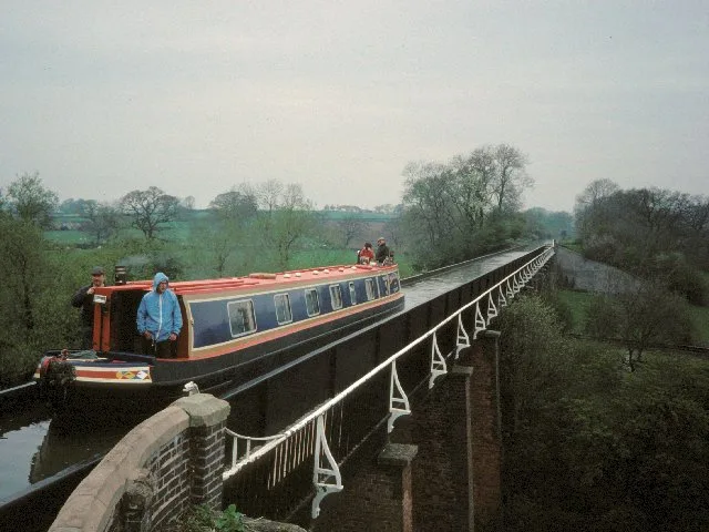
The Barton Aqueduct, opened on 17 July 1761, carried the Bridgewater Canal over the River Irwell at Barton-upon-Irwell, in the historic county of Lancashire, England. Designed largely by James Brindley under the direction of John Gilbert, it was the first navigable aqueduct to be built in England, "one of the seven wonders of the canal age" according to industrial archaeologist Mike Nevell. Construction proceeded quickly, but disaster almost struck when the aqueduct was first filled with water and one of its three arches began to buckle under the weight. Remedial work took several months, but the aqueduct was still opened to traffic only 15 months after the enabling Act of Parliament had been passed, on 17 July 1761. It remained in use for more than 100 years, until the construction of the Manchester Ship Canal necessitated its demolition in 1893, replaced by the Barton Swing Aqueduct.
Excerpt from Wikipedia under CC BY-SA 4.0. See the source article linked in Sources below.
Background
History
The original intention was for the Bridgewater Canal to reach Salford from the Duke of Bridgewater's coal mines in Worsley, by remaining on the north bank of the Irwell. Work began in 1759, but it was quickly decided to alter the route by building a masonry aqueduct to carry the waterway over the Irwell at Barton, and terminate instead in Manchester, to the south of the river. A Bill to authorise the new route was presented to parliament on 13 November 1759, and in January the following year Brindley travelled to London to give evidence before a parliamentary committee in support of the proposal. Although a gifted engineer Brindley had no formal education and rarely, if ever, committed his…
Architecture
At about 200 yd long, 12 yd wide and 39 ft above the river at its highest point, the aqueduct was, for its time, an enormous construction. Early illustrations show the aqueduct's piers to have been flat-faced, but an engraving of 1864 shows them to have pointed cutwaters extending beyond the spring of the arch; it is likely that the piers were refaced in the early 1820s. The arches were composed of several rings of brickwork, with masonry used for decorative keystones. All the masonry used in the structure was coursed ashlar. On the day it was first tested the water was allowed to flow in, but one of the arches began to buckle under the weight. Brindley, overcome with anxiety, retired to…
Sourced from Wikipedia under CC BY-SA 4.0.
- Coordinates
- 53.4747, -2.3522
- District
- Salford
- Parish
- Salford, unparished area
- Postcode
- M30 0TD
- Parliamentary constituency
- Worsley and Eccles
- Nearest railway station
- Patricroft — 1.2 km
Sources
- wikidata: Q809547 (CC0)
- wikipedia: Barton Aqueduct (CC BY-SA 4.0)
- commons: Watercolour of Barton aqueduct by G.F. Yates 1793.jpg (CC BY-SA 4.0)
Other places nearby
Loading nearby places…
Nearby
 📷 5
📷 5Historic bridges · West Midlands
Barton Swing Aqueduct
Barton Swing Aqueduct is a historic bridge in the United Kingdom.
 📷 5
📷 5Historic bridges · West Midlands
Barton Road Bridge
Barton Road Bridge is a historic bridge in the United Kingdom.
 📷 4
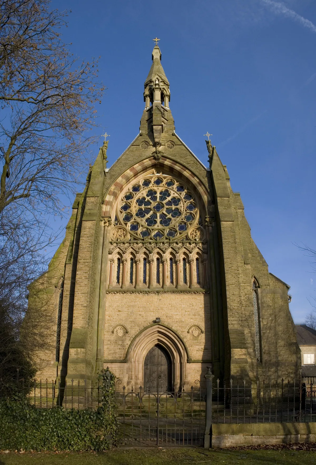
📷 4Historic churches · West Midlands
All Saints' Church, Urmston
All Saints' Church, Urmston — church in Trafford, UK.
 📷 3
📷 3Historic houses · West Midlands
St Catherine's, Barton Upon Irwell
St Catherine's, Barton Upon Irwell — a historic house in england-west-midlands, United Kingdom.
 📷 3
📷 3Galleries · West Midlands
The Puzzle Factory
The Puzzle Factory — a gallery in england-west-midlands, United Kingdom.
 📷 3
📷 3Memorials & monuments · West Midlands
Alan Henning Memorial
Alan Henning Memorial — a memorial in england-west-midlands, United Kingdom.
More places in this region
 📷 3
📷 3Aqueducts · West Midlands
Aqueduct
Aqueduct — aqueduct in Roade, South Northamptonshire, England, UK.
 📷 3
📷 3Aqueducts · West Midlands
Bridgewater Canal Aqueduct Bridgewater Canal Aqueduct Over Hawthorn Road
Bridgewater Canal Aqueduct Bridgewater Canal Aqueduct Over Hawthorn Road — aqueduct in Trafford, Greater Manchester, England, UK.
 📷 5
📷 5Aqueducts · West Midlands
Edstone Aqueduct
Edstone Aqueduct — aqueduct in Wootton Wawen, Warwickshire, England, UK.
 📷 3
📷 3Aqueducts · West Midlands
Gurnett Aqueduct
Gurnett Aqueduct — aqueduct in Sutton, Cheshire East, Cheshire, England, UK.
Frequently asked questions
- Where is Barton Aqueduct?
- Barton Aqueduct is in the West Midlands, United Kingdom (postcode M30 0TD), in the parish of Salford, unparished area.
- Is Barton Aqueduct free to visit?
- Yes, Barton Aqueduct is free to enter.
- How do I get to Barton Aqueduct?
- The nearest railway station is Patricroft, about 1.2 km away. Drivers can navigate to postcode M30 0TD.