Towns & cities · London
Bartlow
Bartlow — village and civil parish in the South Cambridgeshire district of Cambridgeshire, England.

Wikimedia Commons contributors — see linked file page for photographer and licence licence
Plan your visit
- Typical visit
- 3 h–6 h
- Nearest railway station
- Great Chesterford · 8.8 km
- Free entry
- Family-friendly
- Dog-friendly
About
Bartlow is a town, city, village or settlement in the United Kingdom. Recent population estimates put it at around 56 people. Address: CB21. Wikidata describes it as: "village and civil parish in the South Cambridgeshire district of Cambridgeshire, England". Coordinates: 52.0830°, 0.3160°.
Photo gallery
From the Wikipedia article
Bartlow is a small village and civil parish in the South Cambridgeshire district of Cambridgeshire, England, about 12 miles (19 km) south-east of Cambridge and 7 miles (11 km) west of Haverhill in Suffolk. The River Granta runs through the village. In 2021 the parish had a population of 101.
Excerpt from Wikipedia under CC BY-SA 4.0. See the source article linked in Sources below.
Background
History
At Bartlow is one of the smallest parishes in Cambridgeshire. Its southern border, which was partially straightened on a few successive occasions to follow the former railway line, divides it from Ashdon parish in Essex. It also has borders with the neighbouring parishes of Castle Camps and Shudy Camps to the east, Horseheath to the north, and Linton to the west. Though the area has been occupied since Roman times, there is no record of Bartlow itself as a village until 1232, largely because the settlement south of the River Granta with its Roman burial mounds was part of Ashdon parish nearby in Essex. Recorded as Berkelawe in 1232, the name "Bartlow" means "mounds or tumuli where birch…
Sourced from Wikipedia under CC BY-SA 4.0.
- Coordinates
- 52.0830, 0.3160
- County
- Cambridgeshire
- District
- South Cambridgeshire
- Parish
- Bartlow
- Postcode
- CB21
- Parliamentary constituency
- South Cambridgeshire
- Population
- 56
- Nearest railway station
- Great Chesterford — 8.8 km
- Official site
- www.cambridgeshireinsight.org.uk
Sources
- wikidata: Q679215 (CC0)
- wikipedia: Bartlow (CC BY-SA 4.0)
- commons: Bartlow-g1.jpg (CC BY-SA 4.0)
Other places nearby
Loading nearby places…
Nearby
 📷 5
📷 5Hill forts · London
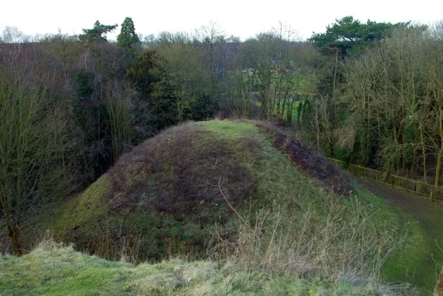
Bartlow Hills
Bartlow Hills — Roman tumuli cemetery in Bartlow (Cambridgeshire, UK).
 📷 5
📷 5Historic houses · London
Barham Hall
Barham Hall — house in Linton, South Cambridgeshire, England, UK.
 📷 5
📷 5Mills · London
Linton Mill
Linton Mill — mill in Linton, South Cambridgeshire, England, UK.
 📷 5
📷 5Windmills · London
Bragg's Mill
Bragg's Mill is a windmill in the United Kingdom.
 📷 5
📷 5Public art & sculpture · London
Hadstock Village Sign
Hadstock Village Sign — a public art in england-london, United Kingdom.
 📷 5
📷 5Cemeteries · London
Linton Cemetery
Linton Cemetery is a cemetery in the United Kingdom.
More towns in this region
 Flagship📷 10
Towns & cities · London
Aldenham
Aldenham — village and civil parish in Hertfordshire, England.
 Flagship📷 10
Towns & cities · London
Ashdon
Ashdon — village and civil parish in Essex, UK.
 Flagship📷 10
Towns & cities · London
Betchworth
Betchworth — village and civil parish in the Mole Valley district of Surrey, England.
 Flagship📷 10
Towns & cities · London
Boxley
Boxley — village and civil parish in Maidstone District, Kent, England, UK.
Frequently asked questions
- Where is Bartlow?
- Bartlow is in Cambridgeshire, London, United Kingdom (postcode CB21), in the parish of Bartlow.
- Is Bartlow free to visit?
- Yes, Bartlow is free to enter.
- How do I get to Bartlow?
- Drivers can navigate to postcode CB21. It sits within the South Cambridgeshire parliamentary constituency.