Towns & cities · East of England
Barford
Barford — village and civil parish in Norfolk, UK.

Wikimedia Commons contributors — see linked file page for photographer and licence licence
Plan your visit
- Typical visit
- 3 h–6 h
- Nearest railway station
- Kimberley Park · 6.1 km
- Free entry
- Family-friendly
- Dog-friendly
About
Barford is a town, city, village or settlement in the United Kingdom. It covers approximately 4 km². Recent population estimates put it at around 508 people. Address: NR9. Wikidata describes it as: "village and civil parish in Norfolk, UK". Coordinates: 52.6240°, 1.1233°.
Photo gallery
From the Wikipedia article
Barford is a village and civil parish in the English county of Norfolk, 4 miles (6.4 km) north of Wymondham and 8 miles (13 km) west of Norwich. The villages name derives from 'bere-ford' meaning 'barley ford'. The civil parish has an area of 4.38 square kilometres (1.69 sq mi) and in the 2001 census had a population of 508 in 201 households, the population increasing to 547 at the 2011 census. For the purposes of local government, the parish falls within the district of South Norfolk. In 1600, William Kempe passed through "Barford Bridge" on his Nine Daies Wonder during which he morris danced from London to Norwich.
Excerpt from Wikipedia under CC BY-SA 4.0. See the source article linked in Sources below.
- Coordinates
- 52.6240, 1.1233
- County
- Norfolk
- District
- South Norfolk
- Parish
- Barford
- Postcode
- NR9
- Parliamentary constituency
- Mid Norfolk
- Population
- 508
- Nearest railway station
- Kimberley Park — 6.1 km
Sources
- wikidata: Q1919339 (CC0)
- wikipedia: Barford, Norfolk (CC BY-SA 4.0)
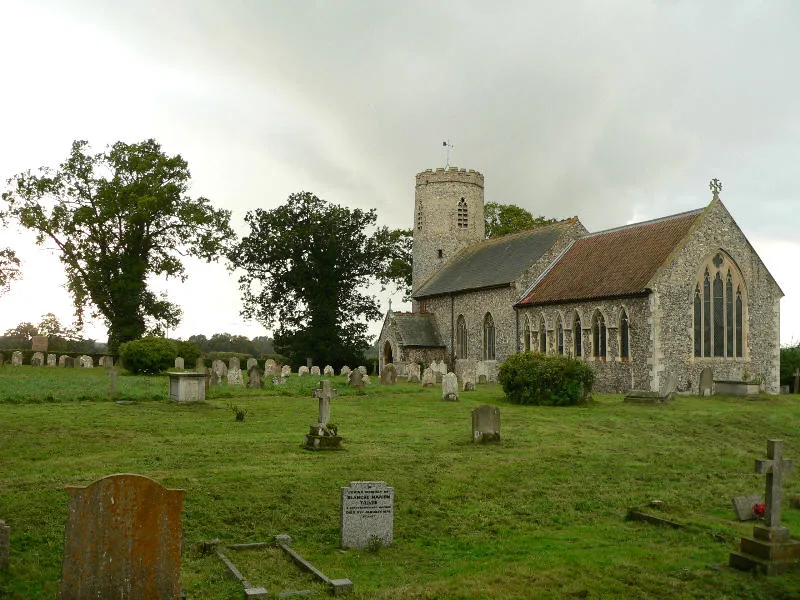
- commons: St Botolph's Church - geograph.org.uk - 675511.jpg (CC BY-SA 4.0)
Other places nearby
Loading nearby places…
Nearby
 📷 3
📷 3Public art & sculpture · East of England
Barford Village Sign
Barford Village Sign — a public art in england-east, United Kingdom.
Caravan parks · East of England
Oak View
Oak View — a caravan park in england east.
 📷 3
📷 3Memorials & monuments · East of England
War Memorial at Church of St Botolph, Barford
War Memorial at Church of St Botolph, Barford — Grade II listed building-listed memorial in england-east, United Kingdom.
 📷 3
📷 3Public art & sculpture · East of England
Wramplingham Village Sign
Wramplingham Village Sign — a public art in england-east, United Kingdom.
 📷 3
📷 3Memorials & monuments · East of England
Wramplingham War Memorial
Wramplingham War Memorial — Grade II listed building-listed memorial in england-east, United Kingdom.
 Flagship📷 3
Towns & cities · East of England
Wramplingham
Wramplingham — village in Norfolk, England, UK.
More towns in this region
 Flagship📷 3
Towns & cities · East of England
Alburgh
Alburgh — village and civil parish in Norfolk, UK.
 Flagship📷 3
Towns & cities · East of England
Aldeby
Aldeby — village and civil parish in Norfolk, UK.
 Flagship📷 5
Towns & cities · East of England
Ashill
Ashill — village and civil parish in the English county of Norfolk.
 Flagship📷 3
Towns & cities · East of England
Aslacton
Aslacton — village and civil parish in Norfolk, UK.
Frequently asked questions
- Where is Barford?
- Barford is in Norfolk, East of England, United Kingdom (postcode NR9), in the parish of Barford.
- Is Barford free to visit?
- Yes, Barford is free to enter.
- How do I get to Barford?
- The nearest railway station is Kimberley Park, about 6.1 km away. Drivers can navigate to postcode NR9.