Towns & cities · Central Scotland
Banknock
Banknock — village in Falkirk, Scotland, UK.

Wikimedia Commons contributors — see linked file page for photographer and licence licence
Plan your visit
- Typical visit
- 3 h–6 h
- Nearest railway station
- Cumbernauld · 5.4 km
- Free entry
- Family-friendly
- Dog-friendly
About
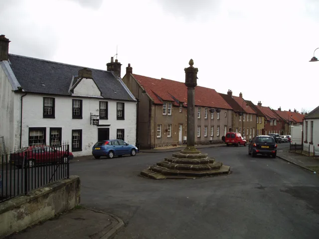
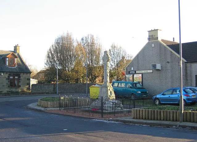
Banknock is a town, city, village or settlement in the United Kingdom. Recent population estimates put it at around 2,440 people. Wikidata describes it as: "village in Falkirk, Scotland, UK". Coordinates: 55.9875°, -3.9524°.
Photo gallery
From the Wikipedia article
Banknock (Scottish Gaelic: Baile nan Cnoc) is a village within the Falkirk council area in Central Scotland. The village is 6.7 miles (10.8 km) west-southwest of Falkirk, 3.9 miles (6.3 km) east-northeast of Kilsyth and 3.0 miles (4.8 km) north-northeast of Cumbernauld. Banknock is located on the Bonny Water, north of the Forth and Clyde canal and west of the A80 road near to the boundary of Falkirk and North Lanarkshire councils. At the time of the 2001 census, Banknock had a population of 2,529 residents.
Excerpt from Wikipedia under CC BY-SA 4.0. See the source article linked in Sources below.
Background
History
There were coal mines along the north side of the valley. Cannerton Pit was one of these mines and its spoil heap, locally called 'the Bing', was a local landmark Before the railway was built, the Banknock mines were linked to the Forth & Clyde Canal by a wagonway which is still traceable today. Banknock once had a railway station on the Kilsyth and Bonnybridge Railway, a line which was built to serve these mines. When these mines closed, brickworks was set up on the Cannerton site. This busy industrial site was once an important feature but is now disused. Another employer in the village was the foundry at the Coneypark end of the village and owned by the Dobson family who lived in the…
Sourced from Wikipedia under CC BY-SA 4.0.
- Coordinates
- 55.9875, -3.9524
- District
- Falkirk
- Postcode
- FK4 1TY
- Parliamentary constituency
- Falkirk
- Population
- 2,440
- Nearest railway station
- Cumbernauld — 5.4 km
- Official site
- www.falkirk.gov.uk
Sources
- wikidata: Q806814 (CC0)
- wikipedia: Banknock (CC BY-SA 4.0)
- commons: Bridge and lock at Banknock - geograph.org.uk - 1006169.jpg (CC BY-SA 4.0)
Other places nearby
Loading nearby places…
Nearby
 📷 5
📷 5Historic bridges · Central Scotland
Bridge, Castlecary
Bridge, Castlecary — category C listed building-listed bridge in scotland-central, United Kingdom.
.jpg?width=1200) 📷 3
📷 3Historic bridges · Central Scotland
Castlecary Viaduct
Castlecary Viaduct is a historic bridge in the United Kingdom.
 📷 3
📷 3Archaeological sites · Central Scotland
Castlecary Fort
Castlecary Fort — a archaeological in scotland-central, United Kingdom.
 📷 5
📷 5Historic churches · Central Scotland
Haggs Parish Church, Kilsyth Road, Haggs
Haggs Parish Church, Kilsyth Road, Haggs — category C listed building-listed church in scotland-central, United Kingdom.
Vineyards · Central Scotland
Coneypark
Coneypark — a UK vineyard in scotland central, producing English or Welsh wine from cool-climate grape varieties.
 📷 3
📷 3Castles · Central Scotland
Castlecary Castle
Castlecary Castle — a castle in scotland-central, United Kingdom.
More towns in this region
 Flagship📷 3
Towns & cities · Central Scotland
Airth
Airth — village in Falkirk, Scotland, UK.
 Flagship📷 5
Towns & cities · Central Scotland
Avonbridge
Avonbridge — village in Falkirk, Scotland, UK.
 Flagship📷 3
Towns & cities · Central Scotland
Dundee
Dundee — city in Scotland, UK.
 Flagship📷 3
Towns & cities · Central Scotland
Dunfermline
Dunfermline — city and former Royal Burgh in Fife, Scotland, UK.
Frequently asked questions
- Where is Banknock?
- Banknock is in central Scotland, United Kingdom (postcode FK4 1TY).
- Is Banknock free to visit?
- Yes, Banknock is free to enter.
- How do I get to Banknock?
- The nearest railway station is Cumbernauld, about 5.4 km away. Drivers can navigate to postcode FK4 1TY.