Reservoirs & lochs · Yorkshire & the Humber
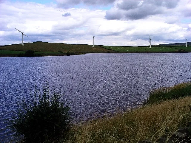
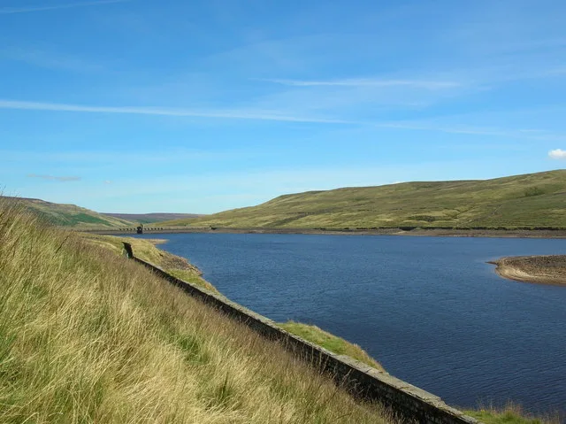
Baitings Reservoir
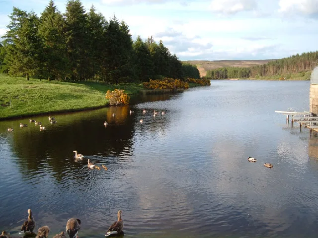
Baitings Reservoir — reservoir in West Yorkshire, England, UK.

Wikimedia Commons licence
Plan your visit
- Typical visit
- 1 h–2.5 h
- Nearest railway station
- Mytholmroyd · 7.1 km
- Free entry
- Dog-friendly
About
Baitings Reservoir is a reservoir in the United Kingdom. Wikidata describes it as: "reservoir in West Yorkshire, England, UK". Coordinates: 53.6658°, -1.9903°.
Photo gallery
Protected designations
- Site of Special Scientific Interest: South Pennine Moors SSSI
Designations sourced from Natural England open data under OGL v3.
From the Wikipedia article
Baitings Reservoir is a large water supply reservoir operated by Yorkshire Water close to Ripponden in the West Yorkshire Pennines, England. It lies in the valley of the River Ryburn, is the higher of two reservoirs built to supply Wakefield with water and was completed in 1956. The lower reservoir is Ryburn Reservoir.
Excerpt from Wikipedia under CC BY-SA 4.0. See the source article linked in Sources below.
Background
History
Wakefield Corporation Waterworks started impounding the valley of the River Ryburn in the 1930s, with Ryburn Reservoir being completed in 1933. Construction on Baitings took place 20 years later with completion in 1956. Baitings is a place name that derives from the Old Norse of Beit (pasture) and Eng (meadow), Baitings Bridge, on an old road linking Yorkshire and Lancashire, was to be flooded under the reservoir so a concrete viaduct was built. During spells of very hot weather and drought conditions, the old road bridge is revealed. The dam head is a curved structure that is 470 m long and over 50 m high. The reservoir covers 24 hectare and has a catchment of 742 hectare, and when it is…
Sourced from Wikipedia under CC BY-SA 4.0.
- Coordinates
- 53.6658, -1.9903
- District
- Calderdale
- Parish
- Ripponden
- Postcode
- HX6 4LR
- Parliamentary constituency
- Calder Valley
- Nearest railway station
- Mytholmroyd — 7.1 km
Sources
- wikidata: Q4848739 (CC0)
- wikipedia: Baitings Reservoir (CC BY-SA 4.0)
Other places nearby
Loading nearby places…
Nearby
 📷 3
📷 3Historic houses · Yorkshire & the Humber
Clough Side
Clough Side — a historic house in england-yorkshire, United Kingdom.
.jpg?width=1200) 📷 3
📷 3Reservoirs & lochs · Yorkshire & the Humber
Ryburn Reservoir
Ryburn Reservoir — reservoir in West Yorkshire, England, UK.
 📷 3
📷 3Archaeological sites · North West England
Cat Stones
Cat Stones — a archaeological in england-north-west, United Kingdom.
 📷 3
📷 3Memorials & monuments · Yorkshire & the Humber
Rishworth war memorial
Rishworth war memorial — Grade II listed building-listed memorial in england-yorkshire, United Kingdom.
 📷 3
📷 3Towns & cities · Yorkshire & the Humber
Ripponden
Ripponden — village and civil parish in Calderdale, West Yorkshire, UK.
 📷 3
📷 3Memorials & monuments · Yorkshire & the Humber
Ripponden War Memorial
Ripponden War Memorial — Grade II listed building-listed memorial in england-yorkshire, United Kingdom.
More places in this region
 Flagship📷 3
Reservoirs & lochs · Yorkshire & the Humber
Chelker Reservoir
Chelker Reservoir — reservoir in North Yorkshire, England, UK.
 Flagship📷 5
Reservoirs & lochs · Yorkshire & the Humber
Cod Beck Reservoir
Cod Beck Reservoir — reservoir in North Yorkshire, England, UK.
 📷 5
📷 5Reservoirs & lochs · Yorkshire & the Humber
Angram Reservoir
Angram Reservoir — reservoir in North Yorkshire, England, UK.
 📷 3
📷 3Reservoirs & lochs · Yorkshire & the Humber
Beaver Dyke Reservoirs
Beaver Dyke Reservoirs — reservoirs in North Yorkshire, England.
Frequently asked questions
- Where is Baitings Reservoir?
- Baitings Reservoir is in Yorkshire, United Kingdom (postcode HX6 4LR), in the parish of Ripponden.
- Is Baitings Reservoir a protected site?
- Yes — Baitings Reservoir is part of the South Pennine Moors SSSI Site of Special Scientific Interest.
- How do I get to Baitings Reservoir?
- The nearest railway station is Mytholmroyd, about 7.1 km away. Drivers can navigate to postcode HX6 4LR.