Towns & cities · South East England
Badminton
Badminton — village and civil parish in Gloucestershire, England.

Wikimedia Commons contributors — see linked file page for photographer and licence licence
Plan your visit
- Typical visit
- 3 h–6 h
- Free entry
- Family-friendly
- Dog-friendly
About
Badminton is a town, city, village or settlement in the United Kingdom. Recent population estimates put it at around 258 people. Address: GL9. Wikidata describes it as: "village and civil parish in Gloucestershire, England". Coordinates: 51.5430°, -2.2850°.
Photo gallery
Protected designations
- Area of Outstanding Natural Beauty: Cotswolds
Designations sourced from Natural England open data under OGL v3.
From the Wikipedia article
Badminton is a village and civil parish in South Gloucestershire, England. The only settlement in the parish is Badminton village, sometimes called Great Badminton to distinguish it from the hamlet of Little Badminton, about one mile to the north in Hawkesbury parish. The large country house called Badminton House is close to the north end of the village, and its surrounding deer park lies to the north and west.
Excerpt from Wikipedia under CC BY-SA 4.0. See the source article linked in Sources below.
Background
History
The Domesday Book of 1086 recorded a manor at Madmintune with 24 households. In 1612 Edward Somerset, 4th Earl of Worcester, bought from Nicholas Boteler his manors of Great and Little Badminton. One century earlier the name Badimyncgtun was recorded, held by that family since 1275.
Sourced from Wikipedia under CC BY-SA 4.0.
- Coordinates
- 51.5430, -2.2850
- District
- South Gloucestershire
- Parish
- Badminton
- Postcode
- GL9
- Parliamentary constituency
- Thornbury and Yate
- Population
- 258
- Official site
- www.badmintonparishcouncil.co.uk
Sources
- wikidata: Q799600 (CC0)
- wikipedia: Badminton, Gloucestershire (CC BY-SA 4.0)
- commons: Fence 12, Badminton Horse Trials - geograph.org.uk - 794809.jpg (CC BY-SA 4.0)
Other places nearby
Loading nearby places…
Nearby
 📷 5
📷 5Historic bridges · South East England
Bridge Over The Road 80 Yards North West Of Mount Pleasant
Bridge Over The Road 80 Yards North West Of Mount Pleasant — Grade II listed building-listed bridge in england-south-east, United Kingdom.
 📷 5
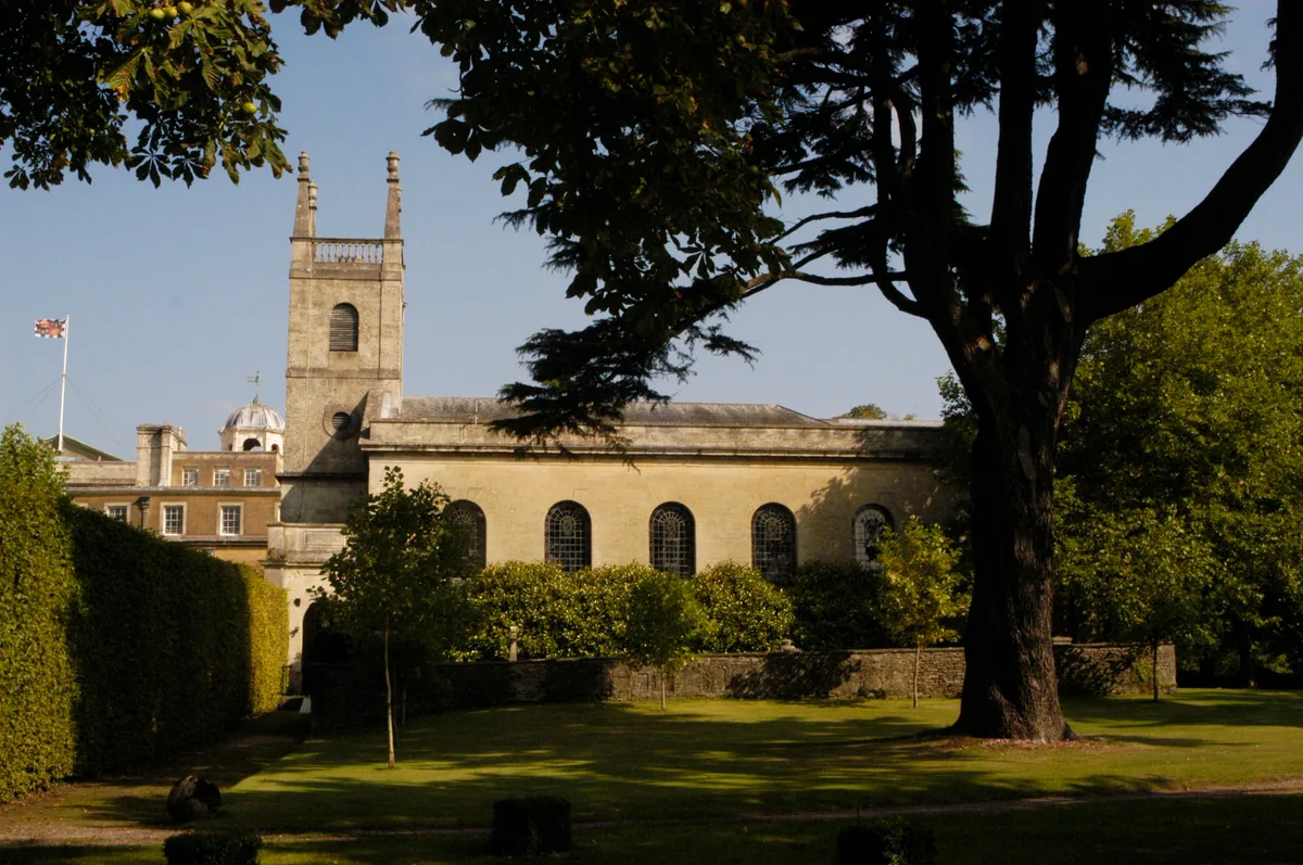
📷 5Historic churches · South East England
St Michael and All Angels Church, Badminton
St Michael and All Angels Church, Badminton — Grade I listed church in Badminton, South Gloucestershire, Gloucestershire, England, UK.
 Flagship📷 5
Historic houses · South East England
Badminton House
Badminton House — a Grade I-listed historic house in england-south-east, United Kingdom.
 📷 5
📷 5Follies · South East England
Slait Lodge
Slait Lodge — Folly or eyecatcher.
 📷 5
📷 5Follies · South East England
Castle Barm
Castle Barm — Folly or eyecatcher.
 📷 5
📷 5Follies · South East England
Hermit's Cell
Hermit's Cell — Folly or eyecatcher.
More towns in this region
 Flagship📷 10
Towns & cities · South East England
Aldermaston
Aldermaston — village and civil parish in West Berkshire in England, UK.
 Flagship📷 10
Towns & cities · South East England
Aldingbourne
Aldingbourne — village and civil parish in Arun, West Sussex, UK.
 Flagship📷 10
Towns & cities · South East England
Aldington
Aldington — village and civil parish in the Ashford District of Kent, England.
 Flagship📷 10
Towns & cities · South East England
Aldworth
Aldworth — village and civil parish in the English county of Berkshire.
Frequently asked questions
- Where is Badminton?
- Badminton is in South-East England, United Kingdom (postcode GL9), in the parish of Badminton.
- Is Badminton a protected site?
- Yes — Badminton is part of the Cotswolds National Landscape (AONB).
- Is Badminton free to visit?
- Yes, Badminton is free to enter.
- How do I get to Badminton?
- Drivers can navigate to postcode GL9. It sits within the Thornbury and Yate parliamentary constituency.