Museums · East Midlands
Ashfield District
Ashfield () is a local government district in Nottinghamshire, England. The council is based in Kirkby-in-Ashfield, but the largest town is neighbouring Sutton-in-Ashfield. The district also contains

Alan Murray-Rust — CC BY-SA 2.0 via Wikimedia Commons licence
Plan your visit
- Typical visit
- 1.5 h–3 h
- Best time of year
- Year-round
- Family-friendly
- Limited wheelchair access
About
Ashfield () is a local government district in Nottinghamshire, England. The council is based in Kirkby-in-Ashfield, but the largest town is neighbouring Sutton-in-Ashfield. The district also contains the town of Hucknall and a few villages. The district is mostly urban, with some of its settlements forming parts of both the Nottingham and Mansfield Urban Areas. The neighbouring districts are Mansfield, Newark and Sherwood, Gedling, Nottingham, Broxtowe, Amber Valley and Bolsover.
Photo gallery
From the Wikipedia article
Ashfield () is a local government district in Nottinghamshire, England. The council is based in Kirkby-in-Ashfield, but the largest town is neighbouring Sutton-in-Ashfield. The district also contains the town of Hucknall and a few villages. The district is mostly urban, with some of its settlements forming parts of both the Nottingham and Mansfield Urban Areas. The neighbouring districts are Mansfield, Newark and Sherwood, Gedling, Nottingham, Broxtowe, Amber Valley and Bolsover.
Excerpt from Wikipedia under CC BY-SA 4.0. See the source article linked in Sources below.
Background
History
The district was created on 1 April 1974 under the Local Government Act 1972, covering the whole of two former districts, most of Hucknall Urban District and of parts of a fourth, which were all abolished at the same time: The new district was named Ashfield, being the shared suffix of two of the towns' names.
Sourced from Wikipedia under CC BY-SA 4.0.
- Coordinates
- 53.0500, -1.3000
- County
- Nottinghamshire
- District
- Ashfield
- Parish
- Selston
- Postcode
- NG16 5GS
- Parliamentary constituency
- Ashfield
Sources
- wikipedia: Ashfield District (CC BY-SA 4.0)
Other places nearby
Loading nearby places…
Nearby
 📷 3
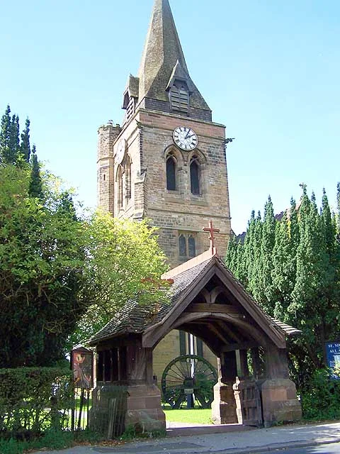
📷 3Historic churches · East Midlands
Church of St. Michael and All Angels, Underwood
Church of St. Michael and All Angels, Underwood — grade II listed church in Selston, Ashfield, Nottinghamshire, England, UK.
 📷 3
📷 3Public art & sculpture · East Midlands
Brinsley Village Sign
Brinsley Village Sign — a public art in england-east-midlands, United Kingdom.
 📷 5
📷 5Towns & cities · East Midlands
Brinsley
Brinsley — village in Nottinghamshire, England, UK.
 📷 3
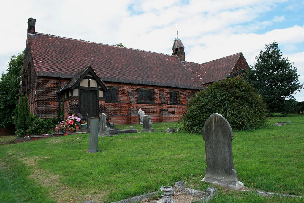
📷 3Historic churches · East Midlands
St. Mary's Church, Westwood
St. Mary's Church, Westwood — church in United Kingdom.
 📷 3
📷 3Abbeys & priories · East Midlands
Beauvale Priory
Beauvale Priory — a abbey in england-east-midlands, United Kingdom.
 📷 3
📷 3Memorials & monuments · East Midlands
Jacksdale War Memorial
Jacksdale War Memorial is a memorial in the United Kingdom.
More museums in this region
 📷 3
📷 3Museums · East Midlands
6 Former Filter Beds, Water Tank With Gazebo, And Steps At Swithland Reservoir Water Works
6 Former Filter Beds, Water Tank With Gazebo, And Steps At Swithland Reservoir Water Works — architectural ensemble in Quorndon, Charnwood, Leicestershire, England, UK.
 📷 3
📷 3Museums · East Midlands
Abbeydale Industrial Hamlet
Abbeydale Industrial Hamlet — hamlet and industrial museum in Sheffield, UK.
 📷 3
📷 3Museums · East Midlands
Alstonefield Geohut
Alstonefield Geohut — museum in Alstonefield, Staffordshire, England, UK.
 📷 3
📷 3Museums · East Midlands
Ashby de la Zouch Museum
Ashby de la Zouch Museum — local museum in Ashby de la Zouch, Leicestershire, United Kingdom.
Frequently asked questions
- Where is Ashfield District?
- Ashfield District is in East Midlands, in the United Kingdom — coordinates 53.0500°, -1.3000°.
- Is Ashfield District wheelchair accessible?
- Partially — OpenStreetMap notes limited wheelchair access at Ashfield District. Check ahead for specific facilities.