Natural landmarks · Scottish Highlands
Aonach Beag
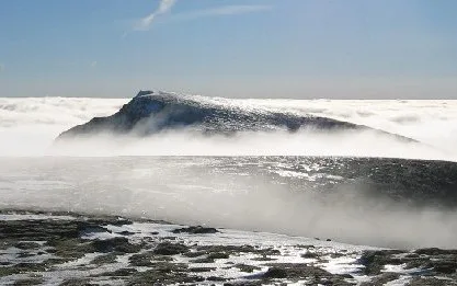
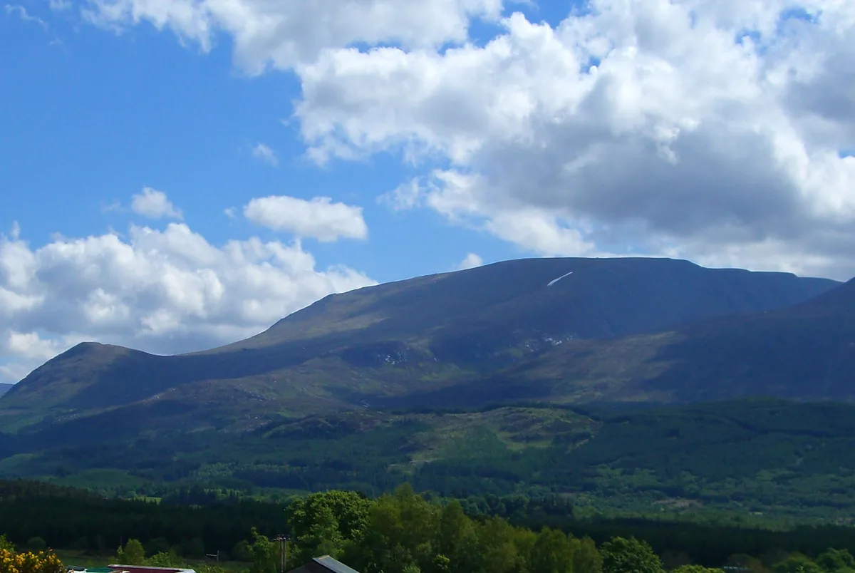
Aonach Beag — 1234m high mountain in Highland, Scotland, UK.

Wikimedia Commons contributors — see linked file page for photographer and licence licence
Plan your visit
- Typical visit
- 1 h–2 h
- Nearest railway station
- Fort William · 9.5 km
- Free entry
- Dog-friendly
About
Aonach Beag is a named natural landmark in the United Kingdom. Wikidata describes it as: "1234m high mountain in Highland, Scotland, UK". Coordinates: 56.8000°, -4.9541°.
Photo gallery
From the Wikipedia article
Aonach Beag is a mountain in the Scottish Highlands. It is located about 3 km east of Ben Nevis on the north side of Glen Nevis, near the town of Fort William. Apart from Ben Nevis, Aonach Beag is the highest peak in the British Isles outside the Cairngorm mountains in eastern Scotland. Aonach Beag is linked to its close neighbour to the north, Aonach Mòr, by a high saddle or bealach. The name Aonach Beag (small ridge) might imply that this mountain is smaller than Aonach Mòr (big ridge). However, Aonach Beag is higher; the names refer to the relative bulk of the two mountains rather than their elevation. The easiest way up is to take the gondola lift serving the Nevis Range ski area on Aonach Mòr to an elevation of 650 m and follow the ridge joining the two peaks. More traditionally, the hill is often climbed from the south from Glen Nevis. This way the walker avoids the paraphernalia associated with the ski development. Aonach Beag is often climbed in conjunction with Aonach Mòr. Aonach Beag's north face holds one of Scotland's longest-lying snow patches (grid reference NN196718), which sits at the bottom of the climb known as 'Queen's View' at an elevation of about 950 m. This patch has been known to last through to the first lasting snows of the new winter, and was present continuously from late 2006 to late November 2011.
Excerpt from Wikipedia under CC BY-SA 4.0. See the source article linked in Sources below.
- Coordinates
- 56.8000, -4.9541
- Address
- Lochaber, Scotland
- Nearest railway station
- Fort William — 9.5 km
- Official site
- www.hill-bagging.co.uk
Sources
- wikidata: Q2412502 (CC0)
- wikipedia: Aonach Beag (CC BY-SA 4.0)
- commons: Aonach beag.jpg (CC BY-SA 4.0)
Other places nearby
Loading nearby places…
Nearby
 📷 3
📷 3Mountains & hills · Scottish Highlands
Aonach Beag
Aonach Beag — Named summit at 1234 m.
 📷 3
📷 3Mountains & hills · Scottish Highlands
Stob Coire Bhealaich
Stob Coire Bhealaich — a mountain in scotland-highlands, United Kingdom.
 📷 3
📷 3Natural landmarks · Scottish Highlands
Aonach Mòr
Aonach Mòr — 1221m high mountain in Highland, Scotland, UK.
 📷 3
📷 3Mountains & hills · Scottish Highlands
Aonach Mòr
Aonach Mòr — Named summit at 1221 m.
📷 3Mountains & hills · Scottish Highlands
Sgùrr a' Bhuic
Sgùrr a' Bhuic — a mountain in scotland-highlands, United Kingdom.

Mountains & hills · Scottish Highlands
Stob an Cul Choire
Stob an Cul Choire — a mountain in scotland-highlands, United Kingdom.
More natural landmarks in this region
 Flagship📷 3
Natural landmarks · Scottish Highlands
Dunalastair Water
Dunalastair Water — lake in Perth and Kinross, Scotland, UK, on the River Tummel.
 Flagship📷 3
Natural landmarks · Scottish Highlands
Loch Arkaig
Loch Arkaig — lake in Highland, Scotland, UK, outflows east to River Arkaig.
 Flagship📷 3
Natural landmarks · Scottish Highlands
Loch Assynt
Loch Assynt — lake in Highland, Scotland, UK, outflows to the River Inver and Loch na Garbh Uidhe.
 Flagship📷 3
Natural landmarks · Scottish Highlands
Loch Awe
Loch Awe — lake in Argyll and Bute, Scotland, UK, outflows to the River Awe.
Frequently asked questions
- Where is Aonach Beag?
- Aonach Beag is in Scottish Highlands, in the United Kingdom — coordinates 56.8000°, -4.9541°. The nearest railway station is Fort William, around 9.5 km away.
- Is Aonach Beag free to visit?
- Yes — admission to Aonach Beag is free.