Mountains & hills · Scottish Highlands
An Stac
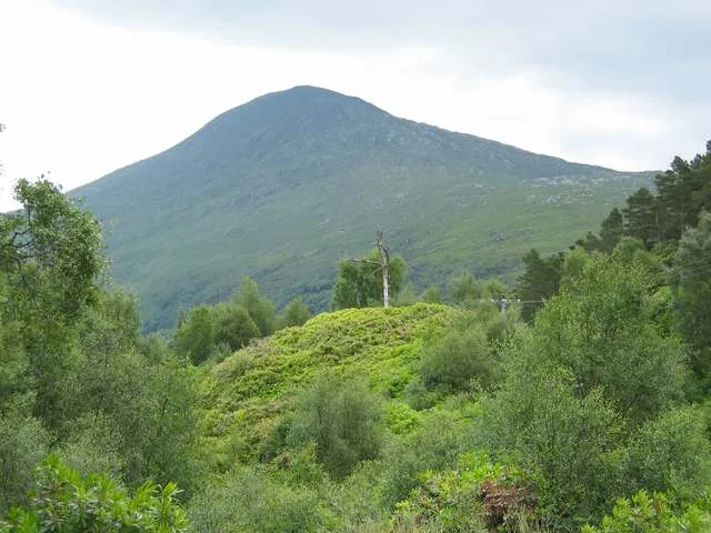
An Stac — Named summit at 814 m.

Wikimedia Commons contributors — see linked file page for photographer and licence licence
Plan your visit
- Typical visit
- 3 h–8 h
- Best time of year
- Late spring – early autumn (May–Oct)
- Nearest railway station
- Lochailort · 3.4 km
- Free entry
- Dog-friendly
About
An Stac is a named summit in the United Kingdom. Wikidata describes it as: "Named summit at 814 m.". Coordinates: 56.8509°, -5.6705°.
Photo gallery
From the Wikipedia article
An Stac is the name of a 814 m mountain in the Northwest Highlands, Scotland, on the shore of Loch Ailort on the west coast of Lochaber. A steep-sided conical peak, the mountain is usually climbed in conjunction with its higher neighbour Rois-bheinn. The nearest settlement is the hamlet of Lochailort.
Excerpt from Wikipedia under CC BY-SA 4.0. See the source article linked in Sources below.
- Coordinates
- 56.8509, -5.6705
- Address
- Lochaber, Scotland
- Nearest railway station
- Lochailort — 3.4 km
- Official site
- www.hill-bagging.co.uk
Sources
- osm: n746539921 (ODbL)
- wikipedia: An Stac (CC BY-SA 4.0)
- commons: An Stac from the mouth of Loch Ailort - geograph.org.uk - 86256.jpg (CC BY-SA 4.0)
Other places nearby
Loading nearby places…
Nearby
 📷 3
📷 3Mountains & hills · Scottish Highlands
Rois-Bheinn
Rois-Bheinn — Named summit at 882 m.
 📷 3
📷 3Natural landmarks · Scottish Highlands
Rois-bheinn
Rois-bheinn — mountain in Highland, Scotland, UK.
 📷 3
📷 3Natural landmarks · Scottish Islands
Alisary
Alisary in Scotland Islands, United Kingdom.
 📷 3
📷 3Memorials & monuments · Scottish Highlands
Mrs Cameron-Head Memorial Cairn
Mrs Cameron-Head Memorial Cairn — a memorial in scotland-highlands, United Kingdom.
 📷 5
📷 5Reservoirs & lochs · Scottish Islands
Inverailort House
Inverailort House in Scotland Islands, United Kingdom.
 📷 4
📷 4Reservoirs & lochs · Scottish Islands
Loch Ailort
Loch Ailort in Scotland Islands, United Kingdom.
More mountains in this region
 📷 3
📷 3Mountains & hills · Scottish Highlands
A' Bhuidheanach Bheag
A' Bhuidheanach Bheag — Named summit at 936 m.
 📷 3
📷 3Mountains & hills · Scottish Highlands
A' Chailleach
A' Chailleach — Named summit at 997 m.
 📷 3
📷 3Mountains & hills · Scottish Highlands
A' Chailleach
A' Chailleach — Named summit at 930 m.
 📷 3
📷 3Mountains & hills · Scottish Highlands
A' Chaoirnich
A' Chaoirnich — Named summit at 875 m.
Frequently asked questions
- Where is An Stac?
- An Stac is in the Scottish Highlands, United Kingdom.
- Is An Stac free to visit?
- Yes, An Stac is free to enter.
- How do I get to An Stac?
- The nearest railway station is Lochailort, about 3.4 km away.