Natural landmarks · Scottish Highlands
An Socach
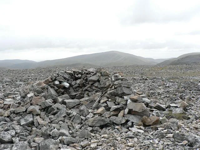
An Socach — 944m high mountain in Aberdeenshire, Scotland, UK.

Wikimedia Commons contributors — see linked file page for photographer and licence licence
Plan your visit
- Typical visit
- 1 h–2 h
- Free entry
- Dog-friendly
About
An Socach is a named natural landmark in the United Kingdom. Wikidata describes it as: "944m high mountain in Aberdeenshire, Scotland, UK". Coordinates: 56.9023°, -3.5132°.
Photo gallery
From the Wikipedia article
An Socach is a Scottish mountain situated some three miles (5 km) west of the A93 road from Perth to Braemar. It is located at grid ref. 080800 on Ordnance Survey sheet 43. The summit altitude is 944 m (3,097 ft). The name may derive from the Gaelic Soc, meaning the snout or beak, leading to the projecting place by analogy with the shape of a snout. Other sources state that it in fact means 'the sow'. The hill has an elongated, round form, and the Munro bagger is advised that the highest top is in fact at its western end and is not the 938 m (3,077 ft) eastern summit as shown on certain OS maps. The hill may be climbed from Glen Ey to the north or from the top of the Glenshee Ski Centre to the east. The Glenshee route involves a descent into Baddoch Burn, and so more climbing is required than the Glen Ey route, which is longer.
Excerpt from Wikipedia under CC BY-SA 4.0. See the source article linked in Sources below.
- Coordinates
- 56.9023, -3.5132
- Address
- Aberdeenshire, Scotland
Sources
- wikidata: Q4750222 (CC0)
- wikipedia: An Socach (Glen Ey) (CC BY-SA 4.0)
- commons: Summit of An Socach - geograph.org.uk - 57554.jpg (CC BY-SA 4.0)
Other places nearby
Loading nearby places…
Nearby
 📷 3
📷 3Mountains & hills · Scottish Highlands
An Socach
An Socach — Named summit at 944 m.
 📷 3
📷 3Mountains & hills · Scottish Highlands
Beinn Iutharn Bheag
Beinn Iutharn Bheag — a mountain in scotland-highlands, United Kingdom.

Mountains & hills · Scottish Highlands
Càrn a' Chlarsaich
Càrn a' Chlarsaich — a mountain in scotland-highlands, United Kingdom.
 📷 3
📷 3Historic houses · Scottish Highlands
Altanaur Lodge
Altanaur Lodge — a historic house in scotland-highlands, United Kingdom.
 📷 4
📷 4Reservoirs & lochs · Scottish Highlands
Loch nan Eun
Loch nan Eun in Scotland Islands, United Kingdom.
 📷 2
📷 2Mountains & hills · Scottish Highlands
Creag Easgaidh
Creag Easgaidh — a mountain in scotland-highlands, United Kingdom.
More natural landmarks in this region
 Flagship📷 3
Natural landmarks · Scottish Highlands
Dunalastair Water
Dunalastair Water — lake in Perth and Kinross, Scotland, UK, on the River Tummel.
 Flagship📷 3
Natural landmarks · Scottish Highlands
Loch Arkaig
Loch Arkaig — lake in Highland, Scotland, UK, outflows east to River Arkaig.
 Flagship📷 3
Natural landmarks · Scottish Highlands
Loch Assynt
Loch Assynt — lake in Highland, Scotland, UK, outflows to the River Inver and Loch na Garbh Uidhe.
 Flagship📷 3
Natural landmarks · Scottish Highlands
Loch Awe
Loch Awe — lake in Argyll and Bute, Scotland, UK, outflows to the River Awe.
Frequently asked questions
- Where is An Socach?
- An Socach is in Scottish Highlands, in the United Kingdom — coordinates 56.9023°, -3.5132°.
- Is An Socach free to visit?
- Yes — admission to An Socach is free.