Natural landmarks · Scottish Highlands
An Sgùrr
Also known as: An Sgúrr
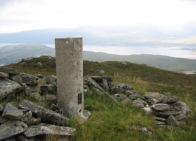
An Sgùrr — 391m high mountain in Highland, Scotland, UK.

Toby Speight — CC BY-SA 2.0 via Wikimedia Commons licence
Plan your visit
- Typical visit
- 1 h–2 h
- Nearest railway station
- Stromeferry · 4.2 km
- Free entry
- Dog-friendly
About
An Sgùrr is a named natural landmark in the United Kingdom. Wikidata describes it as: "391m high mountain in Highland, Scotland, UK". Coordinates: 57.3885°, -5.5674°.
From the Wikipedia article
An Sgùrr is a hill in Scotland, occupying the broad peninsula between Loch Carron and Loch Kishorn. It has the appearance of a rough knoll, with small crags ringing the summit, particularly on the western side. The hill may be climbed from a number of locations. The A896 road passes some two kilometres to the north, whilst a forestry track from south of Lochcarron allows access to the southeast. The path between Achintraid and Reraig passes to the south west side of An Sgùrr; the summit may be reached from Bealach that separates An Sgùrr from Bad a' Chreamha, which lies a kilometre or so east of this path.
Excerpt from Wikipedia under CC BY-SA 4.0. See the source article linked in Sources below.
- Coordinates
- 57.3885, -5.5674
- District
- Highland
- Postcode
- IV54 8XG
- Parliamentary constituency
- Inverness, Skye and West Ross-shire
- Nearest railway station
- Stromeferry — 4.2 km
Sources
- wikidata: Q4750217 (CC0)
- wikipedia: An Sgùrr (Lochcarron) (CC BY-SA 4.0)
Other places nearby
Loading nearby places…
Nearby
 📷 3
📷 3Natural landmarks · Scottish Highlands
Bad a' Chreamha
Bad a' Chreamha — 395m high mountain in Highland, Scotland, UK.
 📷 3
📷 3Mountains & hills · Scottish Highlands
Bad a' Chreamha
Bad a' Chreamha — Named summit at 395 m.
 📷 4
📷 4Reservoirs & lochs · Scottish Islands
Ardarroch
Ardarroch in Scotland Islands, United Kingdom.
Hostels · Scottish Highlands
Sanachan Bunkhouse
Sanachan Bunkhouse — a hostel in scotland highlands.
 📷 3
📷 3Archaeological sites · Scottish Highlands
Lag An Duin, broch site
Lag An Duin, broch site — a archaeological in scotland-highlands, United Kingdom.
 📷 5
📷 5Museums · Scottish Highlands
Pride of Strome
Pride of Strome — a museum in scotland-highlands, United Kingdom.
More natural landmarks in this region
 Flagship📷 3
Natural landmarks · Scottish Highlands
Dunalastair Water
Dunalastair Water — lake in Perth and Kinross, Scotland, UK, on the River Tummel.
 Flagship📷 3
Natural landmarks · Scottish Highlands
Loch Arkaig
Loch Arkaig — lake in Highland, Scotland, UK, outflows east to River Arkaig.
 Flagship📷 3
Natural landmarks · Scottish Highlands
Loch Assynt
Loch Assynt — lake in Highland, Scotland, UK, outflows to the River Inver and Loch na Garbh Uidhe.
 Flagship📷 3
Natural landmarks · Scottish Highlands
Loch Awe
Loch Awe — lake in Argyll and Bute, Scotland, UK, outflows to the River Awe.
Frequently asked questions
- Where is An Sgùrr?
- An Sgùrr is in the Scottish Highlands, United Kingdom (postcode IV54 8XG).
- Is An Sgùrr free to visit?
- Yes, An Sgùrr is free to enter.
- How do I get to An Sgùrr?
- The nearest railway station is Stromeferry, about 4.2 km away. Drivers can navigate to postcode IV54 8XG.