Mountains & hills · Scottish Highlands
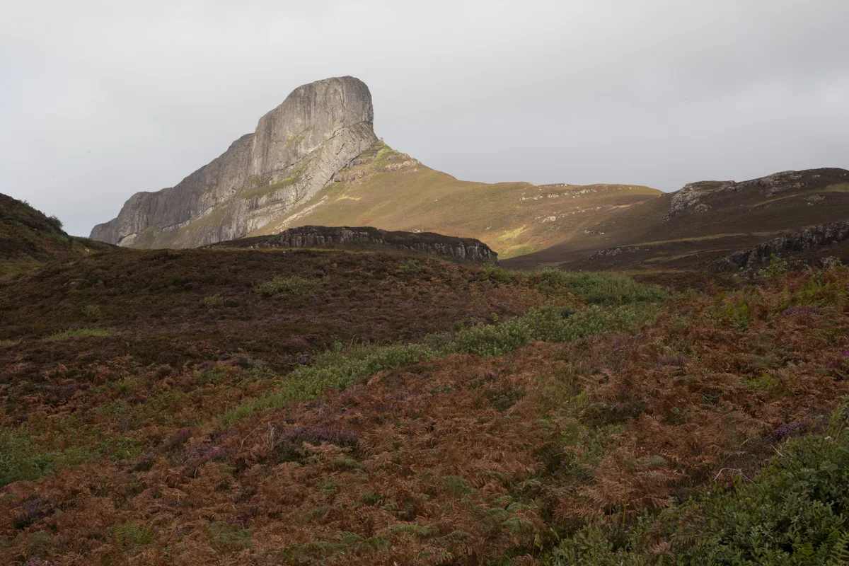
An Sgùrr
Also known as: An Sgùrr, Eige
An Sgùrr — Named summit at 393 m.

Wikimedia Commons contributors — see linked file page for photographer and licence licence
.jpg)
Plan your visit
- Typical visit
- 3 h–8 h
- Best time of year
- Late spring – early autumn (May–Oct)
- Free entry
- Dog-friendly
About
An Sgùrr is a named summit in the United Kingdom. Wikidata describes it as: "Named summit at 393 m.". Coordinates: 56.8840°, -6.1658°.
Photo gallery
From the Wikipedia article
An Sgùrr is the highest point on the island of Eigg in Scotland's Small Isles. It was formed 59 million years ago; the result of one of the last eruptions of a volcano, the core of which now forms the Isle of Rùm. Thick viscous pitchstone lava of rhyodacitic composition flowed out, filling a river valley. The lava cooled and formed column-like structures, similar to those at Giant's Causeway. The surrounding basalt was softer than the pitchstone, and hence the valley became inverted, with the pitchstone withstanding the erosion far better than the surrounding rock. An Sgùrr is thus an inselberg. The mountain appears most strikingly in the view of the eastern end, known as the Nose of Sgùrr. The peak is most frequently climbed from the ferry terminal at Galmisdale on the southeast corner of Eigg. A rough track heads west, passing between the northern side of An Sgùrr and the shoreline. About three-quarters of the way along the side of the ridge there is a gully; a fairly easy scramble allows access to the summit ridge. The route now almost doubles back on itself, heading east to reach the summit, which is crowned by a trig point. The climb, from ferry terminal to the Nose of An Sgùrr and back, takes at least four hours. An Sgùrr is also known as the Sgurr of Eigg.
Excerpt from Wikipedia under CC BY-SA 4.0. See the source article linked in Sources below.
- Coordinates
- 56.8840, -6.1658
- Address
- Eigg, Scotland
Sources
- osm: n709205180 (ODbL)
- wikipedia: An Sgùrr (Eigg) (CC BY-SA 4.0)
- commons: An Sgùrr (42173131400).jpg (CC BY-SA 4.0)
Other places nearby
Loading nearby places…
Nearby
 📷 3
📷 3Natural landmarks · Scottish Highlands
An Sgùrr
An Sgùrr — mountain on Eigg, HIghland, Scotland, UK.
Vineyards · Scottish Highlands
Eigg, An Sgurr
Eigg, An Sgurr — a UK vineyard in scotland highlands, producing English or Welsh wine from cool-climate grape varieties.
 📷 3
📷 3Archaeological sites · Scottish Highlands
Grulin, dun site
Grulin, dun site — a archaeological in scotland-highlands, United Kingdom.
Vineyards · Scottish Highlands
Eigg, Garbh Bealach
Eigg, Garbh Bealach — a UK vineyard in scotland highlands, producing English or Welsh wine from cool-climate grape varieties.
 📷 3
📷 3Forts · Scottish Highlands
Garbh Bealach
Garbh Bealach is a fort in the United Kingdom.
 📷 3
📷 3Caves · Scottish Highlands
Uamh a' Chràbhaidh
Uamh a' Chràbhaidh is a cave in the United Kingdom.
More mountains in this region
 📷 3
📷 3Mountains & hills · Scottish Highlands
A' Bhuidheanach Bheag
A' Bhuidheanach Bheag — Named summit at 936 m.
 📷 3
📷 3Mountains & hills · Scottish Highlands
A' Chailleach
A' Chailleach — Named summit at 997 m.
 📷 3
📷 3Mountains & hills · Scottish Highlands
A' Chailleach
A' Chailleach — Named summit at 930 m.
 📷 3
📷 3Mountains & hills · Scottish Highlands
A' Chaoirnich
A' Chaoirnich — Named summit at 875 m.
Frequently asked questions
- Where is An Sgùrr?
- An Sgùrr is in Scottish Highlands, in the United Kingdom — coordinates 56.8840°, -6.1658°.
- Is An Sgùrr free to visit?
- Yes — admission to An Sgùrr is free.