Towns & cities · South West England
Altarnun
Altarnun — village and civil parish in Cornwall, England.

Wikimedia Commons contributors — see linked file page for photographer and licence licence
Plan your visit
- Typical visit
- 3 h–6 h
- Nearest railway station
- Mansion House Station · 6.5 km
- Free entry
- Family-friendly
- Dog-friendly
About
Altarnun is a town, city, village or settlement in the United Kingdom. Recent population estimates put it at around 976 people. Address: PL15. Wikidata describes it as: "village and civil parish in Cornwall, England". Coordinates: 50.6030°, -4.5110°.
Photo gallery
Protected designations
- Area of Outstanding Natural Beauty: Cornwall
Designations sourced from Natural England open data under OGL v3.
From the Wikipedia article
Altarnun ( AWL-tər-NUN, OL-; Standard Written Form: Alternonn) is a village and civil parish in Cornwall, England, United Kingdom. It lies 7 miles (11 km) west of Launceston on the north-eastern edge of Bodmin Moor at grid reference SX 223 811. The parish of Altarnun includes the village of Fivelanes and the hamlets of Bolventor, Treween and Trewint, and had a population of 976 at the 2001 census, increasing to 1,084 according at the 2011 census. Other hamlets in the parish are Bowithick, Palmersbridge, South Carne, Tolborough, Lower Tregunnon and Tredaule. The area of the parish is 15,018 acres (60.78 km2), the largest in Cornwall. By the time of the 2011 census the figures for the ward of Altarnun were provided. This ward contained 48 locations in the area and gave a population of 4,038. The moorland area of the parish is large and lies west of the village towards Rough Tor and southwards towards Dozmary Pool. There is a large conifer plantation at Wilsey Down Forest (Halvana Plantation). The village is in the valley of the Penpont Water and the parish is divided by the A30 trunk road which passes close to Fivelanes, once an important stopping place for stage coaches.
Excerpt from Wikipedia under CC BY-SA 4.0. See the source article linked in Sources below.
- Coordinates
- 50.6030, -4.5110
- District
- Cornwall
- Parish
- Altarnun
- Postcode
- PL15
- Parliamentary constituency
- North Cornwall
- Population
- 976
- Nearest railway station
- Mansion House Station — 6.5 km
- Official site
- www.ons.gov.uk
Sources
- wikidata: Q517315 (CC0)
- wikipedia: Altarnun (CC BY-SA 4.0)
- commons: Altarnun village centre, Cornwall - geograph.org.uk - 1780139.jpg (CC BY-SA 4.0)
Other places nearby
Loading nearby places…
Nearby
 📷 5
📷 5Chapels · South West England
Altarnun Methodist Chapel
Altarnun Methodist Chapel — chapel in Altarnun, Cornwall, England, UK.
 📷 3
📷 3Memorials & monuments · South West England
Altarnun War Memorial
Altarnun War Memorial — Grade II listed building-listed memorial in england-south-west, United Kingdom.
📷 3Historic bridges · South West England
Altarnun Old Bridge
Altarnun Old Bridge — a Grade II*-listed bridge in england-south-west, United Kingdom.
 📷 5
📷 5Historic churches · South West England
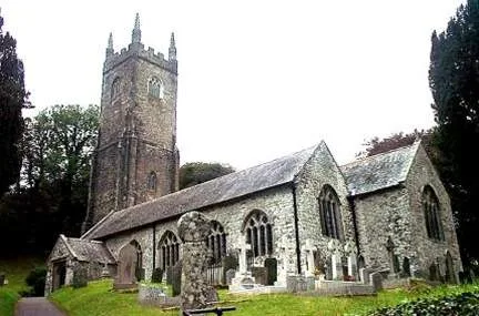
St Nonna's Church, Altarnun
St Nonna's Church, Altarnun — church in Altarnun, Cornwall, England, UK.
Campsites · South West England
Nathania
Nathania — a campsite in england south west.
Campsites · South West England
Rising Sun Inn Campsite
Rising Sun Inn Campsite — a campsite in england south west.
More towns in this region
 Flagship📷 10
Towns & cities · South West England
All Saints
All Saints — village and civil parish in Devon, England, UK.
 Flagship📷 10
Towns & cities · South West England
Axmouth
Axmouth — village and civil parish in Devon, England, UK.
 ★ Iconic📷 10
Towns & cities · South West England
Beer
Beer — village and civil parish in Devon, UK.
 Flagship📷 10
Towns & cities · South West England
Branscombe
Branscombe — village and civil parish in Devon, UK.
Frequently asked questions
- Where is Altarnun?
- Altarnun is in South-West England, United Kingdom (postcode PL15), in the parish of Altarnun.
- Is Altarnun a protected site?
- Yes — Altarnun is part of the Cornwall National Landscape (AONB).
- Is Altarnun free to visit?
- Yes, Altarnun is free to enter.
- How do I get to Altarnun?
- The nearest railway station is Mansion House Station, about 6.5 km away. Drivers can navigate to postcode PL15.