Castles · South Wales
Allt y Gaer
Allt y Gaer — Site of Special Scientific Interest in Wales.

Wikimedia Commons contributors — see linked file page for photographer and licence licence
Plan your visit
- Typical visit
- 1.5 h–3 h
- Nearest railway station
- Ffairfach · 5.7 km
- Family-friendly
- Limited wheelchair access
About
Allt y Gaer is a castle in the United Kingdom — fortified architecture from the medieval, Tudor, or Victorian-revival period. Heritage designation: Site of Special Scientific Interest. Wikidata describes it as: "Site of Special Scientific Interest in Wales". Coordinates: 51.8688°, -4.0755°.
Photo gallery
From the Wikipedia article
Allt y Gaer (Welsh for 'hill of the fort') is a Site of Special Scientific Interest (SSSI) in Llangathen community, Carmarthenshire, Wales. It is a 3.5ha conifer woodland on the northern slopes of the Tywi Valley, which has SSSI protected designation because it holds the largest heronry in West Wales.
Excerpt from Wikipedia under CC BY-SA 4.0. See the source article linked in Sources below.
- Coordinates
- 51.8688, -4.0755
- District
- Carmarthenshire
- Parish
- Llangathen
- Postcode
- SA32 8RP
- Parliamentary constituency
- Caerfyrddin
- Nearest railway station
- Ffairfach — 5.7 km
Sources
- wikidata: Q4733307 (CC0)
- wikipedia: Allt y Gaer (CC BY-SA 4.0)
- commons: Buildings at Alltygaer - geograph.org.uk - 1018816.jpg (CC BY-SA 4.0)
Other places nearby
Loading nearby places…
Nearby
Vineyards · South Wales
Gaer Hill Camp, Penterry
Gaer Hill Camp, Penterry — a UK vineyard in wales south, producing English or Welsh wine from cool-climate grape varieties.
 📷 4
📷 4Mountains & hills · South Wales
Grongar Hill
Grongar Hill — a mountain in wales-south, United Kingdom, 143 m.
Vineyards · South Wales
Grongaer, Llangathen
Grongaer, Llangathen — a UK vineyard in wales south, producing English or Welsh wine from cool-climate grape varieties.
 📷 3
📷 3Gardens · South Wales
Aberglasney Gardens
Aberglasney Gardens — a garden in wales-south, United Kingdom.
 📷 4
📷 4Historic houses · South Wales
Aberglasney
Aberglasney House and Gardens is a medieval house and gardens set in the Tywi valley in the parish of Llangathen, Carmarthenshire, West Wales. It is owned and run by Aberglasney Restoration Trust, a r
 📷 5
📷 5Memorials & monuments · South Wales
War Memorial in Llangathen Churchyard
War Memorial in Llangathen Churchyard — Grade II listed building-listed memorial in wales-south, United Kingdom.
More castles in this region
 📷 5
📷 5Castles · South Wales
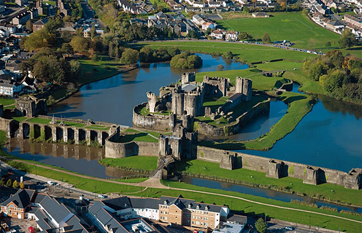
Caerphilly Castle
Caerphilly Castle — castle in Caerphilly, Wales.
 📷 3
📷 3Castles · South Wales
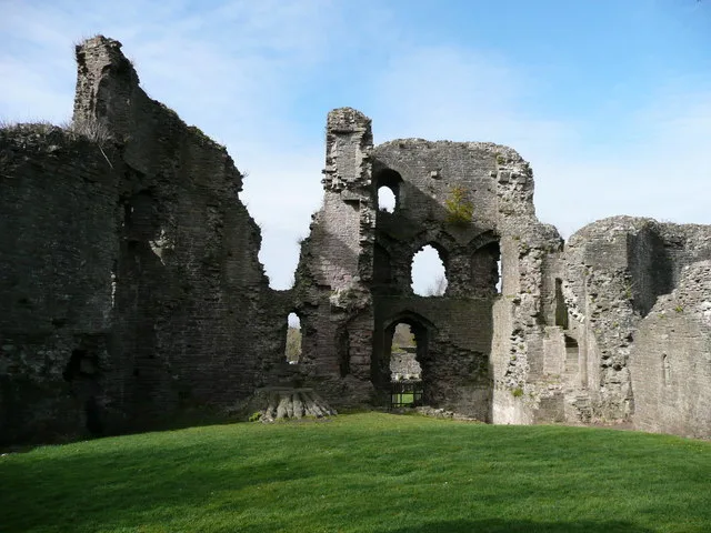
Abergavenny Castle
Abergavenny Castle — Grade I listed building in Abergavenny. Ruined castle in the market town of Abergavenny, Monmouthshire, Wales.
 📷 3
📷 3Castles · South Wales
Aberyscir Castle
Aberyscir Castle is a castle in the United Kingdom.
 📷 3
📷 3Castles · South Wales
Allt y Ferin
Allt y Ferin — hillfort in Carmarthenshire.
Frequently asked questions
- Where is Allt y Gaer?
- Allt y Gaer is in South Wales, United Kingdom (postcode SA32 8RP), in the parish of Llangathen.
- Is Allt y Gaer a listed building?
- Allt y Gaer is officially recognised as Site of Special Scientific Interest listed.
- Does Allt y Gaer charge admission?
- Allt y Gaer typically charges admission. Check the official site for current ticket prices and opening hours.
- How do I get to Allt y Gaer?
- The nearest railway station is Ffairfach, about 5.7 km away. Drivers can navigate to postcode SA32 8RP.