Museums · South West England
Alford, Somerset
Alford is a village and parish on the River Alham, in Somerset, England, situated 8 miles (12.9 km) south of Shepton Mallet and two miles west of Castle Cary. The village has a population of 63.

Lewis Clarke — CC BY-SA 2.0 via Wikimedia Commons licence
Plan your visit
- Typical visit
- 1.5 h–3 h
- Best time of year
- Year-round
- Family-friendly
- Limited wheelchair access
About
Alford is a village and parish on the River Alham, in Somerset, England, situated 8 miles (12.9 km) south of Shepton Mallet and two miles west of Castle Cary. The village has a population of 63.
Photo gallery
From the Wikipedia article
Alford is a village and parish on the River Alham, in Somerset, England, situated 8 miles (12.9 km) south of Shepton Mallet and two miles west of Castle Cary. The village has a population of 63.
Excerpt from Wikipedia under CC BY-SA 4.0. See the source article linked in Sources below.
Background
History
The parish was part of the hundred of Catsash. William Rosewell purchased the manor from Sir James FitzJames c. 1563 and it was inherited by subsequent generations: William Rosewell of Forde Abbey (1563–1593); and Sir Henry Rosewell (1593–1656). In 1634 Henry and his wife Mary (Drake) conveyed the manor to Simon Court, who before 1639 sold it to Sir Robert Gorges of Redlynch. Alford House was built in the late 18th century, but remodelled by F. C. Penrose in 1877. A chalybeate spring was at Alford Well Farm. It was visited by Celia Fiennes in 1698; she remarked that "it's a quick purger". It was reported as "disused" in 1848 and as "now neglected" in 1870.
Sourced from Wikipedia under CC BY-SA 4.0.
- Coordinates
- 51.0800, -2.5700
- District
- Somerset
- Parish
- Alford
- Postcode
- BA7 7PZ
- Parliamentary constituency
- Glastonbury and Somerton
- Official site
- www.somersetintelligence.org.uk
Sources
- wikipedia: Alford, Somerset (CC BY-SA 4.0)
Other places nearby
Loading nearby places…
Nearby
 📷 3
📷 3Memorials & monuments · South West England
Unidentified Monument In Churchyard About 4 Metres South East Of Porch, Church Of St Thomas Of Canterbury
Unidentified Monument In Churchyard About 4 Metres South East Of Porch, Church Of St Thomas Of Canterbury — Grade II listed building-listed memorial in england-south-west, United Kingdom.
 📷 5
📷 5Historic churches · South West England
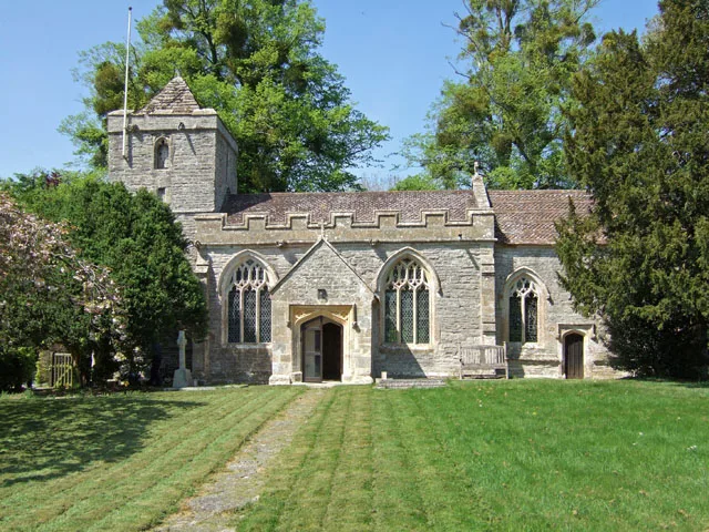
Church of All Saints, Alford
Church of All Saints, Alford — church in Alford, Somerset, England, UK.
 📷 5
📷 5Museums · South West England
River Alham
The River Alham flows through Somerset, England. It rises at Higher Alham above Batcombe and runs through Alhampton, Milton Clevedon and joins the River Brue to the north of Alford. It was known as th
 📷 3
📷 3Historic bridges · South West England
Bolter's Bridge
Bolter's Bridge — a Grade II*-listed bridge in england-south-west, United Kingdom.
 📷 3
📷 3Historic houses · South West England
Church (Remains of)
Church (Remains of) — a historic house in england-south-west, United Kingdom.
Vineyards · South West England
Medieval settlement 190m south west of Perry's Bridge
Medieval settlement 190m south west of Perry's Bridge — a UK vineyard in england south west, producing English or Welsh wine from cool-climate grape varieties.
More museums in this region
 📷 5
📷 5Museums · South West England
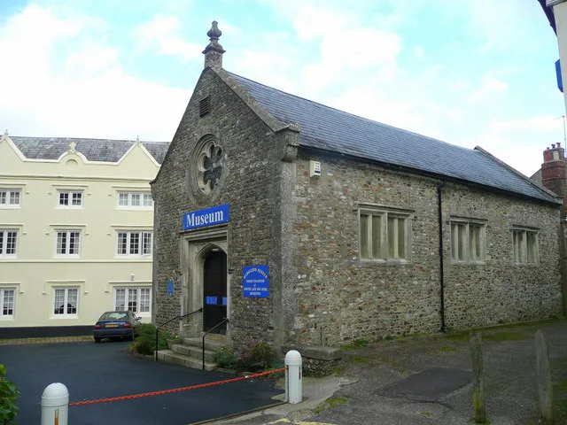
Allhallows Museum
Allhallows Museum — museum in Honiton, Devon, England, United Kingdom.
 📷 5
📷 5Museums · South West England
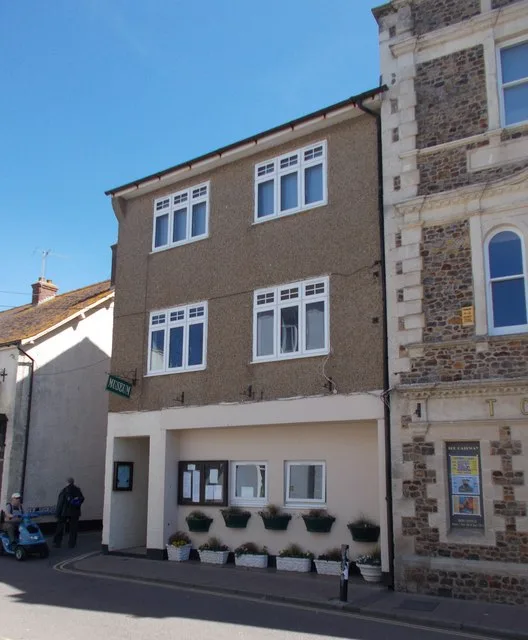
Axe Valley Heritage Museum
Axe Valley Heritage Museum — museum in Seaton, England, UK.
 📷 5
📷 5Museums · South West England
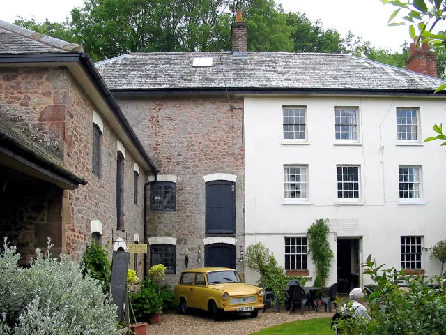
Bakelite Museum
Bakelite Museum is a museum in the United Kingdom.
 📷 5
📷 5Museums · South West England
Barometer World
Barometer World — former museum in Devon, England.
Frequently asked questions
- Where is Alford, Somerset?
- Alford, Somerset is in South West England, in the United Kingdom — coordinates 51.0800°, -2.5700°.
- Is Alford, Somerset wheelchair accessible?
- Partially — OpenStreetMap notes limited wheelchair access at Alford, Somerset. Check ahead for specific facilities.