Museums · London
Addlestone
Addlestone ( or ) is a town in Surrey, England. It is located approximately 18+1⁄2 miles (30 kilometres) southwest of London. The town is the administrative centre of the Borough of Runnymede, of whic

JThomas — CC BY-SA 2.0 via Wikimedia Commons licence
Plan your visit
- Typical visit
- 1.5 h–3 h
- Best time of year
- Year-round
- Family-friendly
- Wheelchair accessible
About
Addlestone ( or ) is a town in Surrey, England. It is located approximately 18+1⁄2 miles (30 kilometres) southwest of London. The town is the administrative centre of the Borough of Runnymede, of which it is the largest settlement.
Photo gallery
From the Wikipedia article
Addlestone ( or ) is a town in Surrey, England. It is located approximately 18+1⁄2 miles (30 kilometres) southwest of London. The town is the administrative centre of the Borough of Runnymede, of which it is the largest settlement.
Excerpt from Wikipedia under CC BY-SA 4.0. See the source article linked in Sources below.
Background
History
The name Addlestone probably means "Attel's Denu": the valley belonging to a Saxon named Attel. Addlestone, historically called Atlesdon or Atlesford, was a part of Chertsey ecclesiastical parish, the basic unit of civil administration. In 1241 the place was listed as "Attelsdene" and by 1610 John Speed's map shows "Adleston", halfway between named hills St. Annhill and St. Georg Hill, just south of the Thames. The Crouch Oak, an oak tree believed to have originated in the 11th Century, is an important symbol of the town. It used to mark the boundary of Windsor Great Park. Legend says that Queen Elizabeth I stopped by it and had a picnic. The tree is one of the main historic features of the…
Description
Heading north from the town, towards the Addlestonemoor five-way, two-lane roundabout is a Grade II listed building at the renaming Brighton Road to Chertsey Road, the George Inn, This Inn is a Tudor Period building with 18th century and later alterations and has three gables facing the road.
Sourced from Wikipedia under CC BY-SA 4.0.
- Coordinates
- 51.3695, -0.4901
- County
- Surrey
- District
- Runnymede
- Parish
- Runnymede, unparished area
- Postcode
- KT15 2NH
- Parliamentary constituency
- Runnymede and Weybridge
- Official site
- www.nomisweb.co.uk
Sources
- wikipedia: Addlestone (CC BY-SA 4.0)
Other places nearby
Loading nearby places…
Nearby
Cinemas · London
The Light
The Light — a cinema in england london.
 📷 5
📷 5Memorials & monuments · London
Weybridge Police War Memorial
Weybridge Police War Memorial — a memorial in england-london, United Kingdom.
 📷 5
📷 5Historic churches · London
Surrey Muslim Centre
Surrey Muslim Centre — a church in england-london, United Kingdom.
 📷 5
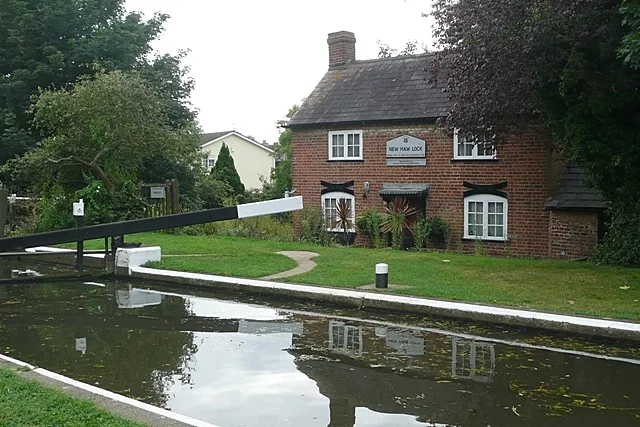
📷 5Canal locks · London
Coxes Lock
Coxes Lock — lock on the River Wey Navigation in Addlestone, Surrey, England, UK.
 📷 5
📷 5Historic churches · London
St George's College Weybridge
St George's College Weybridge — a school heritage in england-london, United Kingdom.
 Flagship📷 10
Towns & cities · London
New Haw
New Haw — village in the borough of Runnymede, Surrey, United Kingdom.
More museums in this region
 Flagship📷 10
Museums · London
Kenwood House
Kenwood House — art museum and historic house in Hampstead, London.
 📷 5
📷 5Museums · London
American Air Museum
American Air Museum — museum at Imperial War Museum Duxford, Cambridgeshire, England, UK.
 📷 5
📷 5Museums · London
Amora London
Amora London — European touring exhibition dedicated to love, relationships and sexual wellbeing.
 📷 5
📷 5Museums · London
Antique Breadboard Museum
Antique Breadboard Museum — small museum in Putney, London, England, UK.
Frequently asked questions
- Where is Addlestone?
- Addlestone is in London, in the United Kingdom — coordinates 51.3695°, -0.4901°.
- Is Addlestone wheelchair accessible?
- Yes — Addlestone is tagged in OpenStreetMap as wheelchair-accessible.