Archaeological sites · North West England
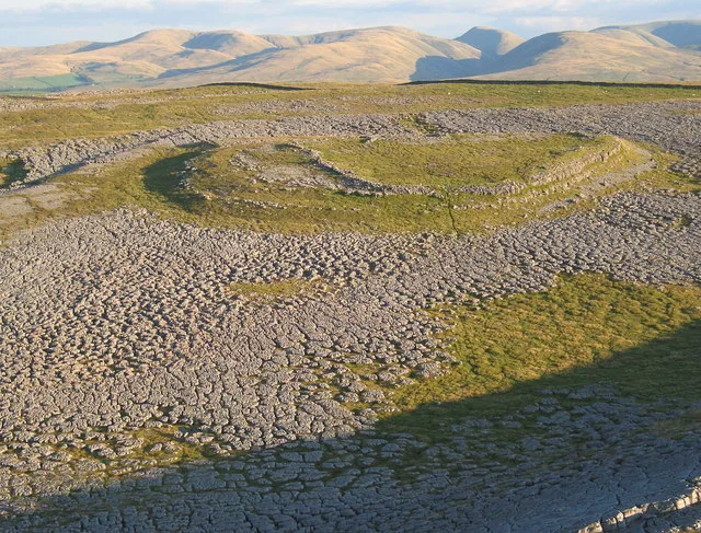
1847/8 lead mning
1847/8 lead mning — a archaeological in england-north-west, United Kingdom.

Trevor Littlewood — CC BY-SA 2.0 via Wikimedia Commons licence
Plan your visit
- Typical visit
- 45 min–1.5 h
- Free entry
- Dog-friendly
About
1847/8 lead mning is a archaeological located in england-north-west, United Kingdom. Sourced from OpenStreetMap (ODbL licence); see local listings for visitor information, opening hours and admission details.
Photo gallery
Place summary
The 1847/8 lead mining site is an archaeological location in North-West England. It represents significant industrial activity from the 19th century, highlighting the region's historical mining practices. The site provides insights into lead extraction methods used during this period.
AI-generated from the structured facts on this page (operator, designation, listing, era). Not a substitute for visiting.
- Coordinates
- 54.1631, -2.0552
- District
- North Yorkshire
- Parish
- Kettlewell with Starbotton
- Postcode
- BD23 5JF
- Parliamentary constituency
- Skipton and Ripon
Sources
- osm: way/637565876 (ODbL)
Other places nearby
Loading nearby places…
Nearby
 📷 3
📷 3Archaeological sites · North West England
old leaad mining shafts
old leaad mining shafts — a archaeological in england-north-west, United Kingdom.
 📷 3
📷 3Archaeological sites · North West England
Smelting Mill (Lead)
Smelting Mill (Lead) — a archaeological in england-north-west, United Kingdom.
Campsites · North West England
Wharfe Camp
Wharfe Camp — a campsite in england north west.
 📷 3
📷 3Caves · North West England
Dove Caves
Dove Caves is a cave in the United Kingdom.
 📷 3
📷 3Archaeological sites · North West England
old mining ?
old mining ? — a archaeological in england-north-west, United Kingdom.
 📷 3
📷 3Archaeological sites · North West England
Lead smelting mill
Lead smelting mill — a archaeological in england-north-west, United Kingdom.
More archaeological sites in this region
 📷 3
📷 3Archaeological sites · North West England
Castle Folds Romano-British defended stone hut circle settlement and medieval shieling
Castle Folds Romano-British defended stone hut circle settlement and medieval shieling — Romano-British walled settlement in Asby, Westmorland and Furness, Cumbria, England, UK.
 📷 3
📷 3Archaeological sites · North West England
Chapel Hill Motte, Arkholme
Chapel Hill Motte, Arkholme — archaeological site in Arkholme-with-Cawood, Lancaster, England, UK.
 📷 3
📷 3Archaeological sites · North West England
Dike, circles and cairns on Bleaberry Haws
Dike, circles and cairns on Bleaberry Haws — Scheduled Monument in the parish of Torver, Cumbria, England, UK.
 📷 3
📷 3Archaeological sites · North West England
Fother Royd Wood
Fother Royd Wood is a archaeological site in the United Kingdom.
Frequently asked questions
- Where is 1847/8 lead mning?
- 1847/8 lead mning is in North West England, in the United Kingdom — coordinates 54.1631°, -2.0552°.
- Is 1847/8 lead mning free to visit?
- Yes — admission to 1847/8 lead mning is free.